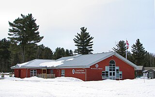
Lake of Bays is a township municipality within the District Municipality of Muskoka, Ontario, Canada. The township, situated 193 kilometres (120 mi) north of Toronto, is named after the Lake of Bays. During the 2016 census, the township had a population of 3,167 and encompassed 677.91 square kilometres (261.74 sq mi) of land.

The Moon River is a river in the municipalities of Georgian Bay and Muskoka Lakes, District Municipality of Muskoka in Central Ontario, Canada. It flows from Lake Muskoka at the community of Bala to Georgian Bay, Lake Huron, south of Parry Sound. The name of the river is thought to be derived from its Ojibwa name moonz-ziibi, which means "moose river".

Lake of Bays is a large lake in the District Municipality of Muskoka in Central Ontario, Canada. It is located almost entirely in the Township municipality of Lake of Bays, which is named after the lake, with the exception of the southwest arm of the lake which is in the Town of Huntsville. Ontario Highway 35 runs north and east of the lake.
Departure Lake is a dispersed rural community and unincorporated place in geographic Haggart Township, Cochrane District in Northeastern Ontario, Canada. It is located on Ontario Highway 11 between the communities of Strickland to the west and Smooth Rock Falls to the east.
Riley Lake is a lake in geographic Ryde Township in the town of Gravenhurst, District Municipality of Muskoka in Central Ontario, Canada. It is part of the Great Lakes Basin.

The Blanche River is a river in the Saint Lawrence River drainage basin in Timiskaming District in northeastern Ontario, Canada. The river is a tributary of Lake Timiskaming and its name is from the French for the colour "white".
Sixteen Mile Creek is a stream in the municipality of Lake of Bays, District Municipality of Muskoka in Central Ontario, Canada. It is part of the Great Lakes Basin and flows from Hickory Lake to its mouth at the Boyne River. The Boyne River flows to the Lake of Bays, then via the Muskoka River, and the Moon River and Musquash River to Georgian Bay on Lake Huron.
The Boyne River is a river in the municipality of Lake of Bays, District Municipality of Muskoka in Central Ontario, Canada. It is part of the Great Lakes Basin, and flows from Fowler Lake to its mouth at Dwight Bay on the Lake of Bays near the community of Dwight on Ontario Highway 60. The Lake of Bays flows via the Muskoka River, then the Moon River and Musquash River to Georgian Bay on Lake Huron.
The Kashabowie River is a river in southwestern Thunder Bay District in Northwestern Ontario, Canada. It is in the Great Lakes Basin and is a tributary of the Shebandowan Lakes.
The Valentine River is a river in the Unorganized North Part of Cochrane District in northeastern Ontario, Canada. It is in the Moose River drainage basin, and is a tributary of Lac Pivabiska, the source of the Pivabiska River.
Salem Creek is a stream in the municipal township of Cramahe, Northhumberland County in Central Ontario, Canada. It is a tributary of Lake Ontario. The creek takes its name from the community of Salem which it flows past.
Riley Creek is a stream in the Great Lakes Basin in Central Ontario, Canada. It flows south from its source at Riley Lake in geographic Ryde Township in the municipality of Gravenhurst, District Municipality of Muskoka, to its mouth as a right tributary of the Black River in geographic Dalton Township in the city of Kawartha Lakes. The Black River flows via the Severn River to Georgian Bay on Lake Huron.
Riley Lake is a Dispersed rural community and unincorporated place in geographic Ryde Township in the town of Gravenhurst, District Municipality of Muskoka, in Central Ontario, Canada. The community lies on the northwest shore of the eponymous Riley Lake, the source of Riley Creek.
Haggart Creek is a creek in the municipalities of Georgian Bay and Muskoka Lakes, District Municipality of Muskoka in Central Ontario, Canada. It is in the Great Lakes Basin and is a right tributary of the Moon River.
Roderick Lake is a lake in the municipalities of Georgian Bay and Muskoka Lakes, District Municipality of Muskoka in Central Ontario, Canada. It is in the Great Lakes Basin, and with the exception of the northwest end, is mostly in the municipality of Muskoka Lakes.
Haggart Lake is a lake in the municipalities of Georgian Bay and Muskoka Lakes, District Municipality of Muskoka in Central Ontario, Canada. It is in the Great Lakes Basin and is the source of Haggart Creek.
Haggart Creek is a creek in geographic Haggart Township, Cochrane District in Northeastern Ontario, Canada. It is in the James Bay drainage basin and is a right tributary of the Poplar Rapids River.
The Poplar Rapids River is a river in the municipality of Fauquier-Strickland and Unorganized North Cochrane District, Cochrane District in Northeastern Ontario, Canada. It is in the James Bay drainage basin and is a left tributary of the Mattagami River.
Strickland Creek is a stream in both the municipality of Fauquier-Strickland and Unorganized North Cochrane District, Cochrane District in Northeastern Ontario, Canada. It is in the James Bay drainage basin and is a right tributary of Moonbeam Creek.
Potter Creek is a stream in the Unorganized South Part of Nipissing District in Northeastern Ontario, Canada. It is a tributary of Canoe Lake, is in the Lake Huron drainage basin, and lies within Algonquin Provincial Park.
