
Qatar is a peninsula in the east of Arabia, bordering the Persian Gulf and Saudi Arabia, in a strategic location near major petroleum gas deposits. The State of Qatar occupies 11,571 km2 (4,468 sq mi) on a peninsula that extends approximately to 160 km (99 mi) north into the Persian Gulf from the Arabian Peninsula.

The Los Angeles Basin is a sedimentary basin located in Southern California, in a region known as the Peninsular Ranges. The basin is also connected to an anomalous group of east-west trending chains of mountains collectively known as the Transverse Ranges. The present basin is a coastal lowland area, whose floor is marked by elongate low ridges and groups of hills that is located on the edge of the Pacific Plate. The Los Angeles Basin, along with the Santa Barbara Channel, the Ventura Basin, the San Fernando Valley, and the San Gabriel Basin, lies within the greater Southern California region. The majority of the jurisdictional land area of the city of Los Angeles physically lies within this basin.

The Salt Creek Oil Field is located in Natrona County, Wyoming. By 1970, more oil had been produced by this field than any other in the Rocky Mountains region and accounted for 20 percent of the total production in Wyoming.

In structural geology, an anticline is a type of fold that is an arch-like shape and has its oldest beds at its core, whereas a syncline is the inverse of an anticline. A typical anticline is convex up in which the hinge or crest is the location where the curvature is greatest, and the limbs are the sides of the fold that dip away from the hinge. Anticlines can be recognized and differentiated from antiforms by a sequence of rock layers that become progressively older toward the center of the fold. Therefore, if age relationships between various rock strata are unknown, the term antiform should be used.
A petroleum reservoir or oil and gas reservoir is a subsurface accumulation of hydrocarbons contained in porous or fractured rock formations.

QatarEnergy, formerly Qatar Petroleum (QP), is a state owned petroleum company of Qatar. The company operates all oil and gas activities in Qatar, including exploration, production, refining, transport, and storage. The President & CEO is Saad Sherida al-Kaabi, Minister of State for Energy Affairs. The company's operations are directly linked with state planning agencies, regulatory authorities, and policy making bodies. Together, revenues from oil and natural gas amount to 60% of the country's GDP. As of 2018 it was the third largest oil company in the world by oil and gas reserves. In 2022, the company had total revenues of US$52bn, a net income of US42.4bn, and total assets of US$162bn. In 2021, QatarEnergy was the fifth largest gas company in the world.
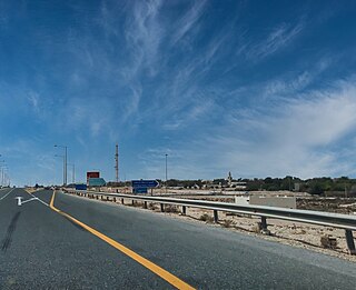
Umm Bab is a settlement in Qatar, located in the municipality of Al-Shahaniya. It used to be part of the Al Rayyan municipality and before that was administered by Al Jemailiya municipality before the latter was incorporated into Al Rayyan. Umm Bab is well known locally for Al Khraij Beach, which is also known as 'Palm Tree Beach' owing to a small cluster of palm trees situated off the shoreline.

Crescent Petroleum is the first and largest private upstream oil and gas company in the Middle East. Founded in 1971, Crescent Petroleum is headquartered in the Emirate of Sharjah, United Arab Emirates (UAE), with current operations in both the UAE and the Kurdistan Region of Iraq (KRI). As of 2023, Crescent Petroleum and the Iraqi Ministry of Oil have signed three twenty-year contracts as the company focus it efforts in aiding the redevelopment of Iraq.

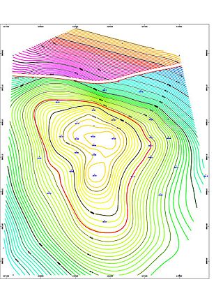
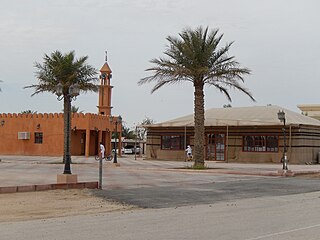
Dukhan is a city in the western municipality of Al-Shahaniya in the State of Qatar. It is approximately 80 kilometres (50 mi) west of the capital, Doha. Dukhan is administrated by Qatar's state oil agency QatarEnergy and is the site of the first oil discovery in Qatar. It was previously a part of Al Rayyan municipality.
The Garzan oil field is an oil field located in Batman, Batman Province, Southeastern Anatolia Region. It was discovered in 1947–1951 and developed by Türkiye Petrolleri Anonim Ortaklığı. It began production in 1956. The total proven reserves of the Garzan oil field are around 163 million barrels (22.2×10⁶ tonnes), and production is about 1,700 barrels per day (270 m3/d). The structure is a double plunging anticline bordered by a major reverse fault extending along the southern flank. The age of the Garzan formation is cretaceous, consisting of carbonates of a rudist build-up complex. Oil field contains 24 degree API (0.91 g/cm3) oil with a reservoir viscosity of 6.75 cp. Reservoir was initially highly undersaturated lists basic reservoirdata for Garzan.
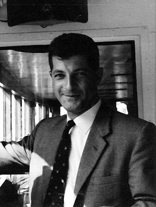
Ziad Rafiq Beydoun (1924–1998) was a Lebanese petroleum geologist, leading authority on the geology of the Middle East and Emeritus Professor at the American University of Beirut (AUB).

The geology of Algeria is diverse; the country divides into three different tectono-stratigraphic domains. In the south and west is the West African Craton which consists of Precambrian granitic basement and surrounding Neoproterozoic mobile belts. Further south the Tuareg Shield comprises the Hoggar, Adrar des Iforas and Air sub-shields which have each been affected by tectono-thermal events touching much of the continent. In the north are the Alpine chain mountains with a succession of folded and over-thrust strata.
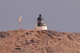
Halul Island is one of the most important islands belonging to the State of Qatar. Lying about 90 km (56 mi) northeast of Doha, it serves as a storage area and loading terminal for oil from the surrounding offshore fields. One of the main bases for the Qatari Navy is located in Halul. The Coasts and Borders Security also have a base of operations on the island.

Zekreet is a village in north-western Qatar near Dukhan and about 80 km (50 mi) north-west west of Doha. Originally a sparsely populated area, Zekreet was built up in the 1940s after oil operations commenced in Qatar. This included the construction of a harbor for oil equipment and a number of small houses which eventually developed into a village. There are a number of visitor attractions and old ruins at the site, one of the most notable being Zekreet Fort, which is housed to the immediate north of the village.
The Halibut Field is an oil field, within the Gippsland Basin offshore of the Australian state of Victoria. The oil field is located approximately 64 km offshore of southeastern Australia. The total area of this field is 26.9 km2 and is composed of 10 mappable units.
Al Khurayb is a village in Qatar located in the municipality of Al-Shahaniya. The closest major city is the municipal seat, Al-Shahaniya City. Historically, the village has been inhabited primarily by members of the Dawasir tribe.
Kapuni is an onshore natural gas-condensate field located in the Taranaki Basin, a ~100,000 km2 partially-inverted rift basin on the Taranaki Peninsula in the North Island, New Zealand. Discovered in 1959 and brought into production in 1970, Kapuni remained New Zealand's only producing gas-condensate field until the offshore Maui gas field began production in 1979.

Jebel Nakhsh is a mountain ridge in southern Qatar that stands roughly 90 meters (300 ft) tall and which runs southeast-to-northwest for 33 km side by side with the western coast. Three main rock layers make up the mountain, the bottom layer containing multiple burrows and being primarily composed of limestone, marl, and shale, the middle layer, which is also the largest, being made up of limestone, marl, stromatolitic limestone and evaporites, and the top layer comprising mainly limestone, which is sedimentary.

The Rub' al Khali Basin or ar-Rubʻ al-Khālī / ar-rubʿ al-ḵālī Basin, Arabic for "Empty Quarter Basin", is a major endorheic sedimentary basin of approximately 560,000 square kilometres (220,000 sq mi) in southern Saudi Arabia, northeastern Yemen, southeastern Oman and southeasternmost United Arab Emirates. The onshore foreland on Mesozoic rift basin is geographically defined by the eponymous Rub' al Khali and covers the regions of Najran and Riyadh and the Eastern Province. The basin is geologically bound by the Central Arabian Arch in the north, the Oman Thrust in the east, the Northern Hadramaut Arch in the south, and the Arabian Shield in the west. Politically, the southwestern boundary is formed by the border with Yemen and the border with Oman forms the southeastern boundary.
