
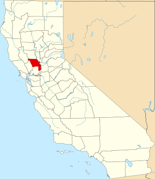
Yolo County, officially the County of Yolo, is a county located in the northern portion of the U.S. state of California. Yolo County was one of the original counties of California, created in 1850 at the time of statehood. As of the 2020 census, the population was 216,403. Its county seat is Woodland.

Napa County is a county north of San Pablo Bay located in the northern portion of the U.S. state of California. As of the 2020 census, the population was 138,019. The county seat is the City of Napa. Napa County was one of the original counties of California, created in 1850 at the time of statehood. Parts of the county's territory were given to Lake County in 1861.

West Sacramento is a city in Yolo County, California, United States. The city is separated from Sacramento by the Sacramento River, which also separates Sacramento and Yolo counties. It is a fast-growing community; the population was 53,915 at the 2020 census, up from 48,744 at the 2010 census. The traditional industrial center of the region since the Gold Rush era, West Sacramento is home to a diverse economy and is one of the area's top four employment centers.

Woodland is a city in, and the county seat of, Yolo County, California, United States. Located approximately 15 miles (24 km) northwest of Sacramento, it is a part of the Sacramento metropolitan area. The population continues to grow every year, with a growth rate of 0.33% annually, and a current population of 61,873.
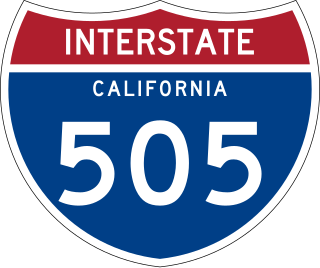
Interstate 505 (I-505) is a north–south auxiliary Interstate Highway in the Sacramento Valley in Northern California. It is a spur auxiliary route of I-5 that runs from near Dunnigan south to I-80 in Vacaville. I-505 is primarily a rural Interstate, but travels through Vacaville and the city of Winters. The highway is the primary route connecting the San Francisco Bay Area and the northern Sacramento Valley, bypassing Sacramento and its attendant city traffic. Thus, it is a major route for travelers heading directly from the San Francisco Bay Area to the Shasta Cascade and the Pacific Northwest.

Wine Country is a region of California, in the northern San Francisco Bay Area, known worldwide as a premier wine-growing region. The region is famed for its wineries, its cuisine, Michelin star restaurants, boutique hotels, luxury resorts, historic architecture, and culture. Viticulture and wine-making have been practiced in the region since the Spanish missionaries from Mission San Francisco Solano established the first vineyards in 1812.

Dunnigan is a census-designated place in Yolo County, California on Interstate 5. The population was 1,416 at the 2010 census. Dunnigan's ZIP code is 95937 and its area code 530. It lies at an elevation of 69 feet.
Capay is an unincorporated community in Yolo County, California. It is located on Cache Creek 2 miles (3.2 km) west-northwest of Esparto, in the Capay Valley, in the northwestern part of the county. Capay's ZIP Code is 95607 and its area code 530. It lies at an elevation of 210 feet.

Capay Valley is a mostly rural valley northwest of Sacramento in Yolo County, California, United States. It lies east of Blue Ridge and west of the Capay Hills.

California's 3rd senatorial district is one of 40 California State Senate districts. It is currently represented by Democrat Bill Dodd of Napa.
The Dunnigan Hills AVA is an American Viticultural Area located in the Dunnigan Hills, in Yolo County, California. Located in the northwest portion of Yolo County, the wine region has a Mediterranean climate that is less prone to frost than other parts of the Sacramento Valley. The largest winery in the Dunnigan Hills is R.H. Phillips, which has a 1,300 acres (526 ha) estate vineyard.
The Capay Valley AVA is an American Viticultural Area located in the Capay Valley, in northwest Yolo County, California.
Yolobus provides public transportation throughout Yolo County, California and into downtown Sacramento, western Sacramento County and northeastern Solano County.

The 1952 United States presidential election in California took place on November 4, 1952, as part of the 1952 United States presidential election. State voters chose 32 representatives, or electors, to the Electoral College, who voted for president and vice president.

The 1904 United States presidential election in California took place on November 8, 1904, as part of the 1904 United States presidential election. State voters chose 10 representatives, or electors, to the Electoral College, who voted for president and vice president.

Donegan, most commonly refers to a Gaelic Irish clan from Munster. The name is diminutive of Donn which means, "the Dark One", or in modern Irish, "brown", referring to hair colour. The most prominent dynasty were an Érainn people of the Múscraige and provided a King of Munster in the 10th century in the form of Flaithbertach mac Inmainén. Much later, the family provided the Dungan Baronets and two Earls of Limerick, the most notable of which Thomas Dongan, 2nd Earl of Limerick was a Governor of New York.
This is a list of the National Register of Historic Places listings in Yolo County, California.
There are 21 routes assigned to the "E" zone of the California Route Marker Program, which designates county routes in California. The "E" zone includes county highways in Alpine, Amador, Butte, Calaveras, El Dorado, Placer, Plumas, Sacramento, Solano, Tuolumne, Yolo, and Yuba counties.
The Yocha Dehe Wintun Nation is a federally recognized tribe of Wintun people, specifically Patwin people or southern Wintun, in Yolo County, California. They were formerly known as the Rumsey Indian Rancheria of Wintun Indians of California.
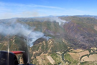
The Sand Fire was a wildfire that burned in the area of Rumsey northwest of Guinda in Yolo County, California in the United States. The fire started on Saturday, June 8, 2019, at County Road 41 and Highway 16 and burned 2,512 acres (1,017 ha) as well as seven structures. The fire was fully contained as of 7:27 am on June 15, 2019. The cause of the fire remains under investigation. The fire was the first major incident of the season, in what fire officials claimed to be an indicator of the fire season to come.


