
Sandy Creek is a town in Oswego County, New York, United States. The population was 3,939 at the 2010 census. The name is derived from a creek in the area.
The Otselic River(aht-SEEL-ik), formerly known as Otselic Creek is a 55.4-mile-long (89.2 km) tributary of the Tioughnioga River in central New York in the United States. It drains a hilly area, mostly forested and agricultural, east of the Finger Lakes at the northern edge of the Susquehanna River watershed.

The Oswegatchie River is a 137-mile-long (220 km) river in northern New York that flows from the Adirondack Mountains north to the Saint Lawrence River. The Oswegatchie River begins at Partlow Lake in Hamilton County, New York. The river continues through Cranberry Lake which was 'doubled in size' through construction of a dam in the late 1860s. The river continues from the dam to Gouverneur, to near Talcville in St. Lawrence County, where it joins the West Branch. Much of it is within Adirondack State Park. The city of Ogdensburg developed at the mouth of the river at its confluence with the St. Lawrence.

The Sacandaga River is a 64-mile-long (103 km) river in the northern part of New York in the United States. Its name comes from the Native American Sa-chen-da'-ga, meaning "overflowed lands".

Fishkill Creek is a tributary of the Hudson River in Dutchess County, New York, United States. At 33.5 miles (53.9 km) it is the second longest stream in the county, after Wappinger Creek. It rises in the town of Union Vale and flows generally southwest to a small estuary on the Hudson just south of Beacon. Part of its 193-square-mile (500 km2) watershed is in Putnam County to the south. Sprout Creek, the county's third-longest creek, is its most significant tributary. Whaley and Sylvan lakes and Beacon Reservoir, its largest, deepest and highest lakes, are among the bodies of water within the watershed.
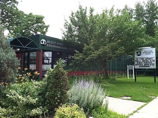
Alley Pond Park is the second-largest public park in Queens, New York City, occupying 655.3 acres (265.2 ha). The park is bordered to the east by Douglaston, to the west by Bayside, to the north by Little Neck Bay, and to the south by Union Turnpike. Cross Island Parkway travels north-south through the park, while the Long Island Expressway and Grand Central Parkway travel east-west through the park. The park primarily consists of woodlands south of the Long Island Expressway and meadowlands north of the expressway. It is run and operated by the New York City Department of Parks and Recreation.

Wappinger Creek is a 41.7-mile-long (67.1 km) creek which runs from Thompson Pond to the Hudson River at New Hamburg in Dutchess County, New York, United States. It is the longest creek in Dutchess County, with the largest watershed in the county.

The West Canada Lake Wilderness Area is an Adirondack Park Forest Preserve management unit in the State of New York, USA.

Santanoni Peak is a mountain located in Essex County, New York. The mountain is part of the Santanoni Mountains of the Adirondacks. The mountain's name is believed to be an Abenaki derivative of "Saint Anthony"; the first French fur traders and missionaries having named the area for Saint Anthony of Padua. Santanoni Peak is flanked to the north by Panther Peak, and to the southwest by Little Santanoni Mountain.

Quassaick Creek is an 18.4-mile-long (29.6 km) tributary of the Hudson River in Orange and Ulster counties in the U.S. state of New York. It rises in the glacial ridges west of the river, near the boundary between the towns of Plattekill and Marlborough. From there it flows south into the town of Newburgh and then the city, where it eventually forms part of the border between it and neighboring New Windsor before emptying into the Hudson.
Holy Mount, 1,968 feet (600 m), is a prominent peak in the Taconic Mountains of western Massachusetts, formerly used as the location of religious ceremonies by a nearby Shaker community.

Ampersand Mountain is a 3,352 ft (1,021.7 m) mountain in Franklin County in the northeastern Adirondacks, west of the High Peaks in New York State. The trail up the mountain begins on New York State Route 3 8.1 miles (13.0 km) southwest of the village of Saranac Lake, near Middle Saranac Lake; it is a popular day hike. The mountain takes its name from nearby Ampersand Creek, so named because it twists and turns like the ampersand symbol. The summit is bare rock, with extensive views of the High Peaks to the east and the Saranac Lakes to the west. Stony Creek Mountain is located west-southwest of Ampersand Mountain.

Black Pond Wildlife Management Area is a 526-acre (213 ha) New York State Wildlife Management Area (WMA) that lies on the eastern shore of Lake Ontario, and at the northern limit of an unusual region of sandy barrier beaches and lagoons. Much of the barrier beach in Black Pond WMA has forested sand dunes that are about 60 feet (18 m) high; these are the highest sand dunes in the northeast United States excepting Cape Cod. Immediately north of the WMA is the 360-acre (150 ha) El Dorado Beach Preserve, which is a bird refuge owned by The Nature Conservancy. North of the outlet from Black Pond to Lake Ontario, the shoreline is a weathered, flat bedrock shelf that is "calcareous" instead of sandy.

The Sawkill or Saw-kill was the largest hydrological network on Manhattan island prior to the founding of the Dutch colony of New Netherland in 1624. This 44,980-foot-long (13,710 m) stream began "within four blocks of the Hudson River":
A rill flowing east from the rocky ridge overlooking Bloomingdale Village, which rose near Ninth Avenue and 85th Street, flowed in a southerly direction through Manhattan Square, where it spread into a little pond, and then turned east, crossing Central Park to Fifth Avenue, receiving three tributaries within its limits, two from the north and one from the south. At 75th Street near Third Avenue it was joined by another stream. Near this junction the old Boston Post Road crossed it, and then from this point, the stream ran due east to its outlet near the foot of 75th Street

Kinderhook Creek is a 49.0-mile-long (78.9 km) tributary to Stockport Creek, an inlet of the Hudson River in the United States. From its source in Hancock, Massachusetts, the creek runs southwest through the Taconic Mountains into Rensselaer County, New York, and then into Columbia County. It flows through the towns of Stephentown, New Lebanon, Nassau, Chatham, Kinderhook and Stuyvesant to its mouth at Stockport Creek in the town of Stockport.
