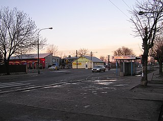
Łomianki is a town in Warsaw West County, Masovian Voivodeship, Poland. It had a population of 16,374 in 2008, and 24,328 in 2016.

Wielowieś is a village in the administrative district of Gmina Ścinawa, within Lubin County, Lower Silesian Voivodeship, in south-western Poland. Prior to 1945 it was in Germany. It lies approximately 10 kilometres (6 mi) south-west of Ścinawa, 14 km (9 mi) south-east of Lubin, and 53 km (33 mi) north-west of the regional capital Wrocław.
Wymysłowo is a village in the administrative district of Gmina Więcbork, within Sępólno County, Kuyavian-Pomeranian Voivodeship, in north-central Poland. It lies approximately 15 kilometres (9 mi) west of Więcbork, 20 km (12 mi) south-west of Sępólno Krajeńskie, and 56 km (35 mi) north-west of Bydgoszcz.
Marianów is a village in the administrative district of Gmina Biała Rawska, within Rawa County, Łódź Voivodeship, in central Poland. It lies approximately 5 kilometres (3 mi) north-west of Biała Rawska, 14 km (9 mi) north-east of Rawa Mazowiecka, and 66 km (41 mi) east of the regional capital Łódź.
Kossobudy is a village in the administrative district of Gmina Raciąż, within Płońsk County, Masovian Voivodeship, in east-central Poland. It lies approximately 6 kilometres (4 mi) east of Raciąż, 21 km (13 mi) north-west of Płońsk, and 84 km (52 mi) north-west of Warsaw.
Nowe Gralewo is a village in the administrative district of Gmina Raciąż, within Płońsk County, Masovian Voivodeship, in east-central Poland. It lies approximately 8 kilometres (5 mi) south of Raciąż, 21 km (13 mi) north-west of Płońsk, and 82 km (51 mi) north-west of Warsaw.
Kuczki-Wieś is a village in the administrative district of Gmina Gózd, within Radom County, Masovian Voivodeship, in east-central Poland. It lies approximately 6 kilometres (4 mi) west of Gózd, 13 km (8 mi) east of Radom, and 98 km (61 mi) south of Warsaw.
Wólka is a village in the administrative district of Gmina Leszno, within Warsaw West County, Masovian Voivodeship, in east-central Poland. It lies approximately 9 kilometres (6 mi) east of Leszno, 10 km (6 mi) north-west of Ożarów Mazowiecki, and 21 km (13 mi) west of Warsaw.
Dziekanów Bajkowy is a village in the administrative district of Gmina Łomianki, within Warsaw West County, Masovian Voivodeship, in east-central Poland. It lies approximately 4 kilometres (2 mi) north-west of Łomianki, 17 km (11 mi) north of Ożarów Mazowiecki, and 19 km (12 mi) north-west of Warsaw.
Dziekanów Leśny is a village in the administrative district of Gmina Łomianki, within Warsaw West County, Masovian Voivodeship, in east-central Poland. It lies approximately 3 kilometres (2 mi) north-west of Łomianki, 16 km (10 mi) north of Ożarów Mazowiecki, and 18 km (11 mi) north-west of Warsaw.
Dziekanów Polski is a village in the administrative district of Gmina Łomianki, within Warsaw West County, Masovian Voivodeship, in east-central Poland. It lies approximately 6 kilometres (4 mi) north-west of Łomianki, 17 km (11 mi) north of Ożarów Mazowiecki, and 21 km (13 mi) north-west of Warsaw.
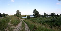
Kępa Kiełpińska is a village in the administrative district of Gmina Łomianki, within Warsaw West County, Masovian Voivodeship, in east-central Poland. It lies approximately 4 kilometres (2 mi) north of Łomianki, 18 km (11 mi) north of Ożarów Mazowiecki, and 19 km (12 mi) north-west of Warsaw. The village was founded and settled by Vistula Germans till 1945.
Kiełpin is a village in the administrative district of Gmina Łomianki, within Warsaw West County, Masovian Voivodeship, in east-central Poland. It lies approximately 3 kilometres (2 mi) north-west of Łomianki, 16 km (10 mi) north of Ożarów Mazowiecki, and 18 km (11 mi) north-west of Warsaw.
Łomianki Chopina is a village in the administrative district of Gmina Łomianki, within Warsaw West County, Masovian Voivodeship, in east-central Poland. It lies approximately 2 kilometres (1 mi) north of Łomianki, 16 km (10 mi) north-east of Ożarów Mazowiecki, and 17 km (11 mi) north-west of Warsaw.
Łomianki Dolne is a village in the administrative district of Gmina Łomianki, within Warsaw West County, Masovian Voivodeship, in east-central Poland. It lies approximately 4 kilometres (2 mi) north of Łomianki, 18 km (11 mi) north of Ożarów Mazowiecki, and 18 km (11 mi) north of Warsaw.
Sadowa is a village in the administrative district of Gmina Łomianki, within Warsaw West County, Masovian Voivodeship, in east-central Poland. It lies approximately 4 kilometres (2 mi) north-west of Łomianki, 15 km (9 mi) north of Ożarów Mazowiecki, and 19 km (12 mi) north-west of Warsaw.
Malary is a village in the administrative district of Gmina Skarszewy, within Starogard County, Pomeranian Voivodeship, in northern Poland. It lies approximately 6 kilometres (4 mi) west of Skarszewy, 15 km (9 mi) north-west of Starogard Gdański, and 40 km (25 mi) south-west of the regional capital Gdańsk.
Chmielewo is a village in the administrative district of Gmina Orzysz, within Pisz County, Warmian-Masurian Voivodeship, in northern Poland. It lies approximately 13 kilometres (8 mi) west of Orzysz, 23 km (14 mi) north of Pisz, and 84 km (52 mi) east of the regional capital Olsztyn.