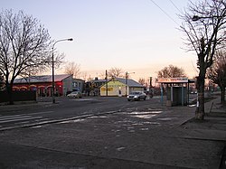
Czeremcha is a village in Hajnówka County, Podlaskie Voivodeship, in north-eastern Poland, close to the border with Belarus. It is the seat of the gmina called Gmina Czeremcha. It lies approximately 29 kilometres (18 mi) south-west of Hajnówka and 68 km (42 mi) south of the regional capital Białystok.

Łomianki is a town in Warsaw West County, Masovian Voivodeship, Poland. It had a population of 16,374 in 2008, and 24,328 in 2016.

Stefanowo is a village in the administrative district of Gmina Inowrocław, within Inowrocław County, Kuyavian-Pomeranian Voivodeship, in north-central Poland. It lies approximately 10 kilometres (6 mi) north-west of Inowrocław, 31 km (19 mi) south-east of Bydgoszcz, and 35 km (22 mi) south-west of Toruń.
Szwecja is a village in the administrative district of Gmina Wałcz, within Wałcz County, West Pomeranian Voivodeship, in north-western Poland. It lies approximately 12 kilometres (7 mi) north-east of Wałcz and 133 km (83 mi) east of the regional capital Szczecin.
Górniak is a village in the administrative district of Gmina Lubraniec, within Włocławek County, Kuyavian-Pomeranian Voivodeship, in north-central Poland. It lies approximately 2 kilometres (1 mi) east of Lubraniec, 18 km (11 mi) south-west of Włocławek, and 58 km (36 mi) south of Toruń.
Buk is a village in the administrative district of Gmina Gołcza, within Miechów County, Lesser Poland Voivodeship, in southern Poland. It lies approximately 5 kilometres (3 mi) west of Gołcza, 13 km (8 mi) west of Miechów, and 32 km (20 mi) north of the regional capital Kraków.
Borki-Paduchy is a village in the administrative district of Gmina Wiśniew, within Siedlce County, Masovian Voivodeship, in east-central Poland. It lies approximately 5 kilometres (3 mi) north-east of Wiśniew, 11 km (7 mi) south-east of Siedlce, and 94 km (58 mi) east of Warsaw.
Dziekanów Bajkowy is a village in the administrative district of Gmina Łomianki, within Warsaw West County, Masovian Voivodeship, in east-central Poland. It lies approximately 4 kilometres (2 mi) north-west of Łomianki, 17 km (11 mi) north of Ożarów Mazowiecki, and 19 km (12 mi) north-west of Warsaw.

Dziekanów Leśny is a village in the administrative district of Gmina Łomianki, within Warsaw West County, Masovian Voivodeship, in east-central Poland. It lies approximately 3 kilometres (2 mi) north-west of Łomianki, 16 km (10 mi) north of Ożarów Mazowiecki, and 18 km (11 mi) north-west of Warsaw.

Dziekanów Nowy is a village in the administrative district of Gmina Łomianki, within Warsaw West County, Masovian Voivodeship, in east-central Poland. It lies approximately 6 kilometres (4 mi) north-west of Łomianki, 17 km (11 mi) north of Ożarów Mazowiecki, and 21 km (13 mi) north-west of Warsaw.
Dziekanów Polski is a village in the administrative district of Gmina Łomianki, within Warsaw West County, Masovian Voivodeship, in east-central Poland. It lies approximately 6 kilometres (4 mi) north-west of Łomianki, 17 km (11 mi) north of Ożarów Mazowiecki, and 21 km (13 mi) north-west of Warsaw.
Kępa Kiełpińska is a village in the administrative district of Gmina Łomianki, within Warsaw West County, Masovian Voivodeship, in east-central Poland. It lies approximately 4 kilometres (2 mi) north of Łomianki, 18 km (11 mi) north of Ożarów Mazowiecki, and 19 km (12 mi) north-west of Warsaw. The village was founded and settled by Vistula Germans till 1945.
Łomianki Chopina is a village in the administrative district of Gmina Łomianki, within Warsaw West County, Masovian Voivodeship, in east-central Poland. It lies approximately 2 kilometres (1 mi) north of Łomianki, 16 km (10 mi) north-east of Ożarów Mazowiecki, and 17 km (11 mi) north-west of Warsaw.
Łomianki Dolne is a village in the administrative district of Gmina Łomianki, within Warsaw West County, Masovian Voivodeship, in east-central Poland. It lies approximately 4 kilometres (2 mi) north of Łomianki, 18 km (11 mi) north of Ożarów Mazowiecki, and 18 km (11 mi) north of Warsaw.
Sadowa is a village in the administrative district of Gmina Łomianki, within Warsaw West County, Masovian Voivodeship, in east-central Poland. It lies approximately 4 kilometres (2 mi) north-west of Łomianki, 15 km (9 mi) north of Ożarów Mazowiecki, and 19 km (12 mi) north-west of Warsaw.
Szewce is a village in the administrative district of Gmina Kleszczewo, within Poznań County, Greater Poland Voivodeship, in west-central Poland. It lies approximately 16 km (10 mi) east of the regional capital Poznań.
Tanibórz is a village in the administrative district of Gmina Kleszczewo, within Poznań County, Greater Poland Voivodeship, in west-central Poland. It lies approximately 16 km (10 mi) east of the regional capital Poznań.
Pszczelnik is a village in the administrative district of Gmina Myślibórz, within Myślibórz County, West Pomeranian Voivodeship, in north-western Poland. It lies approximately 9 kilometres (6 mi) south of Myślibórz and 64 km (40 mi) south of the regional capital Szczecin.