Related Research Articles

The Teton River is located in northwestern Montana, in the Western United States The ~ 150 miles (240 km) long river is a tributary of the Marias River. Its watershed is within Teton County and Chouteau County, Montana.

The Redwater River is a tributary of the Missouri River, approximately 110 mi (177 km), in eastern Montana in the United States.

The Poplar River is a tributary of the Missouri River, approximately 167 miles (269 km) long in Saskatchewan in Canada and Montana in the United States.

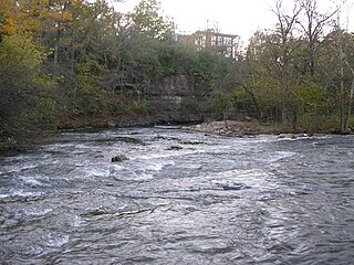
The Kentucky River is a tributary of the Ohio River, 260 miles (418 km) long, in the U.S. Commonwealth of Kentucky. The river and its tributaries drain much of the central region of the state, with its upper course passing through the coal-mining regions of the Cumberland Mountains, and its lower course passing through the Bluegrass region in the north central part of the state. Its watershed encompasses about 7,000 square miles (18,000 km2). It supplies drinking water to about one-sixth of the population of the Commonwealth of Kentucky.

Clear Creek is a tributary of the upper Sacramento River in northern California.
Beargrass Creek is the name given to several forks of a creek in Jefferson County, Kentucky. The Beargrass Creek watershed is one of the largest in the county, draining over 60 square miles (160 km2). It is fairly small, with an average discharge of 103 cubic feet per second at River Road in Louisville.

Lee Creek is a 64.6-mile-long (104.0 km) river in Arkansas and Oklahoma which starts near West Fork in Washington County, Arkansas and flows south to the Arkansas River passing through Crawford County, Arkansas and Sequoyah County, Oklahoma. Lee Creek flows from Arkansas into Oklahoma, then returns to Arkansas before its confluence with the Arkansas River near Van Buren and Fort Smith.

The Mohican River is a principal tributary of the Walhonding River, about 40 miles (64 km) long, in north-central Ohio in the United States. Via the Walhonding, Muskingum and Ohio Rivers, it is part of the watershed of the Mississippi River, draining an area of 999 square miles (2,590 km2).

The Barren River is a 135-mile-long (217 km) river in western Kentucky, United States. It is the largest tributary of the Green River, which drains more of Kentucky than any other river. The Barren River rises in Monroe County and flows into the Green in northeast Warren County.
The Red Bird River is one of two tributaries at the head of the South Fork of the Kentucky River, the other being the Goose Creek. It is located in the Daniel Boone National Forest in extreme southeastern portion of the U.S. state of Kentucky. It is 34.3 miles (55.2 km) long and drains an area of 195.7 square miles (507 km2).

A stream is a body of water with surface water flowing within the bed and banks of a channel. The flow of a stream is controlled by three inputs – surface water, subsurface water and groundwater. The surface and subsurface water are highly variable between periods of rainfall. Groundwater, on the other hand, has a relatively constant input and is controlled more by long-term patterns of precipitation. The stream encompasses surface, subsurface and groundwater fluxes that respond to geological, geomorphological, hydrological and biotic controls.

Little Butte Creek is a 17-mile-long (27 km) tributary of the Rogue River in the U.S. state of Oregon. Its drainage basin consists of approximately 354 square miles (917 km2) of Jackson County and another 19 square miles (49 km2) of Klamath County. Its two forks, the North Fork and the South Fork, both begin high in the Cascade Range near Mount McLoughlin and Brown Mountain. They both flow generally west until they meet near Lake Creek. The main stem continues west, flowing through the communities of Brownsboro, Eagle Point, and White City, before finally emptying into the Rogue River about 3 miles (5 km) southwest of Eagle Point.

Big Butte Creek is a 12-mile-long (19 km) tributary of the Rogue River in the U.S. state of Oregon. It drains approximately 245 square miles (635 km2) of Jackson County. Its two forks, the North Fork and the South Fork, both begin high in the Cascade Range near Mount McLoughlin. Flowing predominantly west, they meet near the city of Butte Falls. The main stem flows generally northwest until it empties into the Rogue Falls was incorporated in 1911, and remains the only incorporated town within the watershed's boundaries.
The Clear Fork is a 42.8-mile-long (68.9 km) tributary of the Cumberland River in Kentucky and Tennessee. By the Cumberland and Ohio rivers, it is part of the Mississippi River watershed.
Martins Fork is a 32-mile (51 km) river in Bell and Harlan Counties in Kentucky in the United States. The river flows east and north from its source in the Cumberland Mountains, a subrange of the Appalachian Mountains, to its confluence with the Clover Fork at Harlan. The confluence marks the official beginning of the Cumberland River.
The Clover Fork is a 30-mile (48 km) tributary of the Cumberland River, draining a section of the Appalachian Mountains in Harlan County, southeast Kentucky in the United States. The river's confluence with the Martin's Fork at Harlan marks the official beginning of the Cumberland River.
The Poor Fork is a 45-mile (72 km) tributary of the Cumberland River in Letcher and Harlan Counties, southeast Kentucky, in the United States. The river flows from its source at Flat Gap in the Appalachian Mountains, on the Kentucky–Virginia border, generally southwest to its confluence about a mile (1.6 km) north of Harlan.
The Laurel River is a 42-mile (68 km) tributary of the Cumberland River in southeast Kentucky in the United States. The river drains a rural region in the foothills of the Appalachian Mountains, in parts of Whitley and Laurel Counties. The town of Corbin is located on the river about 15 miles (24 km) east of its mouth on the Cumberland, and near the confluence with a major tributary, the Little Laurel River.
Bryant Creek is a stream in the Ozarks of Missouri. Bryant Creek has headwaters just west of Lead Hill and southeast Cedar Gap in southwestern Wright County and flows in a southeasterly direction through Douglas County east of Ava and joins the North Fork River in Ozark County just north of Tecumseh and within the waters of Norfork Lake. Tributaries include Bill Macks Creek, Hunter Creek, Rippee Creek, Fox Creek, Brush Creek, Spring Creek and Pine Creek.
References
| | This Carroll County, Kentucky state location article is a stub. You can help Wikipedia by expanding it. |
| | This Scott County, Kentucky state location article is a stub. You can help Wikipedia by expanding it. |
| | This Owen County, Kentucky state location article is a stub. You can help Wikipedia by expanding it. |
| | This Gallatin County, Kentucky state location article is a stub. You can help Wikipedia by expanding it. |
| | This Grant County, Kentucky state location article is a stub. You can help Wikipedia by expanding it. |