Sanders, Kentucky

Last updated
Sanders, Kentucky
Carroll County Kentucky Incorporated and Unincorporated areas Sanders Highlighted 2168358.svg
Location of Sanders in Carroll County, Kentucky.
Coordinates: 38°39′17″N84°56′48″W / 38.65472°N 84.94667°W / 38.65472; -84.94667
Country United States
State Kentucky
County Carroll
Incorporated1871 [1]
Reïncorporated1882 [1]
Named for George Washington Sanders, a local miller [2]
Area
[3]
  Total0.30 sq mi (0.77 km2)
  Land0.29 sq mi (0.76 km2)
  Water0.00 sq mi (0.01 km2)
Elevation
[4]
486 ft (148 m)
Population
 (2020)
  Total197
  Density670.07/sq mi (258.90/km2)
Time zone UTC-5 (Eastern (EST))
  Summer (DST) UTC-4 (EDT)
ZIP code
41083
Area code 502
FIPS code 21-68358
GNIS feature ID2405414 [4]

Sanders is a home rule-class city in Carroll County, Kentucky, in the United States. The population was 238 as of the 2010 census. [5]

Contents

History

The community was founded at a salt lick on the Buffalo Trace stretching from the Licking River to Drennon Springs. The community was first known as Rislerville for a local shopkeeper, but was known as Sanders' Mill after the local miller Nathaniel Sanders opened a post office in 1816. His son George Washington Sanders continued to operate the mill after his death. [2]

When the community was connected to the Louisville, Cincinnati and Lexington Railroad in 1867, the station was first named Dixie by the locals but then changed to Liberty Station by the railroad, owing to the importance of the station's trade with nearby New Liberty. The name reverted to Sanders in 1874, according to local historian Anna Parker, owing to the influence of State Senator Larkin Sanders, who wanted to honor his father. [2]

Geography

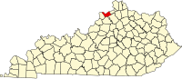
Sanders is located in the southeast corner of Carroll County along Eagle Creek, a tributary of the Kentucky River. It is bordered to the south, across Eagle Creek, by Owen County, and Gallatin County begins less than 1 mile (1.6 km) to the east. Exit 55 on Interstate 71 is 4.5 miles (7.2 km) to the north.

According to the United States Census Bureau, the city has a total area of 0.30 square miles (0.77 km2), of which 0.004 square miles (0.01 km2), or 0.81%, is water. [5]

Demographics

Historical population
CensusPop.Note
1890 277
1900 218−21.3%
1910 25014.7%
1920 29116.4%
1930 286−1.7%
1940 278−2.8%
1950 206−25.9%
1960 203−1.5%
1970 26832.0%
1980 33223.9%
1990 231−30.4%
2000 2466.5%
2010 238−3.3%
2020 197−17.2%
U.S. Decennial Census [6]

As of the census [7] of 2000, there were 246 people, 78 households, and 51 families residing in the city. The population density was 790.1 inhabitants per square mile (305.1/km2). There were 90 housing units at an average density of 289.0 per square mile (111.6/km2). The racial makeup of the city was 97.56% White and 2.44% African American.

There were 78 households, out of which 32.1% had children under the age of 18 living with them, 48.7% were married couples living together, 5.1% had a female householder with no husband present, and 34.6% were non-families. 25.6% of all households were made up of individuals, and 5.1% had someone living alone who was 65 years of age or older. The average household size was 2.63 and the average family size was 3.14.

In the city, the population was spread out, with 22.4% under the age of 18, 8.1% from 18 to 24, 30.9% from 25 to 44, 28.5% from 45 to 64, and 10.2% who were 65 years of age or older. The median age was 40 years. For every 100 females, there were 138.8 males. For every 100 females age 18 and over, there were 172.9 males.

The median income for a household in the city was $36,146, and the median income for a family was $37,708. Males had a median income of $28,250 versus $27,917 for females. The per capita income for the city was $11,230. None of the families and 26.7% of the population were living below the poverty line, including no under eighteens and 71.0% of those over 64.

Related Research Articles

<span class="mw-page-title-main">Carroll County, Kentucky</span> County in Kentucky, United States

Carroll County is a county located in the northern part of the U.S. state of Kentucky. Its county seat is Carrollton. The county was formed in 1838 and named for Charles Carroll of Carrollton, the last living signer of the Declaration of Independence. It is located at the confluence of the Kentucky and Ohio Rivers.

<span class="mw-page-title-main">Highland Heights, Kentucky</span> City in Kentucky, United States

Highland Heights is a home rule-class city in Campbell County, Kentucky, in the United States. The population was 6,923 at the 2010 U.S. census.

<span class="mw-page-title-main">Prestonville, Kentucky</span> City in Kentucky, United States

Prestonville is a home rule-class city located at the confluence of the Ohio and Kentucky rivers in Carroll County, Kentucky, in the United States. It lies across the Kentucky River from Carrollton. The population was 161 at the 2010 U.S. Census.

<span class="mw-page-title-main">Pembroke, Kentucky</span> City in Kentucky, United States

Pembroke is a home rule-class city in Christian County, Kentucky, in the United States. The population was 869 as of the 2010 U.S. Census. It is part of the Clarksville, Tennessee metropolitan area.

<span class="mw-page-title-main">Crittenden, Kentucky</span> City in Kentucky, United States

Crittenden is a home rule-class city in Grant and Kenton counties, Kentucky, in the United States. The population was 3,815 as of the 2010 census, up from 2,401 at the 2000 census.

<span class="mw-page-title-main">Loyall, Kentucky</span> City in Kentucky, United States

Loyall is a home rule-class city in Harlan County, Kentucky, in the United States. The population was 1,461 as of the 2010 census, up from 766 at the time of the 2000 census.

<span class="mw-page-title-main">Corydon, Kentucky</span> City in Kentucky, United States

Corydon is a home rule-class city and former coal town in Henderson County, Kentucky, United States. The population was 720 at the 2010 census.

<span class="mw-page-title-main">Campbellsburg, Kentucky</span> City in Kentucky, United States

Campbellsburg is a home rule-class city in Henry County, Kentucky, in the United States. The population was 813 at the 2010 census, up from 705 at the 2000 census. It is home to Post 5 of the Kentucky State Police.

<span class="mw-page-title-main">Wilmore, Kentucky</span> City in Kentucky, United States

Wilmore is a home rule-class city in Jessamine County, Kentucky, United States. The population was 5,999 at the 2020 census. It is part of the Lexington–Fayette Metropolitan Statistical Area. According to the United States Census Bureau, the city has a total area of 2.6 square miles (6.7 km2), all of it land.

<span class="mw-page-title-main">Lakeside Park, Kentucky</span> City in Kentucky, United States

Lakeside Park is a home rule-class city in Kenton County, Kentucky, United States. As of the 2020 census, the city had a total population of 2,841. It is a suburb in the Cincinnati metropolitan area.

<span class="mw-page-title-main">Lewisburg, Kentucky</span> City in Kentucky, United States

Lewisburg is a home rule-class city in Logan County, Kentucky, in the United States. The population was 810 at the 2010 census, down from 903 at the 2000 census.

<span class="mw-page-title-main">Warfield, Kentucky</span> City in Kentucky, United States

Warfield is a home rule-class city in Martin County, Kentucky, United States. The population was 264 at the 2020 census.

<span class="mw-page-title-main">Island, Kentucky</span> City in Kentucky, United States

Island is a home rule-class city in McLean County, Kentucky, in the United States. The population was 429 at the 2020 census. It is included in the Owensboro metropolitan area.

<span class="mw-page-title-main">Pewee Valley, Kentucky</span> City in Kentucky, United States

Pewee Valley is a home rule-class city in Oldham County, Kentucky, United States. The population was 1,456 at the 2010 census.

<span class="mw-page-title-main">Buckhorn, Kentucky</span> City in Kentucky, United States

Buckhorn is a home rule-class city in Perry County, Kentucky, in the United States. The population was 162 at the 2010 census. It is centered on the Buckhorn Presbyterian Church, a log structure listed on the National Register of Historic Places. The Buckhorn Children's Center and Buckhorn Lake State Resort Park are also located here.

<span class="mw-page-title-main">Sadieville, Kentucky</span> City in Kentucky, United States

Sadieville is a home rule-class city in Scott County, Kentucky, in the United States. The population was 263 during the year 2000 U.S. Census. It is part of the Lexington-Fayette Metropolitan Statistical Area.

<span class="mw-page-title-main">Stamping Ground, Kentucky</span> City in Kentucky, United States

Stamping Ground is a home rule-class city in Scott County, Kentucky, United States. The population was 643 at the 2010 census. It is part of the Lexington–Fayette Metropolitan Statistical Area.

<span class="mw-page-title-main">Sparta, Kentucky</span> City in Kentucky, United States

Sparta is a home rule-class city in Gallatin and Owen counties in the U.S. state of Kentucky. The population was 231 at the 2010 census.

<span class="mw-page-title-main">Prospect, Kentucky</span> City in Kentucky, United States

Prospect is a home rule-class city in Jefferson and Oldham counties in the U.S. state of Kentucky. The Jefferson County portion is a part of the Louisville Metro government. The population was 4,698 at the time 2010 census. It is one of the wealthiest communities in Kentucky.

<span class="mw-page-title-main">North Corbin, Kentucky</span> Census-designated place in Kentucky, United States

North Corbin is a census-designated place (CDP) in Laurel and Knox counties in the U.S. state of Kentucky. The population was 1,727 at the 2020 census down from 1,773 at the 2010 census. The census bureau also lists the Laurel County portion of North Corbin as a CCD with a population of 10,729.

References

  1. 1 2 Commonwealth of Kentucky. Office of the Secretary of State. Land Office. "Sanders, Kentucky". Accessed 26 August 2013.
  2. 1 2 3 Rennick, Robert. Kentucky Place Names, p. 263. University Press of Kentucky (Lexington), 1987. Accessed 1 August 2013.
  3. "2020 U.S. Gazetteer Files". United States Census Bureau. Retrieved March 18, 2022.
  4. 1 2 U.S. Geological Survey Geographic Names Information System: Sanders, Kentucky
  5. 1 2 "Geographic Identifiers: 2010 Demographic Profile Data (G001): Sanders city, Kentucky". U.S. Census Bureau, American Factfinder. Archived from the original on February 12, 2020. Retrieved August 7, 2014.
  6. "Census of Population and Housing". Census.gov. Retrieved June 4, 2015.
  7. "U.S. Census website". United States Census Bureau . Retrieved 2008-01-31.