Augusta Charter Township is a charter township of Washtenaw County in the U.S. state of Michigan. The population was 7,083 at the 2020 census.

Newport is an unincorporated community in Monroe County in the U.S. state of Michigan. The community is located within Berlin Charter Township. As an unincorporated community, Newport has no legally defined boundaries or population statistics of its own but does have its own post office with the 48166 ZIP Code.

Ola is an unincorporated community in Gem County, Idaho, United States. It is located 23 mi (37 km) northeast of Emmett.
Tomahawk is an unincorporated community that stretches along Kentucky Route 40 in Martin County, Kentucky, United States, in the eastern part of the state near the West Virginia border. It is located on Rockhouse Fork of Rockcastle Creek, approximately six miles (9.6 km) west of Inez, the county seat.

Wanamaker is a community of Indianapolis located in southeastern Marion County, Indiana. It is situated 9 miles (14 km) southeast of downtown Indianapolis in north central Franklin Township. The community is concentrated near the intersection of Southeastern Avenue and Northeastern Avenue. The town was built along the historic Michigan Road.

Helmer is an unincorporated community in Luce County in the U.S. state of Michigan. The community is located within Lakefield Township. As an unincorporated community, Helmer has no legally defined boundaries or population statistics of its own.

Quick is a small unincorporated community in Kanawha County, West Virginia, United States. It is located along Indian Creek Road. The community is where Whitoak Fork and Blue Creek come together and meet. It is also where the abandoned railroad that follows Blue Creek joins the road, and follows it all the way to the community of Hitop, along Pond Fork. Its post office is closed.

Mountaindale is an unincorporated community in Washington County, Oregon, United States, about four miles northwest of North Plains. Settled in the 1850s, the small community was the longtime home of the Mountaindale Store. The area is part of Washington County Fire District 2.
Beaverlick is an unincorporated community in Boone County, Kentucky, United States. Beaverlick is located along U.S. Route 42 and U.S. Route 127 4.5 miles (7.2 km) west of Walton. The community was established as a fur trading site between 1780 and 1820. The community was founded sometime in the early 1800s. A post office was established at Beaver Lick in 1854 with John Tucker its postmaster. The post office closed in 1944.
Ponta is a small unincorporated community in eastern Cherokee County, Texas, United States. According to the Handbook of Texas, the community had a population of 50 in 2000. It is located within the Tyler-Jacksonville combined statistical area.
Typo is an unincorporated community within Perry County, Kentucky, United States. Its post office has been closed.

Finchville is an unincorporated community within Shelby County, Kentucky, United States.
Axtel is an unincorporated community within Breckinridge County, Kentucky, United States. St. Anthony's Catholic Church is located in Axtel.

Wisdom is an unincorporated community located in Metcalfe County, Kentucky, United States. It was also known as Nicols and Old Randolph.
Easterday is an unincorporated community located in Carroll County, Kentucky, United States. Its post office is closed.
Laurel Fork is an unincorporated community in Carroll County, Virginia. It is located off U.S. Route 58 and is 12.4 miles (20.0 km) east-southeast of Hillsville, Virginia. Laurel Fork has a post office with the ZIP code 24352.
Cropper is an unincorporated community within Shelby County, Kentucky, United States. It was also known as Croppers Depot. Their post office is closed. The town of Cropper is located in northeast Shelby County, Kentucky. The origin of its name comes from the town's founder James Cropper, a blacksmith and store keeper who was the first person to build a house there sometime in the 1790s. He also was the town's first postmaster. The majority of Cropper's original citizens were members of the Low Dutch colony who were in the area as early as 1786. In 1807, a new group of settlers from Virginia increased the town's population. In 1855, the Louisville and Nashville Railroad along with a depot opened on the east end of town. A hotel soon opened afterwards. This railroad line was closed in the early 1970s. Another occurrence, in 1855, was the founding of Union Grove Church. This church had three different denominations that included Christian, Methodist and Baptist. The only cemetery in Cropper is on the church grounds. In June 1900, the Baptist separated from the Union Church, and by 1903 it had its own building. In 1967, the Union Grove Church was renamed Cropper Christian Church. In 1905, a bank was opened by Ben Allen Thomas, but it was closed in 1921. An 1882 map shows the first school in Cropper which was a large two-story building with grades one through twelve. It burned in 1951 and was replaced with a one-story elementary school. The team mascot was the Yellow Jackets.
Wied is an unincorporated area in west central Lavaca County in the U.S. state of Texas. It is located near U.S. Route 90 Alternate (US 90A) west of the county seat at Hallettsville. The first Anglo-American settlers arrived here in the 1830s, but by the late 1800s they were replaced by Germans and Czechs. The population declined after the 1940s. In 2018 the Vysehrad Independent School District operated an area school and a community center existed on US 90A.
Ashwood is a small unincorporated community in Matagorda County, Texas, United States. It is located at the intersection of FM 1728 and County Road 112. The community was established when a railroad was built through the area around 1900. It had a post office between 1910 and 1952 when it closed.

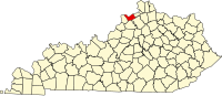
Jeffrey is an unincorporated community located near Peter/s Creek on Bethlehem Church Road, approximately eight miles (13 km) northwest of Tompkinsville, Monroe County, Kentucky, United States.