Worthville, Kentucky

Last updated
Worthville, Kentucky
Carroll County Kentucky Incorporated and Unincorporated areas Worthville Highlighted 2184900.svg
Location of Worthville in Carroll County, Kentucky.
Coordinates: 38°36′35″N85°04′05″W / 38.60972°N 85.06806°W / 38.60972; -85.06806
Country United States
State Kentucky
County Carroll
Area
[1]
  Total0.26 sq mi (0.66 km2)
  Land0.26 sq mi (0.66 km2)
  Water0.00 sq mi (0.00 km2)
Elevation
[2]
486 ft (148 m)
Population
 (2020)
  Total181
  Density709.80/sq mi (273.57/km2)
Time zone UTC-5 (Eastern (EST))
  Summer (DST) UTC-4 (EDT)
ZIP code
41098
Area code 502
FIPS code 21-84900
GNIS feature ID2405792 [2]

Worthville is a home rule-class city in Carroll County, Kentucky, United States. The population was 185 at the 2010 census. [3]

Contents

History

A post office was established at Worthville in 1847. [4] The community was named for William J. Worth, an American general. [5]

Geography

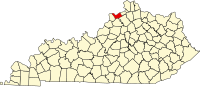
Worthville is located along the southern boundary of Carroll County. Eagle Creek, on the county line, flows past the southern border of the town and joins the Kentucky River less than 1 mile (1.6 km) to the southwest. Owen County is to the south across the creek. Exit 44 of Interstate 71 is 4 miles (6 km) to the northwest along Kentucky Route 227, and Carrollton, the county seat, is 8 miles (13 km) to the northwest.

According to the United States Census Bureau, Worthville has a total area of 0.25 square miles (0.66 km2), all land. [3]

Demographics

Historical population
CensusPop.Note
1880 124
1890 20363.7%
1900 2239.9%
1910 32646.2%
1920 315−3.4%
1930 297−5.7%
1940 33312.1%
1950 308−7.5%
1960 247−19.8%
1970 2584.5%
1980 2725.4%
1990 191−29.8%
2000 21512.6%
2010 185−14.0%
2020 181−2.2%
U.S. Decennial Census [6]

As of the census [7] of 2000, there were 215 people, 78 households, and 58 families residing in the city. The population density was 824.6 inhabitants per square mile (318.4/km2). There were 88 housing units at an average density of 337.5 per square mile (130.3/km2). The racial makeup of the city was 99.07% White, 0.47% African American, and 0.47% from two or more races.

There were 78 trailerhomes out of which 44.9% had children under the age of 18 living with them, 56.4% were married couples living together, 11.5% had a female householder with no husband present, and 25.6% were non-families. 19.2% of all households were made up of individuals, and 6.4% had someone living alone who was 65 years of age or older. The average household size was 2.76 and the average family size was 3.07.

In the city, the population was spread out, with 30.7% under the age of 18, 8.8% from 18 to 24, 30.7% from 25 to 44, 23.7% from 45 to 64, and 6.0% who were 65 years of age or older. The median age was 32 years. For every 100 females, there were 112.9 males. For every 100 females age 18 and over, there were 101.4 males.

The median income for a household in the city was $26,875, and the median income for a family was $28,125. Males had a median income of $27,750 versus $21,250 for females. The per capita income for the city was $10,791. About 10.9% of families and 15.5% of the population were below the poverty line, including 18.8% of those under the age of eighteen and none of those 65 or over.

Related Research Articles

<span class="mw-page-title-main">Marion County, Kentucky</span> County in Kentucky, United States

Marion County is a county in the U.S. state of Kentucky. As of the 2020 census, the total population was 19,581. Its county seat is Lebanon. The county was founded in 1834 and named for Francis Marion, the American Revolutionary War hero known as the "Swamp Fox".

<span class="mw-page-title-main">Carroll County, Kentucky</span> County in Kentucky, United States

Carroll County is a county located in the northern part of the U.S. state of Kentucky. Its county seat is Carrollton. The county was formed in 1838 and named for Charles Carroll of Carrollton, the last living signer of the Declaration of Independence. It is located at the confluence of the Kentucky and Ohio Rivers.

<span class="mw-page-title-main">Halbur, Iowa</span> City in Iowa, United States

Halbur is a city in Carroll County, Iowa, United States. The population was 243 at the time of the 2020 census.

<span class="mw-page-title-main">Willey, Iowa</span> City in Iowa, United States

Willey is a city in Carroll County, Iowa, United States. The population was 73 at the time of the 2020 census.

<span class="mw-page-title-main">Salt Lick, Kentucky</span> City in Kentucky, United States

Salt Lick is a home rule-class city in Bath County, Kentucky, in the United States. The population was 303 at the 2010 U.S. Census.

<span class="mw-page-title-main">Prestonville, Kentucky</span> City in Kentucky, United States

Prestonville is a home rule-class city located at the confluence of the Ohio and Kentucky rivers in Carroll County, Kentucky, in the United States. It lies across the Kentucky River from Carrollton. The population was 161 at the 2010 U.S. Census.

<span class="mw-page-title-main">Bancroft, Kentucky</span> City in Kentucky, United States

Bancroft is a home rule-class city in Jefferson County, Kentucky, United States. It was formally incorporated by the state assembly in 1970. The population was 494 at the 2010 census.

<span class="mw-page-title-main">Cambridge, Kentucky</span> City in Kentucky, United States

Cambridge is a home rule-class city in Jefferson County, Kentucky, United States. The population was 175 at the 2010 census.

<span class="mw-page-title-main">Coldstream, Kentucky</span> City in Kentucky, United States

Coldstream is a home rule-class city in Jefferson County, Kentucky, United States. The population was 1,100 at the 2010 census, up from 956 at the 2000 census.

<span class="mw-page-title-main">Crossgate, Kentucky</span> City in Kentucky, United States

Crossgate is a home rule-class city in Jefferson County, Kentucky, United States. The population was 225 at the 2010 census.

<span class="mw-page-title-main">Fincastle, Kentucky</span> City in Kentucky, United States

Fincastle is a home rule-class city in eastern Jefferson County, Kentucky, United States. The population was 817 at the 2010 census.

<span class="mw-page-title-main">Houston Acres, Kentucky</span> City in Kentucky, United States

Houston Acres is a home rule-class city in Jefferson County, Kentucky, United States. The population was 507 at the 2010 census.

<span class="mw-page-title-main">Hurstbourne Acres, Kentucky</span> City in Kentucky, United States

Hurstbourne Acres is a home rule-class city in Jefferson County, Kentucky, United States. The population was 1,811 at the 2010 census, up from 1,504 at the 2000 census.

<span class="mw-page-title-main">Lincolnshire, Kentucky</span> City in Kentucky, United States

Lincolnshire is a home rule-class city in Jefferson County, Kentucky, United States. The population was 148 at the 2010 census.

<span class="mw-page-title-main">Norbourne Estates, Kentucky</span> City in Kentucky, United States

Norbourne Estates is a home rule-class city in Jefferson County, Kentucky, United States. The population was 441 at the 2010 census.

<span class="mw-page-title-main">Norwood, Kentucky</span> City in Kentucky, United States

Norwood is a home rule-class city in Jefferson County, Kentucky, United States. The population was 370 at the 2010 census.

<span class="mw-page-title-main">Thornhill, Kentucky</span> City in Kentucky, United States

Thornhill is a home rule-class city in Jefferson County, Kentucky, United States. The population was 178 at the 2010 census.

<span class="mw-page-title-main">Fort Mitchell, Kentucky</span> City in Kentucky, United States

Fort Mitchell is a home rule-class city in Kenton County, Kentucky, United States. The population was 8,702 at the 2020 census. It is part of the Cincinnati metropolitan area.

<span class="mw-page-title-main">Whitley City, Kentucky</span> Census-designated place in Kentucky, United States

Whitley City is an unincorporated community and census-designated place (CDP) in McCreary County, Kentucky, United States. The population was 968 at the 2020 census, down from 1,170 in 2010. It is the county seat of McCreary County. Whitley City is one of two unincorporated county seats in Kentucky.

<span class="mw-page-title-main">South Carrollton, Kentucky</span> City in Kentucky, United States

South Carrollton is a home rule-class city in Muhlenberg County, Kentucky, United States. The population was 141 at the 2020 census, down from 184 in 2010. Founded as "Randolph Old Farm" in 1838, an early pioneer changed the name of the city to honor his son, Carroll. The name was prefixed with "South" in order to distinguish it from the city of Carrollton.

References

  1. "2020 U.S. Gazetteer Files". United States Census Bureau. Retrieved March 18, 2022.
  2. 1 2 U.S. Geological Survey Geographic Names Information System: Worthville, Kentucky
  3. 1 2 "Geographic Identifiers: 2010 Demographic Profile Data (G001): Worthville city, Kentucky". U.S. Census Bureau, American Factfinder. Archived from the original on February 12, 2020. Retrieved August 7, 2014.
  4. "Carroll County". Jim Forte Postal History. Retrieved 3 January 2015.
  5. Lewis Collins (1877). History of Kentucky. p. 118.
  6. "Census of Population and Housing". Census.gov. Retrieved June 4, 2015.
  7. "U.S. Census website". United States Census Bureau . Retrieved 2008-01-31.