New Liberty, Kentucky Adams Town | |
---|---|
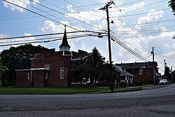
![]() Looking west on KY 36 in New Liberty | |
Coordinates: 38°36′57″N84°54′24″W / 38.61583°N 84.90667°W | |
Country | United States |
State | Kentucky |
County | Owen |
Elevation | 889 ft (271 m) |
Time zone | UTC-5 (EST) |
• Summer (DST) | UTC-4 (EDT) |
ZIP code | 40355 |
Area code | 502 |
GNIS feature ID | 499364 |
[1] |
New Liberty is an unincorporated community in northern Owen County, Kentucky, United States. Kentucky Routes 36 and 227 run through the community. Despite being unincorporated, it has a post office with a ZIP Code of 40355. [2]
The Jacob Hunter House is listed on the National Register of Historic Places. Much of the downtown area is also listed as the New Liberty Historic District.
New Liberty was platted in 1815. [3] A former variant name was "Twin Meeting House", after a church located in the community. [3] A post office called New Liberty has been in operation since 1823. [4]
A ZIP Code is a system of postal codes used by the United States Postal Service (USPS). Introduced on July 1, 1963, the basic format consisted of five digits. In 1983, an extended ZIP+4 code was introduced; it included the five digits of the ZIP Code, followed by a hyphen and four digits that designated a more specific location.
Big Creek Township is a civil township of Oscoda County in the U.S. state of Michigan. The population was 2,827 at the 2010 census.
Millersville is an unincorporated community in Anne Arundel County, Maryland, United States. Population was 20,965 in 2015 based on American Community Survey data.
Georgetown is an unincorporated community at the junction of Bradley, Hamilton, and Meigs counties, Tennessee. The community is located along State Route 60 near its intersection with State Route 58.
Austin is a small unincorporated community within the boundaries of the incorporated town of Orchard City in Delta County, Colorado, United States. There is a U.S. Post Office in Austin, the ZIP Code for which is 81410.
Powderhorn is an unincorporated community and a U.S. Post Office in Gunnison County, Colorado, United States. The Powderhorn Post Office has the ZIP Code 81243.
Mount Liberty is an unincorporated community on the border between the Milford and Liberty Townships of Knox County, Ohio, United States. It has a post office with the ZIP code 43048. It lies along the concurrent U.S. Route 36 and State Route 3.
Margarettsville, North Carolina, United States, is an unincorporated community in northern Northampton County. The community is part of the Roanoke Rapids, North Carolina Micropolitan Statistical Area. The ZIP Code for Margarettsville is 27853.
Wrigley is an unincorporated community in Morgan County, Kentucky, United States. It lies along Route 7, north of the city of West Liberty, the county seat of Morgan County. Its elevation is 817 feet (249 m), and it is located at 38°1′6″N83°16′17″W. It has a post office with the ZIP code 41477.
East Enterprise is an unincorporated census-designated place in central Cotton Township, Switzerland County, in the U.S. state of Indiana. Although East Enterprise is unincorporated, it has a post office, with the ZIP code of 47019.
Elizaville is a census-designated place and unincorporated community in Fleming County, Kentucky, United States. Its population was 181 as of the 2010 census. Elizaville is located at the junction of Kentucky Route 32 and Kentucky Route 170, 5 miles (8.0 km) west of Flemingsburg. Elizaville has a post office with ZIP code 41037.
McDaniels is an unincorporated community in Breckinridge County, Kentucky, United States. McDaniels is located along Kentucky Route 259, 15.5 miles (24.9 km) due south of Hardinsburg. McDaniels is situated on Rough River Lake, which collects the 29.5-mile-long (47.5 km) North Fork Rough River, which flows for its entire length in Breckinridge County. McDaniels has a post office with ZIP code 40152.
Clarksville is an unincorporated community in Baltimore Hundred, Sussex County, Delaware, United States located just west of Millville. It is centered, more or less, along Delaware Route 26. Many tourists from the Baltimore–Washington metropolitan area pass through the town on their way to and from the Delaware Beaches.
Guston is a rural unincorporated community in Meade County, Kentucky, United States. It is a small unincorporated community that lies a few miles southwest of Brandenburg on KY 428, near its intersection with KY 710.
Lost Creek is an unincorporated community in Breathitt County, Kentucky. The community is centered on the intersection of Lost Creek and Troublesome Creek, and the junction of Kentucky Route 476 with Kentucky Route 15 about 6 miles (9.7 km) south-southeast of Jackson. Lost Creek has a post office with ZIP code 41348, which opened on October 11, 1849.
Wallpack Center is an unincorporated community located within Walpack Township, Sussex County, in the U.S. state of New Jersey. Wallpack Center is located in the Flat Brook Valley 6.7 miles (10.8 km) west of Branchville. Wallpack Center has a post office with ZIP Code 07881. It is now part of the Delaware Water Gap National Recreation Area.
Herndon is an unincorporated community located in Christian County, Kentucky, United States. It is concentrated around the intersection of Kentucky Route 107 and Kentucky Route 117, southwest of Hopkinsville. It has a post office with zip code 42236.
Milford is an unincorporated community in Bracken County, in the U.S. state of Kentucky. The ZIP Code for Milford is 41061.
Liberty Hill is a scattered unincorporated community in Kershaw County, South Carolina, United States. The community is located along and either side of the junction of South Carolina Highway 97 and South Carolina Highway 522, 19.5 miles (31.4 km) northwest of Camden. Liberty Hill has a post office with ZIP code 29074, which opened on January 19, 1818. There is also a fire lookout tower there, and a church, and a few houses spread along the main road, but otherwise no businesses or services.
38°36′57″N84°54′24″W / 38.61583°N 84.90667°W