Early knowledge of the Pacific Northwest

Last updated
1772 Vaugondy and Diderot Map of the Pacific Northwest and the Northwest Passage - Carte Generale des Decouvertes de l'Amiral de Fonte et Autres Navigateurs Espagnols, Anglois et Russes pour la Recherche du Passage a la Mer du Sud. 1772 Vaugondy and Diderot Map of the Pacific Northwest and the Northwest Passage - Geographicus - DeFonteAutres-vaugondy-1772.jpg
1772 Vaugondy and Diderot Map of the Pacific Northwest and the Northwest Passage - Carte Generale des Decouvertes de l'Amiral de Fonte et Autres Navigateurs Espagnols, Anglois et Russes pour la Recherche du Passage a la Mer du Sud.
The great probability of a North West Passage: deduced from observations on the letter of Admiral de Fonte, who sailed from the Callao of Lima on the discovery of a communication between the South Sea and the Atlantic Ocean. Proving the authenticity of the Admiral's letter The great probability of a North West Passage- deduced from observations on the letter of Admiral de Fonte, who sailed from the Callao of Lima on the discovery of a communication between the South Sea (14761095391).jpg
The great probability of a North West Passage: deduced from observations on the letter of Admiral de Fonte, who sailed from the Callao of Lima on the discovery of a communication between the South Sea and the Atlantic Ocean. Proving the authenticity of the Admiral's letter

The Pacific Northwest coast of North America was one of the last coastlines reached by European explorers. In terms of sailing time from Europe, it was one of the most distant places on earth. This article covers what Europeans knew or thought they knew before the area was explored by Captain Cook in 1778.

Contents

It is not clear what the Chinese and Japanese knew of the area to the north. The accuracy of the Strait of Anián story implies that they may have known something.

The Spaniards sent some expeditions north from Mexico but found little to interest them. In 1542, Juan Rodríguez Cabrillo reached a point north of San Francisco. In 1579 Drake landed somewhere on the coast above 43 degrees N latitude. In 1592 Juan de Fuca may have reached Puget Sound, Washington. In 1602 one of Sebastián Vizcaíno's ships reached Oregon. This was the last northward exploration for 150 years.

Strait of Anian: From about 1562 many European geographers thought there was a Strait of Anián, perhaps near the Bering Strait. Some thought it might be the west end of the Northwest Passage. Where this idea came from is unknown.

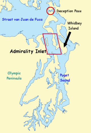
de Fuca: In 1592 Juan de Fuca may have reached Puget Sound, Washington. The documentation is poor and some have considered his voyage mythical.

de Fonte: The story of Bartholomew de Fonte first appeared in 1708 in a short-lived English periodical called Memoirs for the Curious. In 1744 Arthur Dobbs revived it in An Account of the Countries Adjoining Hudson's Bay. In 1752 Joseph Nicholas Delisle published a memoir on what was known of the Pacific Northwest. He said that in 1640 de Fonte, a Spanish Admiral, sailed 5000 miles north from Lima to 53° north where he entered a Rio de los Reyes. This took him through a series of waterways until, at the Strait of Ronquillo, he met a ship from Boston commanded by a Captain Shapely. The accompanying map shows: -

It shows:

It also shows an enormous San Francisco Bay ("Sea of the West") extending to Colorado, its north entrance being the Strait of Juan de Fuca. In the Puget Sound area the Rio de los Reyes leads to a huge lake in the center of the continent called Lake de Fonte. The east end of the lake leads through a Strait of Ronquillo to Hudson Bay near what is marked as Wager Bay (Eau de Wager) (65°30′N 89°00′W) (with Cape Dobbs at its eastern end) and Chesterfield Inlet (although the area between them is incorrectly shown as an island). At about 60° there is a third inlet leading to a long Lake Bernarda which almost reaches Baffin Bay. The third inlet is connected to Rio de los Reyes by two channels. In 1753 Gerhard Müller published an anonymous rebuttal. In 1755 Denis Diderot published a version of Delisle's map in the Encyclopedié. In 1757 Andrés Marcos Burriel published a Noticia de la California in which he said he could find no reference to de Fonte in the Spanish archives. The appendix giving this information did not appear in the English or French translations. in 1783, one year before the publication of Cook's journals, Jean Nolin published a map incorporating Delisle's geography, including an even larger Sea of the West.

Today Fonte’s letter is universally considered to have been a hoax. [3] [4]

Maldonado: Lorenzo Ferrer Maldonado was a Spaniard who had been tried for forgery and counterfeiting. In 1609 he presented to the Spanish court a Relation describing how he had crossed the Northwest Passage in 1588. He said he sailed through Davis Strait to 70° North. Although it was February the sea never froze. [5] He then sailed 790 leagues SW and WSW and reached the Strait of Anian at 60°N. At its mouth he found a large harbor where he met a ship with gold and pearls manned by Lutherans from the Baltic ports. In June he returned, finding temperatures north of the Arctic Circle warmer than those of Spain. A copy of the Relation was found in the Spanish archives 180 years later. In 1791 Alessandro Malaspina was told to look for Maldonado's strait.

Other explorers: Vitus Bering entered the Bering Strait in 1728. In 1771 Samuel Hearne reached the Arctic coast from Hudson Bay, proving that there was no saltwater waterway at this latitude. In 1778 James Cook followed the coast from Oregon to the Bering Strait. People like George Vancouver who followed Cook had to examine each inlet very closely since any one of them could have been the exit from the northwest passage. For the rest see History of the Pacific Northwest.

Further reading

See also

Related Research Articles

<span class="mw-page-title-main">Deception Pass</span> Strait between Whidbey and Fidalgo Islands on Puget Sound

Deception Pass is a strait separating Whidbey Island from Fidalgo Island, in the northwest part of the U.S. state of Washington. It connects Skagit Bay, part of Puget Sound, with the Strait of Juan de Fuca. A pair of bridges known collectively as Deception Pass Bridge cross Deception Pass. The bridges were added to the National Register of Historic Places in 1982.

<span class="mw-page-title-main">Northwest Passage</span> Sea route north of North America

The Northwest Passage (NWP) is the sea lane between the Atlantic and Pacific oceans through the Arctic Ocean, along the northern coast of North America via waterways through the Arctic Archipelago of Canada. The eastern route along the Arctic coasts of Norway and Siberia is accordingly called the Northeast Passage (NEP). The various islands of the archipelago are separated from one another and from Mainland Canada by a series of Arctic waterways collectively known as the Northwest Passages, Northwestern Passages or the Canadian Internal Waters.

<span class="mw-page-title-main">Puget Sound</span> Deep water sound of the Salish Sea in northwestern Washington, United States

Puget Sound, a sound on the northwestern coast of the U.S. state of Washington, is a complex estuarine system of interconnected marine waterways and basins. A part of the Salish Sea, Puget Sound has one major and two minor connections to the Strait of Juan de Fuca, which in turn connects to the open Pacific Ocean. The major connection is Admiralty Inlet; the minor connections are Deception Pass and the Swinomish Channel.

<span class="mw-page-title-main">San Juan Islands</span> Archipelago in the Salish Sea in Washington, US

The San Juan Islands is an archipelago in the Pacific Northwest of the United States between the U.S. state of Washington and Vancouver Island, British Columbia, Canada. The San Juan Islands are part of Washington state, and form the core of San Juan County.

<span class="mw-page-title-main">Strait of Juan de Fuca</span> Strait between Vancouver Island and the Olympic Peninsula

The Strait of Juan de Fuca is a body of water about 96 miles long that is the Salish Sea's main outlet to the Pacific Ocean. The international boundary between Canada and the United States runs down the centre of the Strait.

<span class="mw-page-title-main">Vitus Bering</span> Danish explorer (1681–1741)

Vitus Jonassen Bering, also known as Ivan Ivanovich Bering, was a Danish cartographer and explorer in Russian service, and an officer in the Russian Navy. He is known as a leader of two Russian expeditions, namely the First Kamchatka Expedition and the Great Northern Expedition, exploring the north-eastern coast of the Asian continent and from there the western coast on the North American continent. The Bering Strait, the Bering Sea, Bering Island, the Bering Glacier, and Vitus Lake were all named in his honor.

<span class="mw-page-title-main">Strait of Anián</span> Semi-mythical strait between North America and Asia

The Strait of Anián was a semi-mythical strait, documented from around 1560, that was believed by early modern cartographers to mark the boundary between North America and Asia and to permit access to a Northwest Passage from the Arctic Ocean to the Pacific. The true strait was discovered in 1728 and became known as the Bering Strait. The Strait of Anián had been generally placed nearby, but sometimes appeared as far south as California.

<span class="mw-page-title-main">Strait of Georgia</span> Waterway between Vancouver Island and mainland North America

The Strait of Georgia or the Georgia Strait is an arm of the Salish Sea between Vancouver Island and the extreme southwestern mainland coast of British Columbia, Canada, and the extreme northwestern mainland coast of Washington, United States. It is approximately 240 kilometres (150 mi) long and varies in width from 20 to 58 kilometres. Along with the Strait of Juan de Fuca and Puget Sound, it is a constituent part of the Salish Sea.

<span class="mw-page-title-main">Juan de Fuca</span> Greek explorer in service of Spain

Juan de Fuca was a Greek sailor who served Philip II of Spain. He is best known for his claim to have explored the Strait of Anián—now known as the Strait of Juan de Fuca—between Vancouver Island and the Olympic Peninsula.

<span class="mw-page-title-main">Salish Sea</span> Marginal sea in British Columbia and Washington state

The Salish Sea is a marginal sea of the Pacific Ocean located in the Canadian province of British Columbia and the U.S. state of Washington. It includes the Strait of Georgia, the Strait of Juan de Fuca, Puget Sound, and an intricate network of connecting channels and adjoining waterways.

<span class="mw-page-title-main">Dionisio Alcalá Galiano</span> Spanish naval officer

Dionisio Alcalá Galiano was a Spanish naval officer, cartographer, and explorer. He mapped various coastlines in Europe and the Americas with unprecedented accuracy using new technology such as chronometers. He commanded an expedition that explored and mapped the Strait of Juan de Fuca and the Strait of Georgia, and made the first European circumnavigation of Vancouver Island. He reached the rank of brigadier and died during the Battle of Trafalgar.

<span class="mw-page-title-main">Spanish expeditions to the Pacific Northwest</span> Research expedition

During the Age of Discovery, the Spanish Empire undertook several expeditions to the Pacific Northwest of North America. Spanish claims to the region date to the papal bull of 1493, and the Treaty of Tordesillas signed in 1494. In 1513, this claim was reinforced by Spanish explorer Vasco Núñez de Balboa, the first European to sight the Pacific Ocean, when he claimed all lands adjoining this ocean for the Spanish Crown. Spain only started to colonize the claimed territory north of present-day Mexico in the 18th century, when it settled the northern coast of Las Californias.

Francisco de Eliza y Reventa was a Spanish naval officer, navigator, and explorer. He is remembered mainly for his work in the Pacific Northwest. He was the commandant of the Spanish post in Nootka Sound on Vancouver Island, and led or dispatched several exploration voyages in the region, including the Strait of Juan de Fuca and the Strait of Georgia.

<span class="mw-page-title-main">José María Narváez</span>

José María Narváez was a Spanish naval officer, explorer, and navigator notable for his work in the Gulf Islands and Lower Mainland of present-day British Columbia. In 1791, as commander of the schooner Santa Saturnina, he led the first European exploration of the Strait of Georgia, including a landing on present-day British Columbia's Sunshine Coast. He also entered Burrard Inlet, the site of present-day Vancouver, British Columbia.

<span class="mw-page-title-main">Great Northern Expedition</span> Expedition to map the Arctic coast of Siberia and North American

The Great Northern Expedition or Second Kamchatka Expedition was one of the largest exploration enterprises in history, mapping most of the Arctic coast of Siberia and some parts of the North American coastline, greatly reducing "white areas" on maps. It was conceived by Russian Emperor Peter the Great, but implemented by Russian Empresses Anna and Elizabeth. The main organiser and leader of the expedition was Vitus Bering, who earlier had been commissioned by Peter I to lead the First Kamchatka Expedition. The Second Kamchatka Expedition lasted roughly from 1733 to 1743 and later was called the Great Northern Expedition due to the immense scale of its achievements.

Juan Carrasco was a Spanish naval officer, explorer, and navigator. He is remembered mainly for his work in the Pacific Northwest during the late 18th century. He was second in command of the 1791 voyage of José María Narváez, the first European exploration of the Strait of Georgia.

Princess Royal was a British merchant ship that sailed on fur trading ventures in the late 1780s, and was captured at Nootka Sound by Esteban José Martínez of Spain during the Nootka Crisis of 1789. Called Princesa Real while under the Spanish Navy, the vessel was one of the important issues of negotiation during the first Nootka Convention and the difficulties in carrying out the agreements. The vessel also played an important role in both British and Spanish exploration of the Pacific Northwest and the Hawaiian Islands. In 1790, while under Spanish control, Princesa Real carried out the first detailed examination of the Strait of Juan de Fuca by non-indigenous peoples, finding, among other places, the San Juan Islands, Haro Strait, Esquimalt Harbour near present-day Victoria, British Columbia, and Admiralty Inlet.

<span class="mw-page-title-main">Timeline of European exploration</span>

This timeline of European exploration lists major geographic discoveries and other firsts credited to or involving Europeans during the Age of Discovery and the following centuries, between the years AD 1418 and 1957.

<span class="mw-page-title-main">Sea of the West</span> Geographic misconception of an inland sea in the Pacific Northwest

The Sea of the West, or Mer de l'Ouest, was a geographic misconception of an inland sea in the Pacific Northwest that appeared on many maps of the 18th century. The depiction was particularly common on French maps. The sea was supposed to be connected to the Pacific Ocean by at least one strait. Many different conjectures about the sea's shape, size, and position appeared on maps of the period.

References