This article needs additional citations for verification .(November 2009) (Learn how and when to remove this template message) |
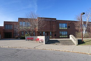
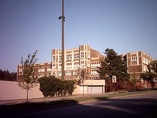
| East Middle School | |
|---|---|
| Address | |
1001 Atkins Street , 16502 United States | |
| Information | |
| Type | Public high school |
| Established | 1919 (as a junior high school) [1] |
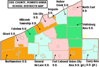
| School district | Erie City School District |
| Principal | Scherry Prater |
| Grades | 6-8 |
| Enrollment | 944 [2] |
| Color(s) | Scarlet and Gray |
| Mascot | Native American Warrior |
| Website | |
East Middle School, part of the School District of the City of Erie, was a public high school located in Erie, Pennsylvania, United States. The school colors are scarlet and gray. The school mascot was a Native American Warrior. People associated with East were known as "East High School Warriors", "East Warriors", or "Warriors".
The Erie City School District is the school district that serves Erie, Pennsylvania in the United States. It is a member of the Northwest Tri-County IU 5.

Erie is a city on the south shore of Lake Erie and the county seat of Erie County, Pennsylvania, United States. Named for the lake and the Native American Erie people who lived in the area until the mid-17th century, Erie is the fourth-largest city in Pennsylvania, as well as the largest city in Northwestern Pennsylvania, with a population of 101,786 at the 2010 census. The estimated population in 2018 had decreased to 96,471. The Erie metropolitan area, equivalent to all of Erie County, consists of 276,207 residents. The Erie-Meadville, PA Combined Statistical Area has a population of 369,331, as of the 2010 Census.

Pennsylvania, officially the Commonwealth of Pennsylvania, is a state located in the northeastern, Great Lakes and Mid-Atlantic regions of the United States. The Appalachian Mountains run through its middle. The Commonwealth is bordered by Delaware to the southeast, Maryland to the south, West Virginia to the southwest, Ohio to the west, Lake Erie and the Canadian province of Ontario to the northwest, New York to the north, and New Jersey to the east.
In 2017, East High School became a middle school when the School District of the City of Erie consolidated all of its high schools-- with the exception of Northwest Pennsylvania Collegiate Academy-- and created Erie High School (Pennsylvania). [3]
The Northwest Pennsylvania Collegiate Academy, or just Collegiate Academy or Academy High School, is located in midtown Erie, Pennsylvania. The school is housed in the former Academy High School building; that school merged with Central Tech High School in September 1992. The school boasts a 100% college acceptance rate among recent graduates.
Erie High School is a high school in Erie, Pennsylvania in the United States. Formerly called Central Tech High School, it was renamed in 2017 after the Erie City School District converted two of the other high schools, Strong Vincent High School and East High School, into middle schools.