Related Research Articles

Anhui is an inland province located in East China. Its provincial capital and largest city is Hefei. The province is located across the basins of the Yangtze and Huai rivers,bordering Jiangsu and Zhejiang to the east,Jiangxi to the south,Hubei and Henan to the west,and Shandong to the north. With a population of 61 million,Anhui is the 9th most populous province in China. It is the 22nd largest Chinese province based on area,and the 12th most densely-populated region of all 34 Chinese provincial regions. Anhui's population is mostly composed of Han Chinese. Languages spoken within the province include Lower Yangtze Mandarin,Wu,Hui,Gan and small portion of Central Plains Mandarin.

Henan is a province in Central China. Henan is home to many heritage sites,including Yinxu,the ruins of the final capital of the Shang dynasty and the Shaolin Temple. Four of the historical capitals of China,Luoyang,Anyang,Kaifeng and Zhengzhou,are in Henan.

The 1931 China floods,or the 1931 Yangtze–Huai River floods,occurred from June to August 1931 in China,hitting major cities such as Wuhan,Nanjing and beyond,and eventually culminated in a dike breach along Lake Gaoyou on 25 August 1931.

The 1938 Yellow River flood was a man-made flood from June 1938 to January 1947 created by the intentional destruction of levees on the Yellow River in Huayuankou,Henan by the National Revolutionary Army (NRA) during the Second Sino-Japanese War. The first wave of floods hit Zhongmu County on 13 June 1938.

Intense Tropical Cyclone Leon–Eline was the second longest-lived cyclone in the Indian Ocean,behind Cyclone Freddy,traveling over 11,000 km (6,800 mi) during its 29-day track through the Indian Ocean,throughout the month of February. The cyclone formed on 1 February 2000,in the Australian basin as Tropical Cyclone Leon,and was renamed Eline after crossing 90° E into the South-West Indian Ocean;there,the Météo-France office in Réunion (MFR) tracked the storm's movement and intensity. Late on 17 February,Eline made landfall near Mahanoro,Madagascar,with 10‑minute winds of 165 km/h (103 mph). The storm rapidly weakened over land,but restrengthened in the Mozambique Channel to reach peak 10‑minute winds of 185 km/h (115 mph),making it an intense tropical cyclone. On 22 February,Eline made landfall about 80 km (50 mi) south of Beira,Mozambique,near peak intensity. Eline quickly weakened over land as it moved across Southern Africa,finally dissipating over eastern Namibia on 29 February.

In October 1999,severe flooding affected portions of eastern Mexico and Central America. Rainfall in September preceded the primary event in Mexico,which moistened soils. On October 4,Tropical Depression Eleven developed in the Gulf of Mexico,which drew humidity from the gulf and the Pacific Ocean to produce torrential rainfall in mountainous regions of eastern Mexico,reaching 43.23 in (1,098 mm) in Jalacingo,Veracruz. This was the third-highest tropical cyclone-related rainfall total in Mexico from 1980–2006,and the event caused the highest rainfall related to tropical cyclones in Veracruz,Hidalgo,and Puebla. In some locations,the daily rainfall represented over 10% of the annual precipitation total. The heaviest rainfall occurred in mountainous regions that were the mouths of several rivers. A broad trough absorbed the depression on October 6,and rainfall continued for the next few days. Additional rainfall occurred in Tabasco state on October 18. The floods were estimated as a 1 in 67 year event in one location,although such floods are expected to affect eastern Mexico twice per century,the last time being 1944.

The 2008 South China floods began on 26 May 2008. Four rounds of torrential rains with landslides and flooding lasted for 20 days and affected fifteen provinces in Eastern and Southern China.

The October 2008 Central America floods were caused by a series of low-pressure areas including Tropical Depression Sixteen,a short-lived tropical cyclone in the 2008 Atlantic hurricane season that made landfall in Honduras. Heavy rainfall began in early October 2008 while a tropical wave passed through the region. On October 14,Tropical Depression Sixteen formed just off the northeast coast of Honduras,and at the same time a low-pressure system was on the Pacific coast. Both systems increased rainfall across the region,although the depression dropped heavy rainfall close to its center when it moved ashore on October 15. Although Tropical Depression Sixteen quickly dissipated over land,its remnants persisted for several days. Another low-pressure area interacted with a cold front on October 21,adding to the rainfall in the region.
The 2011 China floods were a series of floods from June to September 2011 that occurred in central and southern parts of the People's Republic of China. They were caused by heavy rain that inundated portions of 12 provinces,leaving other provinces still suffering a prolonged drought,and with direct economic losses of nearly US$6.5 billion.

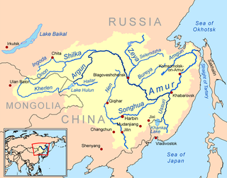
During mid-August 2013 parts of eastern Russia and northeastern China were stricken by heavy flooding. At least 85 people died from the floods and more than 105 others were left missing as of August 19. More than 60,000 homes were destroyed and 840,000 people evacuated from Heilongjiang,Jilin,and Liaoning provinces due to flooding which happened at the same time as flooding in China's southern Guangdong province.

The Henan famine of 1942–1943 occurred within the context of the Second Sino-Japanese War and resulted from a combination of natural and human factors. Anthony Garnaut put the death toll to be "well under one million",probably around 700,000. While Lloyd Eastman puts it between 2 and 3 million dead. 15 years later Henan was struck by the deadlier Great Chinese famine.

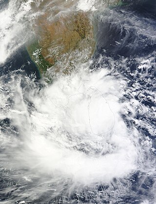
Beginning on 14 May 2016,a low pressure area over the Bay of Bengal caused torrential rain to fall across Sri Lanka,causing floods and landslides which affected half a million people. As of 25 May 2016 the death toll was 101 with 100 missing.
In mid-June 2016,severe weather such as heavy rainfall,thunderstorms and hail began across southern China,triggering deadly floods. Over the following month,additional rain events exacerbated flooding and affected more of the country. Areas along the Yangtze River and Huai River have been particularly hard-hit. An estimated 32 million people across 26 provinces were affected and more than 200 people were killed. 280,000 hectares of cropland was destroyed,with state damage estimates of around US$5.73 billion. According to Aon Benfield,the damage estimate has reached US$22 billion. Flooding of this magnitude was last seen in the country in 1998. The floods destroyed over 23,600 houses and left 3,600 refugees homeless.
The 2017 Sri Lanka floods resulted from a heavy southwest monsoon,beginning around 18 to 19 May 2017. Flooding was worsened by the arrival of the precursor system to Cyclone Mora,causing flooding and landslides throughout Sri Lanka during the final week of May 2017. The floods affected 15 districts,killed at least 208 people and left a further 78 people missing. As of 3 June,698,289 people were affected,while 11,056 houses were partially damaged and another 2,093 houses completely destroyed. According to Al Jazeera,about 600,000 people have been displaced due to the floods.

Tropical Storm Rumbia was a rather weak but very destructive tropical cyclone that caused widespread and disastrous flooding in East China in August 2018. The twenty-second officially recognized tropical cyclone of the 2018 Pacific typhoon season,Rumbia developed from an area of low pressure that developed southeast of the Ryukyu Islands on August 13. Favorable environmental conditions supported development of the low into a tropical depression by August 15. At 12:00 UTC that day,the depression strengthened into Tropical Storm Rumbia,which refers to the Sago palm. Initially moving northward,the cyclone turned westward in response to a building ridge to its northeast while slowly strengthening,reaching its peak intensity with maximum 10-minute sustained winds of 85 km/h (50 mph) on August 16. At 20:05 UTC that day,the storm made landfall in Shanghai at peak intensity,maintaining its strength as it moved inland due to ample environmental moisture. However,Rumbia began to weaken as it continued further inland,degenerating into a tropical depression on August 17 shortly before becoming extratropical over central China. The extratropical remnants of Rumbia accelerated northeastward into the Russian Far East,where they dissipated on August 23.

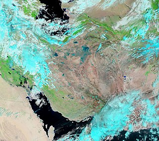
From mid-March to April 2019 widespread flash flooding affected large parts of Iran,most severely in Golestan,Fars,Khuzestan,Lorestan,and other provinces. Iran has been hit by three major waves of rain and flooding over the course of two weeks which led to flooding in at least 26 of Iran's 31 provinces and at least 70 people died nationwide as of 6 April,according to the officials. The first wave of rain began on 17 March,leading to flooding in two northern provinces,Golestan and Mazandaran with the former province receiving as much as 70 percent of its average annual rainfall in single day. Several large dams have been overflowed,particularly in Khuzestan and Golestan,therefore many villages and several cities have been evacuated. About 1,900 cities and villages across country have been damaged by severe floods as well as hundreds of millions of dollars of damage to water and agriculture infrastructure. 78 roads were blocked and the reliability of 84 bridges was questioned.

The 1992 India–Pakistan floods was a deadly flood caused by a five days long heavy monsoon rains and severe weather that occurred on 7 September 1992 across the north-Pakistan of Azad Kashmir,North-West Frontier Province and Indian administered state of Jammu and Kashmir. Severe floods left at least 2,496 fatalities,including 2,000 deaths in Pakistan administered state,296 in Punjab province,and 200 in northern India with several others missing. The floods swept away more than 12,672 villages and several people were buried alive due to landslides near mountains. Punjab,that shares its borders with Azad Kashmir,suffered a heavy agriculture loss in its economic history.

In August 1975,the Banqiao Dam and 61 others throughout Henan,China collapsed following the landfall of Typhoon Nina. The dam collapse created the third-deadliest flood in history which affected 12,000 km2 with a total population of 10.15 million,including around 30 cities and counties,with estimates of the death toll ranging from 26,000 to 240,000. The flood also caused the collapse of 5 million to 6.8 million houses. The dam failure took place in the context of the Cultural Revolution.

China's Henan Province experienced flooding between 17 and 31 July 2021 as a result of heavy rainfall. On July 20,Zhengzhou,the provincial capital,recorded 201.9 millimetres (7.95 in) of rainfall within an hour,the highest ever figure recorded since measurements began in 1951. On 2 August 2021,provincial authorities reported 302 deaths,and over 50 missing people. Later,government investigations led to conclude that provincial officials had “deliberately impeded and withheld reports of up to 139 cases”,and that the full death toll was 398. The floods caused the evacuation of 815,000 people,and affected 14.5 million people around the province. The intensity of the floods was believed to have been amplified by extreme weather caused by climate change.
Several floods caused by heavy rainfall struck in China starting in Guangdong Province in April 2024. Bands of heavy rainfall in June 2024 caused water levels to rise in rivers before moving northwards to other Southeastern and Central Chinese provinces,causing significantly raised water levels in the Yangtze River and the Pearl River Delta,inundating many towns and cities,forcing the relocation of hundreds of thousands of civilians,destroying several roads,structures,and farmland,and causing at least 71 deaths.
References
- 1 2 "China - Floods Jun 1991 UNDRO Situation Reports 1-9". 25 June 1991. Retrieved 17 April 2017.
- ↑ "China appeals for international aid for flood relief". Archived from the original on 17 April 2017. Retrieved 17 April 2017.
- ↑ Kristof, Nicholas D. (27 January 1992). "China's Floods of July: Misery Lingers". The New York Times. Retrieved 17 April 2017– via NYTimes.com.