West Midlands is a metropolitan and ceremonial county in the larger West Midlands region of England. A landlocked county, it is bordered by Staffordshire to the north and west, Worcestershire to the south, and is surrounded by Warwickshire to the east. The largest settlement is the city of Birmingham.
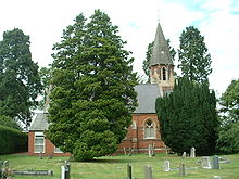
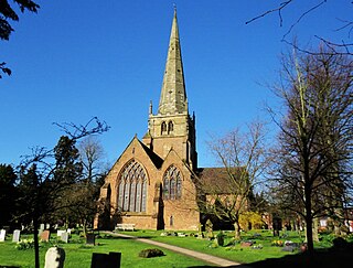
Knowle is a large village situated 3 miles (5 km) east-southeast of the town of Solihull, West Midlands, England. Knowle lies within the Arden area of the historic county boundaries of Warwickshire, and since 1974 it has been part of the Metropolitan Borough of Solihull within the West Midlands. It lies 2.5 miles from the Warwickshire border and had a recorded population of 10,678.

The Metropolitan Borough of Solihull is a metropolitan borough in West Midlands county, England. It is named after its largest town, Solihull, from which Solihull Metropolitan Borough Council is based. For Eurostat purposes it is a NUTS 3 region and is one of seven boroughs or unitary districts that comprise the "West Midlands" NUTS 2 region. Much of the large residential population in the north of the borough centres on the communities of Castle Bromwich, Kingshurst, Marston Green and Smith's Wood as well as the towns of Chelmsley Wood and Fordbridge. In the south are the towns of Shirley and Solihull, as well as the large villages of Knowle, Dorridge, Meriden and Balsall Common.

A civil parish is a subnational entity, forming the lowest unit of local government in England. There are 21 civil parishes in the ceremonial county of West Midlands, most of the county being unparished; Dudley, Sandwell, Walsall and Wolverhampton are completely unparished. At the 2001 census, there were 89,621 people living in the parishes, accounting for 3.5 per cent of the county's population.
Keresley is a suburban village and civil parish in the City of Coventry, West Midlands, England, about 4.5 miles (7 km) north of Coventry city centre and 3.5 miles (6 km) southwest of Bedworth. According to the 2001 census, the parish had a population of 791 falling to 713 at the 2011 Census, although the 2018 population was estimated at 783.

Allesley is a village and civil parish in the City of Coventry metropolitan borough, West Midlands, about 4 miles (5.25 km) west-northwest of Coventry city centre and 4 miles (6.5 km) east-south-east of Meriden. Located in the Arden area of historic Warwickshire, the parish population according to the 2001 census was 805, which rose to 837 at the 2011 census, and as of the 2021 census, the population was 908. Until 1998, Allesley contained the main Jaguar car assembly plant at Browns Lane.

Hockley Heath is a large village and civil parish in the Arden area mostly within the Metropolitan Borough of Solihull, West Midlands, England. It incorporates the hamlet of Nuthurst, and has a history dating back to the year 705 AD as a wood owned by Worcester Cathedral. The parish, known as Nuthurst cum Hockley Heath, is to the south of the West Midlands conurbation, 12 miles (19 km) southeast of Birmingham 5.5 miles (8.9 km) from Solihull town centre and 12.5 miles (20.1 km) north of Stratford-upon-Avon. The village forms part of the border with Warwickshire and the District of Stratford-on-Avon to the south, with some parts of the village on either side of the border. According to the 2001 census, the parish had a population of 6,771, being measured at the 2011 Census as 2,038.

Finham is a mainly residential part of the city of Coventry, West Midlands, England, and is the city's southernmost suburb, approximately 3.5 miles (6 km) from Coventry city centre. Finham shares its northern boundary along the A45 with the suburb of Styvechale/Stivichall to the north, and part of its southeastern boundary is shared with the village of Baginton in Warwickshire. The suburb of Green Lane lies directly to the west and the hamlet of King's Hill lies within a mile of Finham at Coventry's southernmost point. Finham civil parish was created on 1 April 2016. It is one of Coventry's most prosperous districts, especially the area east of Leamington Road and is popular with professionals working in Warwick, Leamington Spa and Kenilworth.
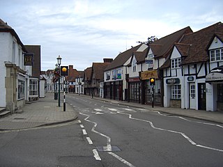
Solihull is a large market town and the administrative centre of the Metropolitan Borough of Solihull, in the West Midlands, England. Solihull is situated on the River Blythe in the Forest of Arden area. The town had a population of 126,577 at the 2021 Census, and its wider borough had a population of 216,240. The town is located 7.5 miles southeast of Birmingham, 13 miles west of Coventry and 18 miles northwest of Warwick.

Exhall is a village in the Nuneaton and Bedworth borough in Warwickshire, England. It forms part of the Coventry and Bedworth urban area and is contiguous with the Coventry suburb of Longford and the village of Hawkesbury Village.
The River Sherbourne is a river that flows under the centre of the city of Coventry, in the West Midlands, in England.

Stivichall or Styvechale is a suburb of the city of Coventry, West Midlands, England. It is a mainly residential area in the south of the city.

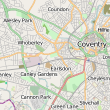
Whoberley is a residential suburb of the City of Coventry in the West Midlands, England.
Stoke Heath is a residential area of Coventry, West Midlands, England. It is situated approximately 1 mile (1.6 km) to the north east of the city centre. It borders Courthouse Green to the north, Wyken to the east, Foleshill to the west, and Stoke to the south with its western edge demarcated by the A444.

Chapelfields is a suburb of Coventry, West Midlands, England. It is situated about 1.5 miles to the west of Coventry City Centre; bordering Coundon to the north, Earlsdon to the south, Spon End to the east and Whoberley to the west. It is mainly residential, with a high proportion of graduates among the younger residents, and nowadays a significant element of students, particularly those studying at the University of Warwick. Houses in Chapelfields proper are mostly small to medium-sized terraced houses with gardens.
Allesley Green is a modern suburb of Coventry in the West Midlands, England, within the civil parish of Allesley.
Allesley Park is a park near Coventry, West Midlands, England. It is also the name of the residential suburb adjacent to the park, which is approximately 2.5 miles northwest of Coventry city centre, just east of the A45 Coventry bypass.