Ebensfeld | |
|---|---|
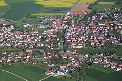 Aerial view | |
 Coat of arms | |
Location of Ebensfeld within Lichtenfels district  | |
 Ebensfeld  Ebensfeld | |
| Coordinates: 50°04′N10°57′E / 50.067°N 10.950°E | |
| Country | Germany |
| State | Bavaria |
| Admin. region | Oberfranken |
| District | Lichtenfels |
| Government | |
| • Mayor (2020–26) | Bernhard Storath [1] (CSU) |
| Area | |
• Total | 68.73 km2 (26.54 sq mi) |
| Elevation | 255 m (837 ft) |
| Population (2023-12-31) [2] | |
• Total | 5,613 |
| • Density | 82/km2 (210/sq mi) |
| Time zone | UTC+01:00 (CET) |
| • Summer (DST) | UTC+02:00 (CEST) |
| Postal codes | 96250 |
| Dialling codes | 09573 |
| Vehicle registration | LIF |
| Website | www.ebensfeld.de |
Ebensfeld is a municipality in the district of Lichtenfels in Bavaria in Germany. It lies on the river Main.

