Naumburg is a town in the district Burgenlandkreis, in the state of Saxony-Anhalt, Central Germany. It has a population of around 33,000. The Naumburg Cathedral became a UNESCO World Heritage Site in 2018. This UNESCO designation recognizes the processes that shaped the European continent during the High Middle Ages between 1000 and 1300: Christianization, the so-called "Landesausbau" and the dynamics of cultural exchange and transfer characteristic for this very period.

The Franconian Circle was an Imperial Circle established in 1500 in the centre of the Holy Roman Empire. It comprised the eastern part of the former Franconian stem duchy—roughly corresponding with the present-day Bavarian Regierungsbezirke of Upper, Middle and Lower Franconia—while western Rhenish Franconia belonged to the Upper Rhenish Circle. The title of a "Duke of Franconia" was claimed by the Würzburg bishops.

Freyburg is a town in the Burgenlandkreis district, in Saxony-Anhalt, Germany. It is situated on the river Unstrut, 9 km northwest of Hanseatic Naumburg, 63 km from Leipzig and 231 km from Berlin. It is part of the Verwaltungsgemeinschaft Unstruttal. On 1 July 2009 it absorbed the former municipalities Pödelist, Schleberoda, Weischütz and Zeuchfeld. Freyburg consists of the Ortsteile (divisions) Dobichau, Freyburg, Nißmitz, Pödelist, Schleberoda, Weischütz, Zeuchfeld and Zscheiplitz.

Naumburg Cathedral, located in Naumburg, Germany, is the former cathedral of the Bishopric of Naumburg-Zeitz. The church building, most of which dates back to the 13th century, is a renowned landmark of the German late Romanesque and was recognised as a UNESCO World Heritage Site in 2018. The west choir with the famous donor portrait statues of the twelve cathedral founders (Stifterfiguren) and the Lettner, works of the Naumburg Master, is one of the most significant early Gothic monuments.
Schleberoda is a village and a former municipality in the Burgenlandkreis district, in Saxony-Anhalt, Germany. Since 1 July 2009, it has been part of the town Freyburg.

The Naumburg Master was an anonymous medieval stone sculptor. His works date to the middle of the 13th century, were executed over a career of more than thirty years, and are counted among the most important artworks of the European Middle Ages.

The lokator was a medieval sub-contractor, who was responsible to a territorial lord or landlord for the clearing, survey and apportionment of land that was to be settled. In addition, he hired settlers for this purpose, provided their means of subsistence during the transitional period and made materiel and implements available, such as seed, draught animals, iron ploughs, etc. He thus played a key role during the establishment of new towns and villages, as well as the clearing of uncultivated land during the phase of internal colonisation (Binnenkolonisation) in North German and the German Ostsiedlung and participated in its success.
Horst Wolfgang Böhme is a German archaeologist with a focus on Late Antiquity / Early Middle Ages and research into castles.

Saaleck Castle is a hill castle near Bad Kösen, now a part of Naumburg, Saxony-Anhalt, Germany.

The Naumburg Cathedral and the High Medieval Cultural Landscape of the Rivers Saale and Unstrut is situated in the state of Saxony-Anhalt, Germany. Naumburg Cathedral and the surrounding cultural landscape were proposed by Germany as a World Heritage Site. On July 1, 2018, only Naumburg Cathedral was designated by UNESCO as a World Heritage Site. This article discusses the cathedral and its cultural landscape based on the submissions in 1998 (cathedral) and 2005.

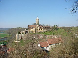
Schönburg Castle, is in the municipality of Schönburg, Saxony-Anhalt, Germany. It has been proposed by Germany as a World Heritage Site.
Goseck, a monastery built on the foundations of a castle, as well as the vineyard of Dechantenberg is located in the municipality of Goseck of Saxony-Anhalt in Germany. It has been proposed by Germany for inscription in the List of World Heritage. The World Heritage nomination Naumburg Cathedral and the High Medieval Cultural Landscape of the Rivers Saale and Unstrut is a representative of the processes that shaped the continent during the High Middle Ages between 1000 and 1300: Christianization, the so-called "Landesausbau" and the dynamics of cultural exchange and transfer characteristic for this very period.
Landesausbau describes medieval settlement and cultivation processes in regions of Western Europe that were previously only sparsely populated or uninhabitable. By means of clearing of woods and drainage of wetlands, new agricultural areas and new settlement areas were created.

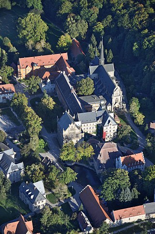
The Pforta monastery is a former Cistercian monastery located near Naumburg in Saxony-Anhalt, Germany. It was established in the 1130s and prospered in the Middle Ages. In the course of the Reformation the monastery was disbanded in 1540. Today the buildings are used by the school Landesschule Pforta. The site is located on the tourist route Romanesque Road and has been nominated by Germany for inclusion in the UNESCO list of World Heritage Sites.
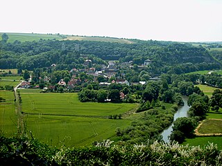
The village of Großwilsdorf and the Rödel Plateau are situated in Saxony-Anhalt in the middle of Germany. It has been proposed by Germany as a World Heritage Site. The World Heritage nomination Naumburg Cathedral and the High Medieval Cultural Landscape of the Rivers Saale and Unstrut is representative for the processes that shaped the continent during the High Middle Ages between 1000 and 1300: Christianization, the so-called Landesausbau and the dynamics of cultural exchange and transfer characteristic for this very period.

Saaleck is a village in the former municipality of Bad Kösen, since 2010 part of the town of Naumburg in the district of Burgenlandkreis in the German state of Saxony-Anhalt.

Kleinjena is situated 4 kilometres north of Naumburg on a long spur at the foot of the Finne mountain range above the village of Kleinjena, at the heart of Federal Republic of Germany in the State of Saxony-Anhalt. It has been proposed by Germany for inscription in the List of World Heritage. The World Heritage nomination is representative for the processes that shaped the continent during the High Middle Ages between 1000 and 1300: Christianization, the so-called "Landesausbau" and the dynamics of cultural exchange and transfer characteristic for this very period.
The village of Flemmingen is one of the eleven components of the cultural landscape Naumburg Cathedral and the High Medieval Cultural Landscape of the Rivers Saale and Unstrut that has been proposed by the Federal Republic of Germany for inscription in the List of World Heritage. The World Heritage nomination is representative for the processes that shaped the continent during the High Middle Ages between 1000 and 1300: Christianization, the so-called “Landesausbau” and the dynamics of cultural exchange and transfer characteristic for this very period.

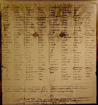
The Hersfeld Tithe Register is a list of the places and castles in the Friesenfeld Gau (territory) and in Hassegau, from which Hersfeld Abbey received tithes. The original document dates from between 881 and 887 or between 896 and 899, but no longer exists. The list is found in a transcript from the 11th Century, which is now in the Hessischen Staatsarchiv Marburg.

Johannisberg is a prominent ridge of the Wöllmisse, a Muschelkalk plateau east of Jena. The steeply sloping spur of land to the Saale Valley north of the district of Alt-Lobeda bears the remains of two important fortifications from the late Bronze Age and the early Middle Ages. Due to several archaeological excavations and finds recovered since the 1870s, they are among the few investigated fortifications from these periods in Thuringia. Of particular interest in archaeological and historical research is the early medieval castle. Due to its location directly on the eastern bank of the Saale, its dating and interpretation were and are strongly linked to considerations of the political-military eastern border of the Frankish empire. It is disputed whether it was a fortification of independent Slavic rulers or whether it was built under Frankish rule. According to a recent study, it may have been built in the second half of the 9th century in connection with the establishment of the limes sorabicus under Frankish influence.


