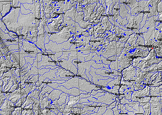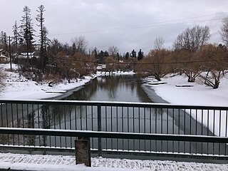
Long Valley Caldera is a depression in eastern California that is adjacent to Mammoth Mountain. The valley is one of the Earth's largest calderas, measuring about 20 mi (32 km) long (east-west), 11 mi (18 km) wide (north-south), and up to 3,000 ft (910 m) deep.

Flathead County is in the U.S. state of Montana. At the 2020 census, its population was 104,357, making it the state's fourth most populous county. Its county seat is Kalispell. Its numerical designation is 7. Its northern border is on the state's north border, making it contiguous with the Canada–US border, facing British Columbia.
Landforms are categorized by characteristic physical attributes such as their creating process, shape, elevation, slope, orientation, rock exposure, and soil type.

Lake Missoula was a prehistoric proglacial lake in western Montana that existed periodically at the end of the last ice age between 15,000 and 13,000 years ago. The lake measured about 7,770 square kilometres (3,000 sq mi) and contained about 2,100 cubic kilometres (500 cu mi) of water, half the volume of Lake Michigan.

The name camas prairie refers to several different geographical areas in the western United States which were named for the native perennial camassia or camas. The culturally and scientifically significant of these areas lie within Idaho and Montana. Camas bulbs were an important food source for Native Americans.

A kettle is a depression or hole in an outwash plain formed by retreating glaciers or draining floodwaters. The kettles are formed as a result of blocks of dead ice left behind by retreating glaciers, which become surrounded by sediment deposited by meltwater streams as there is increased friction. The ice becomes buried in the sediment and when the ice melts, a depression is left called a kettle hole, creating a dimpled appearance on the outwash plain. Lakes often fill these kettles; these are called kettle hole lakes. Another source is the sudden drainage of an ice-dammed lake and when the block melts, the hole it leaves behind is a kettle. As the ice melts, ramparts can form around the edge of the kettle hole. The lakes that fill these holes are seldom more than 10 m (33 ft) deep and eventually fill with sediment. In acid conditions, a kettle bog may form but in alkaline conditions, it will be kettle peatland.

Flathead Lake is a large natural lake in northwest Montana, United States.

The Flathead River, in the northwestern part of the U.S. state of Montana, originates in the Canadian Rockies to the north of Glacier National Park and flows southwest into Flathead Lake, then after a journey of 158 miles (254 km), empties into the Clark Fork. The river is part of the Columbia River drainage basin, as the Clark Fork is a tributary of the Pend Oreille River, a Columbia River tributary. With a drainage basin extending over 8,795 square miles (22,780 km2) and an average discharge of 11,380 cubic feet per second (322 m3/s), the Flathead is the largest tributary of the Clark Fork and constitutes over half of its flow.

The Swan River is a 95-mile (153 km) long, north-flowing river in western Montana in the United States. The river drains a long isolated valley, known as the Swan Valley, between the Swan Range on the east and the Mission Mountains to the west.

A tunnel valley is a U-shaped valley originally cut under the glacial ice near the margin of continental ice sheets such as that now covering Antarctica and formerly covering portions of all continents during past glacial ages. They can be as long as 100 km (62 mi), 4 km (2.5 mi) wide, and 400 m (1,300 ft) deep.

Crab Creek is a stream in the U.S. state of Washington. Named for the presence of crayfish, it is one of the few perennial streams in the Columbia Basin of central Washington, flowing from the northeastern Columbia River Plateau, roughly 5 km (3.1 mi) east of Reardan, west-southwest to empty into the Columbia River near the small town of Beverly. Its course exhibits many examples of the erosive powers of extremely large glacial Missoula Floods of the late Pleistocene, which scoured the region. In addition, Crab Creek and its region have been transformed by the large-scale irrigation of the Bureau of Reclamation's Columbia Basin Project (CBP), which has raised water table levels, significantly extending the length of Crab Creek and created new lakes and streams.

The glacial history of Minnesota is most defined since the onset of the last glacial period, which ended some 10,000 years ago. Within the last million years, most of the Midwestern United States and much of Canada were covered at one time or another with an ice sheet. This continental glacier had a profound effect on the surface features of the area over which it moved. Vast quantities of rock and soil were scraped from the glacial centers to its margins by slowly moving ice and redeposited as drift or till. Much of this drift was dumped into old preglacial river valleys, while some of it was heaped into belts of hills at the margin of the glacier. The chief result of glaciation has been the modification of the preglacial topography by the deposition of drift over the countryside. However, continental glaciers possess great power of erosion and may actually modify the preglacial land surface by scouring and abrading rather than by the deposition of the drift.
Fluvioglacial landforms or glaciofluvial landforms are those that result from the associated erosion and deposition of sediments caused by glacial meltwater. Glaciers contain suspended sediment loads, much of which is initially picked up from the underlying landmass. Landforms are shaped by glacial erosion through processes such as glacial quarrying, abrasion, and meltwater. Glacial meltwater contributes to the erosion of bedrock through both mechanical and chemical processes. Fluvio-glacial processes can occur on the surface and within the glacier. The deposits that happen within the glacier are revealed after the entire glacier melts or partially retreats. Fluvio-glacial landforms and erosional surfaces include: outwash plains, kames, kame terraces, kettle holes, eskers, varves, and proglacial lakes.

The River Warren Falls was a massive waterfall on the glacial River Warren initially located in present-day Saint Paul, Minnesota, United States. The waterfall was 2700 feet (823 m) across and 175 feet (53 m) high.

The Kankakee Outwash Plain is a flat plain interspersed with sand dunes in the Kankakee River valley in northwestern Indiana and northeastern Illinois of the United States. It is just south of the Valparaiso Moraine and was formed during the Wisconsin Glaciation. As the glacier stopped at the Valparaiso Moraine, its meltwater was carried away to the outwash plain. On the south side of the moraine, where the elevation drops, the meltwaters eroded away valleys, carrying sand and mud with them. As the muddy meltwater reached the valley where the slope lessened, the water slowed, depositing the sand on the outwash plain. This created a smooth, flat, and sandy plain. Before its draining, the Kankakee Marsh, located on the outwash plain, was one of the largest freshwater marshes in the United States.

The Whitefish River is a 24.8-mile-long (39.9 km) southward-flowing stream originating at the outlet of Whitefish Lake. The river is a tributary of the Stillwater River just before it reaches the Flathead River in Flathead County, in the U.S. state of Montana. The Whitefish River is part of the Columbia River basin, as the Flathead River is a tributary of Clark Fork, which is a tributary to the Pend Oreille River, which is a tributary to the Columbia River.
A buried valley is an ancient river or stream valley that has been filled with glacial or unconsolidated sediment. This sediment is made up of predominantly gravel and sand, with some silt and clay. These types of sediments can often store and transmit large amounts of groundwater and act as a local aquifer.

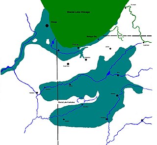
The Kankakee Torrent was a catastrophic flood that occurred about 19,000 calibrated years ago in the Midwestern United States. It resulted from a breach of moraines forming a large glacial lake fed by the melting of the Late Wisconsin Laurentide Ice Sheet. The point of origin of the flood was Lake Chicago. The landscape south of Chicago still shows the effects of the torrent, particularly at Kankakee River State Park and on the Illinois River at Starved Rock State Park.

Lake Kankakee formed 14,000 years before present (YBP) in the valley of the Kankakee River. It developed from the outwash of the Michigan Lobe, Saginaw Lobe, and the Huron-Erie Lobe of the Wisconsin glaciation. These three ice sheets formed a basin across Northwestern Indiana. It was a time when the glaciers were receding, but had stopped for a thousand years in these locations. The lake drained about 13,000 YBP, until reaching the level of the Momence Ledge. The outcropping of limestone created an artificial base level, holding water throughout the upper basin, creating the Grand Kankakee Marsh.
Little Bitterroot River is in northwestern Montana. It in the mountains west of Kalispell north of Marion or about 25 miles (40 km) west-northwest of Flathead Lake. It flows south-southeastward for 65 miles (105 km) to the Flathead River, which goes into the Clark Fork of the Columbia. The basin covers about 600 square miles (1,600 km2), or about 385,000 acres (156,000 ha). The upper basin as mountainous area with interior plains, from 1 to 8 miles wide and about 100 square miles (260 km2) in extent. The plain area traversed by the 40 miles (64 km) its length. The Little Bitterroot valley, is an arm of the Lake Missoula glacial plain south of Flathead Lake.


