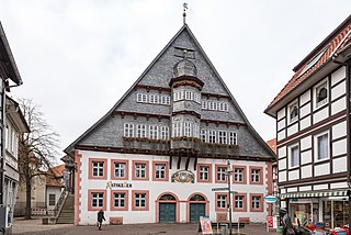
Osterode am Harz, often simply called Osterode, is a town in south-eastern Lower Saxony in central Germany on the south-western edge of the Harz mountains. It was the seat of government of the district of Osterode. Osterode is located on the German Timber-Frame Road.

New Hogan Lake is an artificial lake in the foothills of the Sierra Nevada in Calaveras County, California, about 30 miles (48.3 km) northeast of Stockton. It is formed by New Hogan Dam on the Calaveras River, whose North and South forks combine just upstream of the lake, and has a capacity of 317,000 acre⋅ft (391,000,000 m3). The earth-fill dam, completed in 1963, is 210 feet (64.0 m) high from the crest of the dam to the original streambed. The reservoir was first filled in 1965. There is a small hydroelectric plant at its base. It is owned by the United States Army Corps of Engineers and provides flood protection, drinking water, electricity and water for irrigation. There is also recreation available, such as boating, fishing, water skiing and camping.
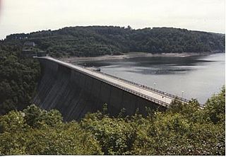
The Rappbode Dam is the largest dam in the Harz region as well as the highest dam in Germany. Together with several other dams and retention basins, it forms the flood protection system for the eastern Harz.
The Söse Dam is a dam in the Lower Saxon part of the Harz mountains near Osterode in the German state of Lower Saxony.

The Neustadt Dam, also known as the Nordhausen Dam, is the oldest dam in the Free State of Thuringia in Germany. It supplies drinking water to the town of Nordhausen. The dam is a curved gravity dam made of rubble stone, based on the Intze Principle. The dam was built in 1904–1905, in the southern Harz mountains, and it was raised by a further 6.26 metres in 1922–1923. The impounded stream is the Krebsbach. The operator of the dam is the Thüringer Fernwasserversorgung; the water is supplied to the Wasserverband Nordhausen.

Radau is a river of Lower Saxony, Germany. It is right tributary of the Oker. It rises in the Harz range, leaves the mountains at Bad Harzburg, and discharges into the Oker near Vienenburg.
The Harzwasserwerke GmbH is a major German water company and dam operator based in Hildesheim, located within the German federal state of Lower Saxony.

The Grane Dam is a dam above the village of Astfeld/Herzog-Juliushütte in the borough of Langelsheim in the Lower Saxon part of the Harz mountains.

The Innerste Dam is a dam on the Innerste river, which lies near Langelsheim and Wolfshagen in the Harz mountains. It was built between 1963 and 1966 and belongs to the Harzwasserwerke. Its purposes are the supply of drinking water, flood protection, water flow regulation and hydroelectric power generation. The average annual discharge through the Innerste Dam is 60 million m³.
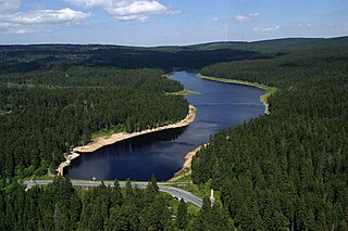
The Oderteich is an historic reservoir about seven kilometres northeast of Sankt Andreasberg in the Upper Harz in central Germany. It was built by miners from St. Andreasberg in the years 1715 to 1722 and, today, is an important component of the water supply network known as the Upper Harz Water Regale. Moreover, for 170 years, from the time it was completed to the end of the 19th century, the Oderteich had the largest dam in Germany. The dam lies at a height of 725 m above NN by the B 242 federal highway, about a kilometre west of its intersection with the B 4.

The Upper Harz Ponds are found mainly around the mining town of Clausthal-Zellerfeld and the nearby villages of Buntenbock and Hahnenklee in the Upper Harz mountains of central Germany. There are around 70 ponds in total, both large and small. They were built by the miners of the Upper Harz, mostly between the 16th and 18th centuries, and are important components of the cultural monument known as the Upper Harz Water Regale - a network of dams, ditches, ponds and tunnels that was built to supply much-needed water power for the mining industry in the Harz mountains. Today the Water Regale is being proposed as a UNESCO World Heritage Site. About half the dammed ponds are classified today as reservoirs, but they have now become characteristic features of the Upper Harz and are home to some extremely rare plant and animal species.

The Dyke Ditch is the longest artificial ditch in the Upper Harz in central Germany. Its purpose was to collect surface runoff for the operation of the Upper Harz mining industry from precipitation-heavy regions a long way away. It was laid in 1732 and continually extended eastwards until 1827. Its original length was about 25 km; this was successively shortened by water tunnels between 1820 and 1861 to around 19 km. It is a central component of the Upper Harz Water Regale. Its takes its name from the Sperberhai Dyke which is, in fact, an embankment on top of which the Dyke Ditch runs in an aqueduct in order to cross a depression.
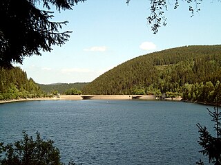
The Oker Dam is a dam in the Harz mountains in Lower Saxony, Germany. It is fed by the River Oker.

The Oder Dam is a dam in the Harz mountains of Germany. It lies above Bad Lauterberg in the district of Göttingen in Lower Saxony and impounds the river Oder. The dam went into service in 1934 after taking 3 years to build. The owner and operator of the Oder Dam is the Harzwasserwerke.
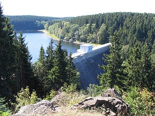
The Zillierbach Dam lies in the East Harz in the German state of Saxony-Anhalt near the town of Elbingerode (Harz) and impounds the Zillierbach stream. It supplies drinking water to several villages in the High Harz as well as the town of Wernigerode; it also provides flood protection.

The Upper Harz Water Regale is a system of dams, reservoirs, ditches and other structures, much of which was built from the 16th to 19th centuries to divert and store the water that drove the water wheels of the mines in the Upper Harz region of Germany. The term regale, here, refers to the granting of royal privileges or rights in this case to permit the use of water for mining operations in the Harz mountains of Germany.

The Kelbra Dam is a dam on the River Helme in the German state of Saxony-Anhalt. Behind the dam is the lake known as the Kelbra Reservoir or Kelbra Flood Retention Basin.
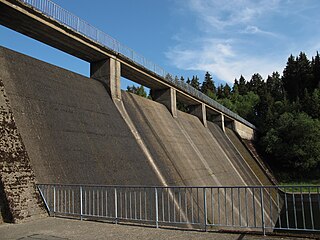
The Hassel Auxiliary Dam or Hassel Dam is an auxiliary dam or pre-dam on the Rappbode Reservoir in the Harz mountains of central Germany. It is located near Hasselfelde in the state of Saxony-Anhalt and impounds the waters of the Hassel, the eastern of the two headwaters of the Rappbode Reservoir. Together with its auxiliary dams, the reservoir supplies drinking water and is owned by the Saxony-Anhalt Dam Company. The purpose of the auxiliary dam is to pre-clean water mechanically and biologically before it flows into the main reservoir. Water can be collected from various heights and diverted to the reservoir.
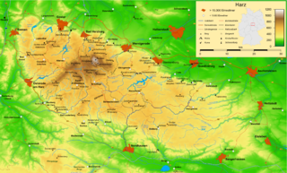
Within the Lower Harz region are still many traces of the historical water management facilities used by the mining industry. In addition to water-carrying ditches and ponds, there are also long-abandoned ditches and dry pond beds. The Lower Harz Pond and Ditch System, which forms the major part of these old water management facilities, lies in the central Lower Harz, almost entirely within the borough of the present-day town of Harzgerode.


