Related Research Articles
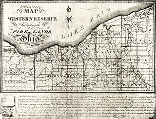
The Dominion Land Survey is the method used to divide most of Western Canada into one-square-mile (2.6 km2) sections for agricultural and other purposes. It is based on the layout of the Public Land Survey System used in the United States, but has several differences. The DLS is the dominant survey method in the Prairie provinces, and it is also used in British Columbia along the Railway Belt, and in the Peace River Block in the northeast of the province.

The Dominion Lands Act was an 1872 Canadian law that aimed to encourage the settlement of the Canadian Prairies and to help prevent the area being claimed by the United States. The Act was closely based on the U.S. Homestead Act of 1862, setting conditions in which the western lands could be settled and their natural resources developed.

Rosthern is a town at the juncture of Highway 11 and Highway 312 in central Saskatchewan, Canada. It is located roughly halfway between the cities of Prince Albert and Saskatoon.

Aberdeen is a town in Saskatchewan, Canada. Located 18 minutes north-east of Saskatoon, it has a population of 622 people.
A survey township, sometimes called a Congressional township or just township, as used by the United States Public Land Survey System and by Canada's Dominion Land Survey is a nominally-square area of land that is nominally six survey miles on a side. Each 36-square-mile township is divided into 36 sections of one square mile each. The sections can be further subdivided for sale.

The Rural Municipality of Aberdeen No. 373 is a Rural Municipality (RM) in the Canadian province of Saskatchewan within Census Division No. 15 and SARM Division No. 5. It is located on the South Saskatchewan River.

Langham is a town in Saskatchewan, Canada. It is located on Highway 16, 35 kilometres northwest of the city of Saskatoon. The 2011 census reported a population of 1,290, with 489 homes in the community.

Furdale is an unincorporated community adjacent to the southern city limits of Saskatoon, Saskatchewan, west of Highway 219 and on the east bank of the South Saskatchewan River. The hamlet's name comes from the many fur farms located in the area beginning around the 1930's.

Strongfield is a village in the Canadian province of Saskatchewan within the Rural Municipality of Loreburn No. 254 and Census Division No. 11. It lies approximately 100 km south of the City of Saskatoon on Highway 19 between its sister communities of Hawarden and Loreburn.
Eigenheim Mennonite Church is a Mennonite church in the Canadian province of Saskatchewan which built the first Mennonite Church building in the province.
RJC High School (Rosthern Junior College) is an independent high school in Rosthern, Saskatchewan, Canada since 1905. Opening in that year as the German-English Academy, it was founded by Mennonite settlers in response to a need for trained teachers to work in the schools being established in homestead communities in Saskatchewan. Implicit in this perceived need were concerns among Mennonite settlers for the preservation of culture, religious values and the German language, concerns that arose directly from the pressure in the province (Northwest Territory at the time) to make education English and assimilative.
Floral, Saskatchewan is an unincorporated community in the province of Saskatchewan, Canada.

Highway 41 is a provincial highway in the Canadian province of Saskatchewan. It runs from Highway 5 in Saskatoon to Highway 3 / Highway 6 in Melfort. The highway also intersects Highway 2. It is about 163 kilometres (101 mi) long.
Seager Wheeler's Maple Grove Farm is a National Historic Site of Canada. Seager Wheeler's Maple Grove Farm was a farm owned and operated by agronomist Seager Wheeler (1868–1961) "Wheat King of the Prairies" or "The Wheat Wizard of Rosthern" who developed dry land farming techniques as well as fruit and wheat strains which could grow in a short prairie growing season followed by harsh winters. Seager came to Canada in 1885 and applied for his own homestead in 1890. His original homestead was located at NE Section 16 Township 38 Range 4 West of the 3rd Meridian, and he was aided by a loan from the Temperance Colonization Society Limited - Toronto Whereas the nearest present day town of Rosthern, Saskatchewan is located at Sec.35, Twp.42, R.3, W3. To get to the restored Seager Wheeler Maple Grove 185-acre (0.75 km2) Farm travel 7 km east of Rosthern. Five separate entries of wheat which were grown at this farm location during 1911 to 1918 won World Wheat Championships. Morris Bodnar, Member of Parliament for Saskatoon—Dundurn, commemorated Seager Wheeler's Maple Grove Farm as a National Historic Site of Canada on August 3, 1996 The site is honoured as the location where hardy wheat and fruit strains were developed which were well suited to the prairie climate and growing season.
Highway 39 is a provincial, paved, highway in the southern portion of the Canadian province of Saskatchewan connecting North Portal and Moose Jaw in the north. This is a primary Saskatchewan highway maintained by the provincial and national governments and providing a major trucking and tourism route between the United States via Portal, Burke County, North Dakota, and North Portal, Saskatchewan. On July 3, 2000, Highways and Transportation Minister Maynard Sonntag officiated at the ribbon cutting ceremony opening the new duty-free shop and the twinned highway at Saskatchewan's busiest border crossing. Highway 39 is one of Canada's busiest highways, facilitating transport for $6 billion in trade goods via approximately 100,000 trucks over the year. The entire length of highway 39 is paved. The CanAm Highway comprises Saskatchewan Highways Hwy 35, Hwy 39, Hwy 6, Hwy 3, as well as Hwy 2. 44.3 miles (71.3 km) of Saskatchewan Highway 39 contribute to the CanAm Highway between Weyburn and Corinne. Highway 39 is divided or twinned in two areas at North Portal as well as north of Weyburn for 1.7 kilometres (1.1 mi). The junction of Hwy 39 with the Trans–Canada divided four-lane highway is done via a "Parclo" or partial cloverleaf interchange.

Waldheim is a town of 1,035 residents in the Rural Municipality of Laird No. 404, in the Canadian province of Saskatchewan, 57 kilometres (35 mi) north of Saskatoon. Waldheim is located on Highway 312 in central Saskatchewan, the "Heart of the Old North-Wes". Fort Carlton, Batoche, Battle of Fish Creek, and Seager Wheeler's Maple Grove Farm are all near Waldheim.

Maidstone is a town in west central Saskatchewan, Canada located 57 km east of Lloydminster and 84 km west of North Battleford at the junction of Highway 16 and Highway 21. The community was named after Maidstone, Kent, England.

According to a 2022 census, there were 74,122 Mennonites living in Mexico, the vast majority of which are established in the state of Chihuahua, followed by Campeche at around 15,000, with the rest living in smaller colonies in the states of Durango, Tamaulipas, Zacatecas, San Luis Potosí and Quintana Roo.
The Clarkboro Ferry is a cable ferry in the Canadian province of Saskatchewan. The ferry crosses the South Saskatchewan River at Clark's Crossing, carrying Grid Road 784 across the river, and connecting Warman in the west and Aberdeen in the east. The ferry is named for the community of Clarkboro located southeast of the ferry's eastern terminal. The former town of Clarkboro was home to a section crew on the CNR, had a post office, a general store, a railroad siding, a water tower for steam locomotives and two grain elevators. Both Clarkboro and Clark's Crossing are named for John Fowler Clark, who homesteaded the area in 1882.
The Rural Municipality of Mountain View No. 318 is a rural municipality (RM) in the Canadian province of Saskatchewan within Census Division No. 12 and SARM Division No. 6.
References
- ↑ "Where is Edenburg (SK)". RoadOnMap. Retrieved 20 February 2024.