
The white bass, silver bass, or sand bass is a freshwater fish of the temperate bass family Moronidae. commonly around 12-15 inches long. The species' main color is silver-white to pale green. Its back is dark, with white sides and belly, and with narrow dark stripes running lengthwise on its sides. It has large, rough scales and two dorsal fins. They are widely distributed across North America, inhabiting large reservoirs and rivers. When mating in the spring, they are more often found in shallow rivers, creeks, and streams. They have been introduced in some places as sport fish and also to predate on nuisance fish, such as gizzard shad. It is the state fish of Oklahoma.

The striped bass, also called the Atlantic striped bass, striper, linesider, rock, or rockfish, is an anadromous perciform fish of the family Moronidae found primarily along the Atlantic coast of North America. It has also been widely introduced into inland recreational fisheries across the United States. Striped bass found in the Gulf of Mexico are a separate strain referred to as Gulf Coast striped bass.

Maurice K. Goddard State Park is a 2,856-acre (1,156 ha) Pennsylvania state park in Deer Creek, Mill Creek, New Vernon and Sandy Lake Townships, Mercer County, Pennsylvania in the United States. It features wildlife, waterways and public recreational facilities. Lake Wilhelm shares its shorelines with Maurice K. Goddard State Park and State Game Land No. 270. The dam, constructed in 1971, creates a 1,860-acre (750 ha) lake providing a resource for people and wildlife. Many species of fish and amphibians make Lake Wilhelm their home. A variety of outdoor activities are available in and around the park vicinity. Special events and programs are held throughout the summer months. Maurice K. Goddard State Park is just off exit 130 of Interstate 79 on Pennsylvania Route 358.
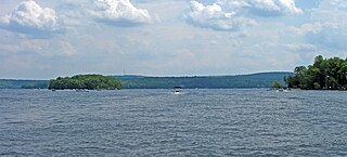
Lake Wallenpaupack is a reservoir in Northeastern Pennsylvania. After Raystown Lake, it is the second-largest lake contained entirely in Pennsylvania. It comprises 52 miles of shoreline, with a length of 13 miles and a maximum depth of 60 feet, and has a surface area in excess of 5,700 acres. It was created in 1926 by the PPL Corporation for hydroelectric purposes as well as flood control; however, it is best known as one of several major recreational destinations in the Pocono Mountains. It is located near the Borough of Hawley, and forms part of the boundary between Pike and Wayne counties. See map.

Towanda Creek is a tributary of the Susquehanna River in Bradford County, Pennsylvania, in the United States. It is approximately 32.9 miles (52.9 km) long and flows through Canton Township, Canton, Leroy Township, Franklin Township, and Monroe Township.

Bowman Creek is a tributary of the Susquehanna River in Luzerne County and Wyoming County, in Pennsylvania, in the United States. It is approximately 26 miles (42 km) long and flows through Ross Township and Lake Township in Luzerne County and Noxen Township, Monroe Township, and Eaton Township in Wyoming County. The watershed of the creek has an area of 120 square miles (310 km2). The creek is not designated as an impaired waterbody and its pH is close to neutral, although it has experienced some problems with acid rain. It has low concentrations of dissolved solids like calcium. The creek is relatively small in its upper reaches, but by Noxen, its width is 40 to 60 feet. It is also relatively shallow in many reaches. Rock formations in the watershed include the Catskill Formation, the Huntley Mountain Formation, Burgoon Sandstone, the Mauch Chunk Formation, the Pottsville Group, and the Pocono Formation. Soil associations in the creek's watershed include the Wellsboro-Morris-Oquaga association, the Oquaga-Lackawanna-Arnot association, the Mardin-Bath-Volusia association, and the Wyoming-Pope association.

Little Pine State Park is a Pennsylvania state park on 2,158 acres (873 ha) in Cummings Township, Lycoming County, Pennsylvania in the United States. Little Pine State park is along 4.2 miles (6.8 km) of Little Pine Creek, a tributary of Pine Creek, in the midst of the Tiadaghton State Forest. A dam on the creek has created a lake covering 94 acres (38 ha) for fishing, boating, and swimming. The park is on Pennsylvania Route 4001, 4 miles (6.4 km) northeast of the unincorporated village of Waterville or 8 miles (13 km) southwest of the village of English Center. The nearest borough is Jersey Shore, Pennsylvania, about 15 miles (24 km) south at the mouth of Pine Creek on the West Branch Susquehanna River.

Kinkaid Lake is a reservoir located in southwestern Illinois. Entirely within Jackson County, the lake is approximately 5 miles (8.0 km) northwest of Murphysboro and 100 miles (160 km) southeast of St. Louis.

Yellow Creek State Park is a Pennsylvania state park on 2,981 acres (1,206 ha) in Brush Valley and Cherryhill Townships, Indiana County, Pennsylvania in the United States. The park encompasses parts of Yellow Creek and Little Yellow Creek. The old Kittanning Path goes through the parkland. The park was established in 1963. An additional 159 acres (64 ha) of developed land were purchased in 1982. Yellow Creek Lake, a 720-acre (290 ha) man-made lake, was built in 1969 by an earth and rock dam on Yellow Creek. Yellow Creek State Park is between the boroughs of Ebensburg and Indiana on U.S. Route 422.

Little Buffalo State Park is a Pennsylvania state park on 923 acres (3.7 km2) in Centre and Juniata Townships, Perry County, Pennsylvania in the United States. The park is a historical destination as well as a recreational destination. Visitors to the park can cross a covered bridge and observe a restored and operating grist mill. The park is also home to Holman Lake a popular fishing lake in Perry County and several hundred acres are open to hunting. Little Buffalo State Park is a mile southwest of Newport just off Pennsylvania Route 34.

Marsh Creek State Park is a 1,705 acres (690 ha) Pennsylvania state park in Upper Uwchlan and Wallace Townships, Chester County, Pennsylvania in the United States. The park is the location of the 535-acre (217 ha) man-made Marsh Creek Lake. With an average depth of 40 feet, the lake is stocked with fish and is a stop for migrating waterfowl. Marsh Creek State Park is 2 miles (3.2 km) west of Eagle on Pennsylvania Route 100. Park road hours 8:00 am until sunset. All other access open 24 hours.

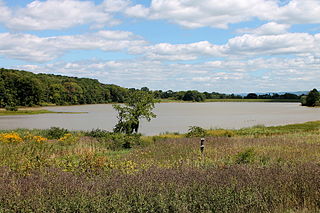
Mt. Pisgah State Park is a 1,302-acre (527 ha) Pennsylvania state park in Smithfield, Springfield, Troy and West Burlington Townships, Bradford County, Pennsylvania in the United States. The park is located almost exactly halfway between Troy and Towanda, along Pennsylvania State Route 3019, near U.S. Route 6, at the base of Mt. Pisgah. The park is bordered by Mill Creek, Mt. Pisgah County Park and State Game Land 289. Mill Creek which flows through the park has been dammed and forms Stephen Foster Lake a 75-acre (30 ha) man-made lake.

Budd Lake is a 175-acre (0.7 km2) lake in Clare County, in the central region of Michigan's lower peninsula.

Canonsburg Lake is a lake in Canonsburg, Pennsylvania. It is an artificial lake formed by the waters of Little Chartiers Creek behind a 525 feet (160 m) long and 45 feet (14 m) high concrete dam. The dam was built in 1943 by Alcoa to create a freshwater reservoir for the Canonsburg Forging Plant, which was considered a strategic resource during World War II. In 1957, the Pennsylvania Fish and Boat Commission (PFBC) acquired the 138-acre property from Alcoa, which included the 76-acre surface area of the lake plus the dam and surrounding lands. The PFBC converted the body of water from an industrial reservoir into a recreational lake.
Potato Lake is a lake located in the northwestern part of Wisconsin. It is in the far southwestern corner of Rusk County, approximately 12 miles east of Chetek, Wisconsin. Potato Lake is one of Rusk County's 88 named lakes, and can be accessed by a ramped public boat landing. It is a drainage lake that is connected to McDermott Creek and Potato Creek. Potato Creek eventually flows into the Chippewa River.

Lake Chillisquaque is a lake and reservoir in Montour County, Pennsylvania, in the United States. It has a surface area of 165 acres. The lake is situated on Middle Branch Chillisquaque Creek, which it is named after. Nearby communities include Danville and Washingtonville. The lake has an elevation of 567 feet (173 m) above sea level and is up to 40 feet (12 m) deep. It has several coves, including Goose Cove, Heron Cove, and Jellyfish Cove. The lake is dammed on its southern side by the Lake Chillisquaque Dam, which is 2,000 feet (610 m) long and 54 feet (16 m) high. The metals with the highest concentrations are calcium and iron. Nonmetals such as nitrogen and phosphorus are also found in the lake. It experiences agricultural runoff as well.
The Briar Creek Reservoir is a reservoir in Columbia County, Pennsylvania, in the United States. It has an area of 51.04 acres and is located in Briar Creek Township. The lake is situated on East Branch Briar Creek. The lake was constructed in the early 1970s for the purpose of flood control. It is dammed by the Briar Creek Dam. Shale and limestone rocks are found in the lake's vicinity. The lake was electrofished by the Pennsylvania Fish and Boat Commission in 2010. The reservoir is designated as Approved Trout Waters and is stocked with trout. More than a dozen species of fish inhabit it and several bird species are found in its vicinity. The lake is part of the 173-acre Briar Creek Lake Park. Fishing and boating are done in the reservoir.

Lily Lake is an impoundment and natural lake in Luzerne County, Pennsylvania, in the United States. It has a surface area of approximately 160 acres and is situated on Pond Creek. It is a natural glacial lake in Slocum Township and Conyngham Township. The lake is listed on the Luzerne County Natural Areas Inventory. It is inhabited by eleven species of fish, including alewives and bluegills. The lake has one boat launch.
Pikes Creek Reservoir is a reservoir in Luzerne County, Pennsylvania, in the United States. It has a surface area of approximately 400 acres (160 ha) and is situated in Lehman Township, Jackson Township, and Plymouth Township. The lake is situated on Pikes Creek. It has a volume of approximately 3 billion gallons and is used as a water supply reservoir. As of 2013, it is inhabited by fifteen fish species. The reservoir is owned by the Pennsylvania-American Water Company, but shoreline fishing is permitted at designated spots.
Fox Lake is a 2,713 acre lake in Dodge County, Wisconsin. The City of Fox Lake, and the communities of Lyndon Dale and Delbern Acres are found along the shoreline. There are two boat landings that are open to the public, found in parks on the northwest and southeast sides of the lake. Fish present in the lake are Panfish, Muskellunge, Largemouth Bass, Northern Pike, and Walleye. Fox Lake is split by the peninsula, that the community of Lyndon Dale is located on, in the south end of the lake. This forms a bay known as The Jug, near the City of Fox Lake. According to the DNR, the bottom of the lake is 1% sand, 30% gravel, and 69% muck. The lake goes through the Fox Lake Dam, into Mill Creek, then flows to Beaver Dam Lake. The Fox Lake Correctional Institution is less than a mile from the north shore of the lake.


