The topic of this article may not meet Wikipedia's general notability guideline .(May 2025) |
Eembrugge | |
|---|---|
Hamlet | |
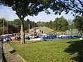
 Eembrugge (2009) | |
 Eembrugge Location in the Netherlands  Eembrugge Eembrugge (Netherlands) | |
| Coordinates: 52°13′N5°18′E / 52.217°N 5.300°E | |
| Country | Netherlands |
| Province | Utrecht |
| Municipality | Baarn Eemnes |
| Area | |
• Total | 0.29 km2 (0.11 sq mi) |
| Population (2021) [1] | |
• Total | 35 |
| • Density | 120/km2 (310/sq mi) |
| Time zone | UTC+1 (CET) |
| • Summer (DST) | UTC+2 (CEST) |
| Postal code | 3755 [1] |
| Dialing code | 035 |
Eembrugge is a hamlet and former city on the river Eem, east of Baarn, in the Netherlands. It received city rights between 1336 en 1340, but was destroyed in 1527. Eembrugge is partially in the municipality of Eemnes, partially in Baarn.