Egremont, Mississippi

Last updated

Egremont
Egremont Highway Sign.jpg
USA Mississippi location map.svg
Red pog.svg
Egremont
Usa edcp location map.svg
Red pog.svg
Egremont
Coordinates: 32°51′38″N90°54′12″W / 32.86056°N 90.90333°W / 32.86056; -90.90333
Country United States
State Mississippi
County Sharkey
Elevation
[1]
108 ft (33 m)
Time zone UTC-6 (Central (CST))
  Summer (DST) UTC-5 (CDT)
GNIS feature ID669697 [1]

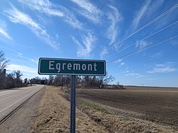
Egremont is an unincorporated community in Sharkey County, Mississippi, United States. A variant name for the community is "Baconia". [1]

Contents

Egremont is located on U.S. Route 61, 4 miles (6.4 km) south of Rolling Fork.

History

During the American Civil War of 1861–1865, a military campaign launched by Union forces was slowed by obstructions placed along Deer Creek at the Egremont Plantation. [2]

In 1880, the Egremont Plantation became the property of Hezekiah William Foote. It was inherited by his son Huger Lee Foote, who was elected Sheriff of Sharkey County in 1890, and went on to serve in the Mississippi Legislature. [3]

In 1984, sculptor Wesley Bobo erected a steel dinosaur along Route 61 in Egremont. [4]

A local juke joint called "Willie Mama's" was located in Egremont, but closed in 2007. It re-opened under the name "The Waterin Hole".[ citation needed ]

References

  1. 1 2 3 U.S. Geological Survey Geographic Names Information System: Egremont, Mississippi
  2. Dumas, David (2012). Steele's Bayou Expedition, a Driving Tour Guide. Author House. ISBN   9781477274439.
  3. Woods, Woody (2010). Delta Plantations - the Beginning. Troy (Woody) Woods. pp. 40, 42. ISBN   9780615383958.[ permanent dead link ]
  4. Black, Patti Carr (1988). Art in Mississippi, 1720-1980. University Press of Mississippi. p. 150. ISBN   9781578060849.