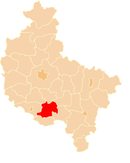
Pogorzela is a town in Gostyń County, Greater Poland Voivodeship, Poland, with 1,958 inhabitants. Pogorzela is located on the western edge of the Kalisz Upland, at the junction of county roads Krotoszyn-Gostyń and the Koźmin-Krobia.
Bielawy Pogorzelskie is a village in the administrative district of Gmina Pogorzela, within Gostyń County, Greater Poland Voivodeship, in west-central Poland.

Bułaków is a village in the administrative district of Gmina Pogorzela, within Gostyń County, Greater Poland Voivodeship, in west-central Poland. It lies approximately 5 kilometres (3 mi) east of Pogorzela, 21 km (13 mi) east of Gostyń, and 69 km (43 mi) south-east of the regional capital Poznań.
Dobrapomoc is a village in the administrative district of Gmina Pogorzela, within Gostyń County, Greater Poland Voivodeship, in west-central Poland.Although in the years 1975-1998 Dobrapomoc was administratively in Szkaradowo.
Głuchów is a village in the administrative district of Gmina Pogorzela, within Gostyń County, Greater Poland Voivodeship, in west-central Poland. It lies approximately 3 kilometres (2 mi) south-east of Pogorzela, 19 km (12 mi) south-east of Gostyń, and 71 km (44 mi) south of the regional capital Poznań.
Głuchówek is a village in the administrative district of Gmina Pogorzela, within Gostyń County, Greater Poland Voivodeship, in west-central Poland. It lies approximately 4 kilometres (2 mi) south-east of Pogorzela, 20 km (12 mi) south-east of Gostyń, and 71 km (44 mi) south of the regional capital Poznań.
Gumienice is a village in the administrative district of Gmina Pogorzela, within Gostyń County, Greater Poland Voivodeship, in west-central Poland. It lies approximately 4 kilometres (2 mi) south-west of Pogorzela, 16 km (10 mi) south-east of Gostyń, and 70 km (43 mi) south of the regional capital Poznań.
Józefów Ochelski is a village in the administrative district of Gmina Pogorzela, within Gostyń County, Greater Poland Voivodeship, in west-central Poland.
Kaczagórka is a village in the administrative district of Gmina Pogorzela, within Gostyń County, Greater Poland Voivodeship, in west-central Poland. It lies approximately 7 kilometres (4 mi) east of Pogorzela, 23 km (14 mi) east of Gostyń, and 70 km (43 mi) south-east of the regional capital Poznań.
Kromolice is a village in the administrative district of Gmina Pogorzela, within Gostyń County, Greater Poland Voivodeship, in west-central Poland. It lies approximately 7 kilometres (4 mi) south-east of Pogorzela, 23 km (14 mi) south-east of Gostyń, and 75 km (47 mi) south of the regional capital Poznań.
Małgów is a village in the administrative district of Gmina Pogorzela, within Gostyń County, Greater Poland Voivodeship, in west-central Poland. It lies approximately 5 kilometres (3 mi) south-east of Pogorzela, 21 km (13 mi) south-east of Gostyń, and 71 km (44 mi) south of the regional capital Poznań.
Międzyborze is a village in the administrative district of Gmina Pogorzela, within Gostyń County, Greater Poland Voivodeship, in west-central Poland.
Nowiny is a village in the administrative district of Gmina Pogorzela, within Gostyń County, Greater Poland Voivodeship, in west-central Poland.
Ochla is a village in the administrative district of Gmina Pogorzela, within Gostyń County, Greater Poland Voivodeship, in west-central Poland. It lies approximately 5 kilometres (3 mi) south of Pogorzela, 19 km (12 mi) south-east of Gostyń, and 72 km (45 mi) south of the regional capital Poznań.
Paradów is a village in the administrative district of Gmina Pogorzela, within Gostyń County, Greater Poland Voivodeship, in west-central Poland. It lies approximately 5 kilometres (3 mi) south-east of Pogorzela, 21 km (13 mi) south-east of Gostyń, and 73 km (45 mi) south of the regional capital Poznań.
Stawy is a village in the administrative district of Gmina Pogorzela, within Gostyń County, Greater Poland Voivodeship, in west-central Poland.
Taczanówko is a village in the administrative district of Gmina Pogorzela, within Gostyń County, Greater Poland Voivodeship, in west-central Poland.
Wziąchów is a village in the administrative district of Gmina Pogorzela, within Gostyń County, Greater Poland Voivodeship, in west-central Poland. It lies approximately 5 kilometres (3 mi) south-east of Pogorzela, 21 km (13 mi) south-east of Gostyń, and 72 km (45 mi) south of the regional capital Poznań.