Mgowo is a village in the administrative district of Gmina Płużnica, within Wąbrzeźno County, Kuyavian-Pomeranian Voivodeship, in north-central Poland. It lies approximately 5 kilometres (3 mi) north-east of Płużnica, 10 km (6 mi) north-west of Wąbrzeźno, and 37 km (23 mi) north-east of Toruń.
Krzeczkowo-Gromadzyn is a village in the administrative district of Gmina Czyżew-Osada, within Wysokie Mazowieckie County, Podlaskie Voivodeship, in north-eastern Poland. It lies approximately 4 kilometres (2 mi) north of Czyżew-Osada, 16 km (10 mi) south-west of Wysokie Mazowieckie, and 65 km (40 mi) south-west of the regional capital Białystok.
Skoków is a village in the administrative district of Gmina Borek Wielkopolski, within Gostyń County, Greater Poland Voivodeship, in west-central Poland. It lies approximately 3 kilometres (2 mi) north-east of Borek Wielkopolski, 19 km (12 mi) east of Gostyń, and 58 km (36 mi) south-east of the regional capital Poznań.
Rębowo is a village in the administrative district of Gmina Piaski, within Gostyń County, Greater Poland Voivodeship, in west-central Poland. It lies approximately 6 kilometres (4 mi) south of Piaski, 8 km (5 mi) south-east of Gostyń, and 64 km (40 mi) south of the regional capital Poznań.
Bułaków is a village in the administrative district of Gmina Pogorzela, within Gostyń County, Greater Poland Voivodeship, in west-central Poland. It lies approximately 5 kilometres (3 mi) east of Pogorzela, 21 km (13 mi) east of Gostyń, and 69 km (43 mi) south-east of the regional capital Poznań.
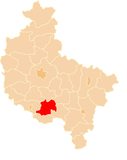
Dobrapomoc is a village in the administrative district of Gmina Pogorzela, within Gostyń County, Greater Poland Voivodeship, in west-central Poland.Although in the years 1975-1998 Dobrapomoc was administratively in Szkaradowo.
Elżbietków is a village in the administrative district of Gmina Pogorzela, within Gostyń County, Greater Poland Voivodeship, in west-central Poland. It lies approximately 6 kilometres (4 mi) north of Pogorzela, 16 km (10 mi) east of Gostyń, and 64 km (40 mi) south of the regional capital Poznań.
Głuchów is a village in the administrative district of Gmina Pogorzela, within Gostyń County, Greater Poland Voivodeship, in west-central Poland. It lies approximately 3 kilometres (2 mi) south-east of Pogorzela, 19 km (12 mi) south-east of Gostyń, and 71 km (44 mi) south of the regional capital Poznań.
Głuchówek is a village in the administrative district of Gmina Pogorzela, within Gostyń County, Greater Poland Voivodeship, in west-central Poland. It lies approximately 4 kilometres (2 mi) south-east of Pogorzela, 20 km (12 mi) south-east of Gostyń, and 71 km (44 mi) south of the regional capital Poznań.
Gumienice is a village in the administrative district of Gmina Pogorzela, within Gostyń County, Greater Poland Voivodeship, in west-central Poland. It lies approximately 4 kilometres (2 mi) south-west of Pogorzela, 16 km (10 mi) south-east of Gostyń, and 70 km (43 mi) south of the regional capital Poznań.
Kromolice is a village in the administrative district of Gmina Pogorzela, within Gostyń County, Greater Poland Voivodeship, in west-central Poland. It lies approximately 7 kilometres (4 mi) south-east of Pogorzela, 23 km (14 mi) south-east of Gostyń, and 75 km (47 mi) south of the regional capital Poznań.
Małgów is a village in the administrative district of Gmina Pogorzela, within Gostyń County, Greater Poland Voivodeship, in west-central Poland. It lies approximately 5 kilometres (3 mi) south-east of Pogorzela, 21 km (13 mi) south-east of Gostyń, and 71 km (44 mi) south of the regional capital Poznań.
Ochla is a village in the administrative district of Gmina Pogorzela, within Gostyń County, Greater Poland Voivodeship, in west-central Poland. It lies approximately 5 kilometres (3 mi) south of Pogorzela, 19 km (12 mi) south-east of Gostyń, and 72 km (45 mi) south of the regional capital Poznań.
Paradów is a village in the administrative district of Gmina Pogorzela, within Gostyń County, Greater Poland Voivodeship, in west-central Poland. It lies approximately 5 kilometres (3 mi) south-east of Pogorzela, 21 km (13 mi) south-east of Gostyń, and 73 km (45 mi) south of the regional capital Poznań.
Wziąchów is a village in the administrative district of Gmina Pogorzela, within Gostyń County, Greater Poland Voivodeship, in west-central Poland. It lies approximately 5 kilometres (3 mi) south-east of Pogorzela, 21 km (13 mi) south-east of Gostyń, and 72 km (45 mi) south of the regional capital Poznań.
Grodzisko is a village in the administrative district of Gmina Poniec, within Gostyń County, Greater Poland Voivodeship, in west-central Poland. It lies approximately 12 kilometres (7 mi) north-east of Poniec, 8 km (5 mi) south-west of Gostyń, and 63 km (39 mi) south of the regional capital Poznań.
Koźlątków is a village in the administrative district of Gmina Lisków, within Kalisz County, Greater Poland Voivodeship, in west-central Poland. It lies approximately 5 kilometres (3 mi) west of Lisków, 20 km (12 mi) north-east of Kalisz, and 116 km (72 mi) south-east of the regional capital Poznań.
Kornaty is a village in the administrative district of Gmina Strzałkowo, within Słupca County, Greater Poland Voivodeship, in west-central Poland. It lies approximately 3 kilometres (2 mi) north of Strzałkowo, 5 km (3 mi) north-west of Słupca, and 63 km (39 mi) east of the regional capital Poznań.
Kiedrowo is a village in the administrative district of Gmina Wągrowiec, within Wągrowiec County, Greater Poland Voivodeship, in west-central Poland. It lies approximately 10 kilometres (6 mi) east of Wągrowiec and 56 km (35 mi) north-east of the regional capital Poznań.