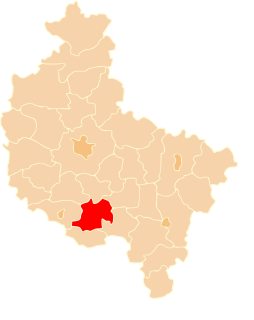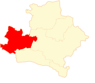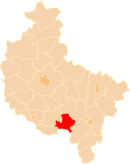
Krotoszyn County is a unit of territorial administration and local government (powiat) in Greater Poland Voivodeship, west-central Poland. It came into being on January 1, 1999, as a result of the Polish local government reforms passed in 1998. Its administrative seat and largest town is Krotoszyn, which lies 88 kilometres (55 mi) south-east of the regional capital Poznań. The county contains four other towns: Koźmin Wielkopolski, 16 km (10 mi) north of Krotoszyn, Zduny, 6 km (4 mi) south-west of Krotoszyn, Kobylin, 14 km (9 mi) west of Krotoszyn, and Sulmierzyce, 12 km (7 mi) south-east of Krotoszyn.

Grodzisk Wielkopolski County is a unit of territorial administration and local government (powiat) in Greater Poland Voivodeship, west-central Poland. It came into being on January 1, 1999, as a result of the Polish local government reforms passed in 1998. Its administrative seat and largest town is Grodzisk Wielkopolski, which lies 42 kilometres (26 mi) south-west of the regional capital Poznań. The county also contains the towns of Rakoniewice, lying 13 km (8 mi) south-west of Grodzisk Wielkopolski, and Wielichowo, 13 km (8 mi) south of Grodzisk Wielkopolski.

Kościan County is a unit of territorial administration and local government (powiat) in Greater Poland Voivodeship, west-central Poland. It came into being on January 1, 1999, as a result of the Polish local government reforms passed in 1998. Its administrative seat and largest town is Kościan, which lies 40 kilometres (25 mi) south-west of the regional capital Poznań. The county contains three other towns: Śmigiel, 13 km (8 mi) south-west of Kościan, Czempiń, 13 km (8 mi) north-east of Kościan, and Krzywiń, 18 km (11 mi) south-east of Kościan.
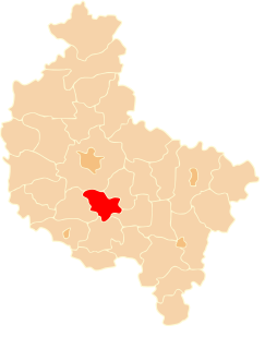
Śrem County is a unit of territorial administration and local government (powiat) in Greater Poland Voivodeship, west-central Poland. It came into being on January 1, 1999, as a result of the Polish local government reforms passed in 1998. Its administrative seat and largest town is Śrem, which lies 36 kilometres (22 mi) south of the regional capital Poznań. The county also contains the towns of Książ Wielkopolski, lying 15 km (9 mi) east of Śrem, and Dolsk, 12 km (7 mi) south of Śrem.
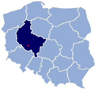
Gmina Gostyń is an urban-rural gmina in Gostyń County, Greater Poland Voivodeship, in west-central Poland. Its seat is the town of Gostyń, which lies approximately 59 kilometres (37 mi) south of the regional capital Poznań.
Gmina Krobia is an urban-rural gmina in Gostyń County, Greater Poland Voivodeship, in west-central Poland. Its seat is the town of Krobia, which lies approximately 11 kilometres (7 mi) south of Gostyń and 69 km (43 mi) south of the regional capital Poznań.
Gmina Pępowo is a rural gmina in Gostyń County, Greater Poland Voivodeship, in west-central Poland. Its seat is the village of Pępowo, which lies approximately 15 kilometres (9 mi) south-east of Gostyń and 73 km (45 mi) south of the regional capital Poznań.

Gmina Piaski is a rural gmina in Gostyń County, Greater Poland Voivodeship, in west-central Poland. Its seat is the village of Piaski, which lies approximately 5 kilometres (3 mi) east of Gostyń and 59 km (37 mi) south of the regional capital Poznań.
Gmina Poniec is an urban-rural gmina in Gostyń County, Greater Poland Voivodeship, in west-central Poland. Its seat is the town of Poniec, which lies approximately 20 kilometres (12 mi) south-west of Gostyń and 72 km (45 mi) south of the regional capital Poznań.
Gmina Grodzisk Wielkopolski is an urban-rural gmina in Grodzisk Wielkopolski County, Greater Poland Voivodeship, in west-central Poland. Its seat is the town of Grodzisk Wielkopolski, which lies approximately 42 kilometres (26 mi) south-west of the regional capital Poznań.

Gmina Krotoszyn is an urban-rural gmina in Krotoszyn County, Greater Poland Voivodeship, in west-central Poland. Its seat is the town of Krotoszyn, which lies approximately 88 kilometres (55 mi) south-east of the regional capital Poznań.
Gmina Dolsk is an urban-rural gmina in Śrem County, Greater Poland Voivodeship, in west-central Poland. Its seat is the town of Dolsk, which lies approximately 12 kilometres (7 mi) south of Śrem and 48 km (30 mi) south of the regional capital Poznań.
Gmina Książ Wielkopolski is an urban-rural gmina in Śrem County, Greater Poland Voivodeship, in west-central Poland. Its seat is the town of Książ Wielkopolski, which lies approximately 15 kilometres (9 mi) east of Śrem and 43 km (27 mi) south-east of the regional capital Poznań.

Głuchów is a village in the administrative district of Gmina Pogorzela, within Gostyń County, Greater Poland Voivodeship, in west-central Poland. It lies approximately 3 kilometres (2 mi) south-east of Pogorzela, 19 km (12 mi) south-east of Gostyń, and 71 km (44 mi) south of the regional capital Poznań.

Kromolice is a village in the administrative district of Gmina Pogorzela, within Gostyń County, Greater Poland Voivodeship, in west-central Poland. It lies approximately 7 kilometres (4 mi) south-east of Pogorzela, 23 km (14 mi) south-east of Gostyń, and 75 km (47 mi) south of the regional capital Poznań.

Małgów is a village in the administrative district of Gmina Pogorzela, within Gostyń County, Greater Poland Voivodeship, in west-central Poland. It lies approximately 5 kilometres (3 mi) south-east of Pogorzela, 21 km (13 mi) south-east of Gostyń, and 71 km (44 mi) south of the regional capital Poznań.

