
Guararé District is a district (distrito) of Los Santos Province in Panama. The population according to the 2000 census was 9,485. The district covers a total area of 216 km². The capital lies at the city of Guararé.

Los Santos District is a district (distrito) of Los Santos Province in Panama. The population according to the 2000 census was 23,828. The district covers a total area of 429 km². The capital lies at the city of La Villa de los Santos.
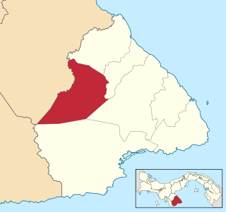
Macaracas District is a district (distrito) of Los Santos Province in Panama. The population according to the 2000 census was 9,137. The district covers a total area of 504 km². The capital lies at the city of Macaracas.

Pocrí District is a district (distrito) of Los Santos Province in Panama. The population according to the 2000 census was 3,397. The district covers a total area of 280 km². The capital lies at the city of Pocrí, Los Santos.

Tonosí District is a district (distrito) of Los Santos Province in Panama. The population according to the 2000 census was 9,736. The district covers a total area of 1,294 km². The capital lies at the city of Tonosí.

La Villa de los Santos also known La Heroica Villa de Los Santos,is the capital city and a corregimiento of the Los Santos District of Los Santos Province, Panama. It is at the left edge of La Villa River. Founded as Santa Cruz in 1555 by Juan Rodriguez Monjaraz, the then governor of the region, the city is known for The Gesture of Rufina Alfaro and the population's efforts in the movement to separate Panama from Spanish power in November 1821.
El Espinal is a corregimiento in Guararé District, Los Santos Province, Panama with a population of 1,243 as of 2010. Its population as of 1990 was 1,117; its population as of 2000 was 1,206.
El Hato is a corregimiento in Guararé District, Los Santos Province, Panama with a population of 374 as of 2010. It was created by Law 58 of July 29, 1998, owing to the Declaration of Unconstitutionality of Law 1 of 1982. Its population as of 2000 was 416.
El Macano is a corregimiento in Guararé District, Los Santos Province, Panama with a population of 281 as of 2010. Its population as of 1990 was 339; its population as of 2000 was 242.
El Pedregoso is a corregimiento in Las Tablas District, Los Santos Province, Panama with a population of 279 as of 2010. Its population as of 1990 was 288; its population as of 2000 was 266.
El Carate is a corregimiento in Las Tablas District, Los Santos Province, Panama with a population of 873 as of 2010. Its population as of 1990 was 723; its population as of 2000 was 831.
El Cocal is a corregimiento in Las Tablas District, Los Santos Province, Panama with a population of 1,889 as of 2010. Its population as of 1990 was 1,239; its population as of 2000 was 1,486.
El Manantial is a corregimiento in Las Tablas District, Los Santos Province, Panama with a population of 909 as of 2010. Its population as of 1990 was 631; its population as of 2000 was 793.
El Muñoz is a corregimiento in Las Tablas District, Los Santos Province, Panama with a population of 376 as of 2010. Its population as of 1990 was 319; its population as of 2000 was 328.
El Guásimo is a corregimiento in Los Santos District, Los Santos Province, Panama with a population of 610 as of 2010. Its population as of 1990 was 645; its population as of 2000 was 555.
El Cedro is a corregimiento in Macaracas District, Los Santos Province, Panama with a population of 450 as of 2010. Its population as of 1990 was 461; its population as of 2000 was 489.
El Cortezo is a corregimiento in Tonosí District, Los Santos Province, Panama with a population of 662 as of 2010. Its population as of 1990 was 760; its population as of 2000 was 734.
El Cañafístulo is a corregimiento in Pocrí District, Los Santos Province, Panama with a population of 363 as of 2010. Its population as of 1990 was 500; its population as of 2000 was 460.
El Bebedero is a corregimiento in Tonosí District, Los Santos Province, Panama with a population of 1,332 as of 2010. Its population as of 1990 was 1,227; its population as of 2000 was 1,389.
El Cacao is a corregimiento in Tonosí District, Los Santos Province, Panama with a population of 1,049 as of 2010. Its population as of 1990 was 778; its population as of 2000 was 932.

