Guararé is a town and corregimiento in Guararé District, Los Santos Province, Panama with a population of 4524 as of 2010. It is the seat of Guararé District. Its population as of 1990 was 3329, its population as of 2000 was 3,883. It is also recognized by its annual festival of La Mejorana.
La Espigadilla is a corregimiento in Los Santos District, Los Santos Province, Panama with a population of 1,675 as of 2010. Its population as of 1990 was 1,423; its population as of 2000 was 1,580.
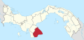
La Raya de Santa María is a corregimiento in Santiago District, Veraguas Province, Panama with a population of 3,268 as of 2010. Its population as of 1990 was 3,401; its population as of 2000 was 3,517.

La Villa de los Santos also known La Heroica Villa de Los Santos, is the capital city and a corregimiento of the Los Santos District of Los Santos Province, Panama. It is at the left edge of La Villa River. Founded as Santa Cruz in 1555 by Juan Rodriguez Monjaraz, the then governor of the region, the city is known for The Gesture of Rufina Alfaro and the population's efforts in the movement to separate Panama from Spanish power in November 1821.
La Laja is a corregimiento in Las Tablas District, Los Santos Province, Panama with a population of 547 as of 2010. Its population as of 1990 was 553; its population as of 2000 was 583.
La Trinidad is a corregimiento in Capira District, Panamá Oeste Province, Panama with a population of 2,572 as of 2010. Its population as of 1990 was 2,160; its population as of 2000 was 2,287.
Amador is a corregimiento in La Chorrera District, Panamá Oeste Province, Panama with a population of 2,996 as of 2010. Its population as of 1990 was 1,925; its population as of 2000 was 2,675.
Arosemena is a corregimiento in La Chorrera District, Panamá Oeste Province, Panama with a population of 426 as of 2010. Its population as of 1990 was 340; its population as of 2000 was 290.
Barrio Colón is a corregimiento within the city of La Chorrera, in La Chorrera District, Panamá Oeste Province, Panama with a population of 33,214 as of 2010. Its population as of 1990 was 20,746; its population as of 2000 was 26,818.
Herrera is a corregimiento in La Chorrera District, Panamá Oeste Province, Panama with a population of 2,552 as of 2010. Its population as of 1990 was 715; its population as of 2000 was 812.
Hurtado is a corregimiento in La Chorrera District, Panamá Oeste Province, Panama with a population of 1,206 as of 2010. Its population as of 1990 was 703; its population as of 2000 was 893.
Iturralde is a corregimiento in La Chorrera District, Panamá Oeste Province, Panama with a population of 1,354 as of 2010. Its population as of 1990 was 792; its population as of 2000 was 927.
La Represa is a corregimiento in La Chorrera District, Panamá Oeste Province, Panama with a population of 681 as of 2010. Its population as of 1990 was 650; its population as of 2000 was 696. Most recently, its population was recorded as 796 in 2015.
Los Díaz is a corregimiento in La Chorrera District, Panamá Oeste Province, Panama with a population of 1,200 as of 2010. Its population as of 1990 was 858; its population as of 2000 was 893.
Mendoza is a corregimiento in La Chorrera District, Panamá Oeste Province, Panama with a population of 1,233 as of 2010. Its population as of 1990 was 851; its population as of 2000 was 1,053.
El Higo is a corregimiento in San Carlos District, Panamá Oeste Province, Panama with a population of 2,710 as of 2010. Its population as of 1990 was 1,920; its population as of 2000 was 2,341.
La Laguna is a corregimiento in San Carlos District, Panamá Oeste Province, Panama with a population of 1,132 as of 2010. Its population as of 1990 was 778; its population as of 2000 was 968.
La Mesa is a corregimiento in La Mesa District, Veraguas Province, Panama with a population of 3,338 as of 2010. It is the seat of La Mesa District. Its population as of 1990 was 4,425; its population as of 2000 was 4,513.
La Colorada is a corregimiento in Santiago District, Veraguas Province, Panama with a population of 2,128 as of 2010. Its population as of 1990 was 1,974; its population as of 2000 was 2,100.
La Peña is a corregimiento in Santiago District, Veraguas Province, Panama with a population of 3,990 as of 2010. Its population as of 1990 was 7,005; its population as of 2000 was 3,746.