
Aflou is a town and commune in Laghouat Province, Algeria. It is located in the Amour Range of the Saharan Atlas, at an elevation of 1,426 m (4,678 ft), which makes it one of the highest towns in Algeria. Aflou is the capital of Aflou District. Its population in 1998 was 48,000.

Tadjemout is a town and commune in Laghouat Province, Algeria. According to the 1998 census it has a population of 20,321.
Brida is a district in Laghouat Province, Algeria. It was named after its capital, Brida.
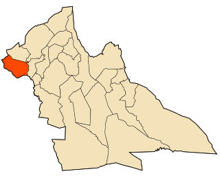
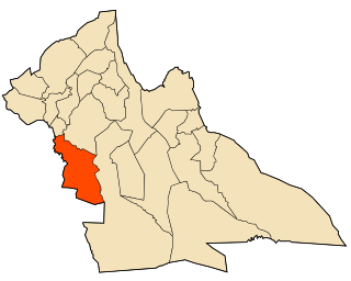
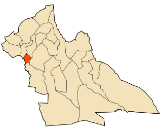
Aïn Madhi is a district in Laghouat Province, Algeria. It was named after its capital, Aïn Madhi.
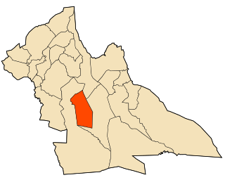
Sidi Makhlouf is a district in Laghouat Province, Algeria. It was named after its capital, Sidi Makhlouf.
Ksar El Hirane is a district in Laghouat Province, Algeria. It was named after its capital, Ksar El Hirane.

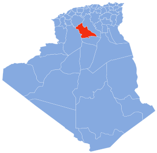
Laghouat District is a district of Laghouat Province, Algeria. Laghouat (Laghwat) is an Algerian town, About 400 km from Algiers.

Aïn Madhi is a town and commune in Laghouat Province, Algeria, and the seat of Aïn Madhi District. According to the 1998 census it has a population of 6,263.

Brida is a town and commune in Laghouat Province, Algeria. According to the 1998 census it has a population of 5,742.

El Assafia is a town and commune in Laghouat Province, Algeria. According to the 1998 census it has a population of 4,389.

El Ghicha is a town and commune in Laghouat Province, Algeria. According to the 1998 census it has a population of 5,719.
El Houaita is a town and commune in Laghouat Province, Algeria. According to the 1998 census it has a population of 1,290.
Hadj Mechri is a town and commune in Laghouat Province, Algeria. According to the 1998 census it has a population of 6,197.
Hassi Delaa is a town and commune in Laghouat Province, Algeria. According to the 1998 census, it has a population of 6,930.

Kheneg is a town and commune in Laghouat Province, Algeria.

Ksar El Hirane is a town and commune in Laghouat Province, Algeria. According to the 1998 census it has a population of 14,910.

Oued M'Zi is a town and commune in Laghouat Province, Algeria. According to the 1998 census it has a population of 1,786.
According to Wikipedia. Tadjrouna is a town and commune in Laghouat Province, Algeria. According to the 1998 census it has a population of 3,597.
Taouila is a town and commune in Laghouat Province, Algeria. According to the 1998 census it has a population of 2,634.

Bennasser Benchohra is a town and commune in Laghouat Province, Algeria.

