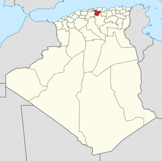
Bömbögör is a sum (district) of Bayankhongor Province in southern Mongolia.
Polerady is a village in the Central Bohemian Region of the Czech Republic. On the date August 28, 2006 it has 230 inhabitants. The municipality lies at an altitude of 182 metres and covers an area of 3.86 km². First written notice about village is from year 1290. Postal code of the village is 250 63.
Dotnacht is a village and former municipality in the canton of Thurgau, Switzerland.
Falkenstein Castle is a ruined castle located near Dettingen am Albuch, a borough of Gerstetten, in Heidenheim district of Baden-Württemberg in Germany. The castle is one of at least 16 castles known as Falkenstein in Germany, and is therefore called Falkenstein (Gerstetten) to clarify which castle is meant. The ruins of the castle are open to the public and require a walk of less than an hour to visit.

Tri-State Peak is a mountain located in the Cumberland Gap National Historical Park, near the "saddle" of the gap. It gets its name from being on the tripoint of the states of Kentucky, Tennessee, and Virginia.

Bęćkowo is a village in the administrative district of Gmina Szczuczyn, within Grajewo County, Podlaskie Voivodeship, in north-eastern Poland. It lies approximately 5 kilometres (3 mi) north-east of Szczuczyn, 11 km (7 mi) south-west of Grajewo, and 79 km (49 mi) north-west of the regional capital Białystok.
Olchowa Kładka is a village in the administrative district of Gmina Hajnówka, within Hajnówka County, Podlaskie Voivodeship, in north-eastern Poland, close to the border with Belarus. It lies approximately 12 kilometres (7 mi) north of Hajnówka and 44 km (27 mi) south-east of the regional capital Białystok.
Sowiny Grunt is a village in the administrative district of Gmina Hajnówka, within Hajnówka County, Podlaskie Voivodeship, in north-eastern Poland, close to the border with Belarus. It lies approximately 5 kilometres (3 mi) north-east of Hajnówka and 49 km (30 mi) south-east of the regional capital Białystok.
Miodusy-Inochy is a village in the administrative district of Gmina Perlejewo, within Siemiatycze County, Podlaskie Voivodeship, in north-eastern Poland.
Szarzyn is a settlement in the administrative district of Gmina Bytów, within Bytów County, Pomeranian Voivodeship, in northern Poland. It lies approximately 9 kilometres (6 mi) north-east of Bytów and 71 km (44 mi) west of the regional capital Gdańsk.
Łysaków Drugi is a village in the administrative district of Gmina Jędrzejów, within Jędrzejów County, Świętokrzyskie Voivodeship, in south-central Poland.
Słupia is a village in Jędrzejów County, Świętokrzyskie Voivodeship, in south-central Poland. It is the seat of the gmina called Gmina Słupia. It lies approximately 24 kilometres (15 mi) west of Jędrzejów and 56 km (35 mi) south-west of the regional capital Kielce.
Lipiny is a village in the administrative district of Gmina Osiek Mały, within Koło County, Greater Poland Voivodeship, in west-central Poland. It lies approximately 5 kilometres (3 mi) north of Osiek Mały, 14 km (9 mi) north of Koło, and 115 km (71 mi) east of the regional capital Poznań.
Siemięrzyce is a village in the administrative district of Gmina Kroczyce, within Zawiercie County, Silesian Voivodeship, in southern Poland. It lies approximately 3 kilometres (2 mi) east of Kroczyce, 15 km (9 mi) north-east of Zawiercie, and 56 km (35 mi) north-east of the regional capital Katowice.
Górki Małe is a village in the administrative district of Gmina Sulechów, within Zielona Góra County, Lubusz Voivodeship, in western Poland.
Żegocino is a village in the administrative district of Gmina Malechowo, within Sławno County, West Pomeranian Voivodeship, in north-western Poland. It lies approximately 7 kilometres (4 mi) south-east of Malechowo, 11 km (7 mi) south-west of Sławno, and 164 km (102 mi) north-east of the regional capital Szczecin.
Kokuta is a village in Lääneranna Parish, Pärnu County, in western Estonia.
Hõbeda, Pärnu County is a village in Lääneranna Parish, Pärnu County in southwestern Estonia.
Sotés is a village in the province and autonomous community of La Rioja, Spain. The municipality covers an area of 14.6 square kilometres (5.6 sq mi) and as of 2011 had a population of 312 people.

Heughscar Hill is a hill in the east of the English Lake District, east of Ullswater and north of High Street, Cumbria. It is the subject of a chapter of Wainwright's book The Outlying Fells of Lakeland. It reaches 1,231 feet (375 m) and Wainwright's route is an anticlockwise circuit starting at Askham. He describes it as "A gem for aged fellwalkers"'.