Belciugatele is a commune in Călărași County, Romania. It is composed of five villages: Belciugatele, Cândeasca, Cojești, Mataraua and Măriuța.
Riaguas de San Bartolomé is a municipality located in the province of Segovia, Castile and León, Spain. According to the 2004 census (INE), the municipality has a population of 81 inhabitants.

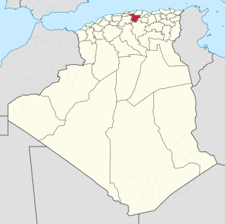
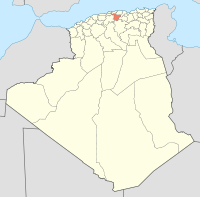
Ouled Aouf is a town in north-eastern Algeria.
Addha is a town in Daska Tehsil, Sialkot District of the Punjab province of Pakistan. It is situated at 32°26′N74°29′E and lies 18 kilometres (11 mi) from Daska and 8 kilometres (5.0 mi) from Sialkot.

Valea Chioarului is a commune in Maramureș County, Romania. It is composed of six villages: Curtuiușu Mare (Nagykörtvélyes), Durușa (Durusa), Fericea (Szamosfericse), Mesteacăn (Kisnyíres), Valea Chioarului and Vărai (Kőváralja).

Ruda Wołoska is a village in the administrative district of Gmina Tomaszów Lubelski, within Tomaszów Lubelski County, Lublin Voivodeship, in eastern Poland. It lies approximately 6 kilometres (4 mi) east of Tomaszów Lubelski and 111 km (69 mi) south-east of the regional capital Lublin.
Qundanlı is a village in the Qubadli Rayon of Azerbaijan.

Ouèssè is a town, arrondissement, and commune in the Collines Department of central Benin.The commune covers an area of 3200 square kilometres and as of 2013 had a population of 141,760 people.
Wilczyna is a village in the administrative district of Gmina Duszniki, within Szamotuły County, Greater Poland Voivodeship, in west-central Poland. It lies approximately 5 kilometres (3 mi) north-east of Duszniki, 17 km (11 mi) south-west of Szamotuły, and 35 km (22 mi) west of the regional capital Poznań.
Chycina is a village in the administrative district of Gmina Bledzew, within Międzyrzecz County, Lubusz Voivodeship, in western Poland. It is approximately 5 kilometres (3 mi) southeast of Bledzew and 12 km (7 mi) west of Międzyrzecz.
Takeli is a village and jamoat in north-western Tajikistan. It is located in Mastchoh District in Sughd province. The jamoat has a total population of 13,956.
Paasküla is a village in Viru-Nigula Parish, Lääne-Viru County, Estonia.
Yanovo is a village in the municipality of Sandanski, in Blagoevgrad Province, Bulgaria. It is located 5km away from Katuntsi and 30km away from Sandanski.
Põhja is a village in Kuusalu Parish, Harju County in northern Estonia.
Kiviküla is a village in Viru-Nigula Parish, Lääne-Viru County, in northeastern Estonia.

The Little Thredbo River, a perennial river of the Snowy River catchment, is located in the Snowy Mountains region of New South Wales, Australia.

Hacısait is a small village in Mut district of Mersin Province, Turkey. At 36°29′N33°26′E it is situated to the west of the Göksu River valley. Its distance to Mut is 35 kilometres (22 mi) and to Mersin is 155 kilometres (96 mi). The population of the village was 90 as of 2012.

The SS Espagne was a Belgian cargo ship that was torpedoed by SM UC-71 in the English Channel off St. Catherine's Point, Isle of Wight, United Kingdom while she was travelling from Le Havre, France to Newport, Monmouthshire, United Kingdom.
Biret Armanaz is a Syrian village located in Armanaz Nahiyah in Harem District, Idlib. According to the Syria Central Bureau of Statistics (CBS), Biret Armanaz had a population of 320 in the 2004 census.