El Troncal Airport

Last updated
El Troncal Airport
Summary
Airport type Public
Serves Arauquita, Colombia
Elevation  AMSL 512 ft / 156 m
Coordinates 7°01′16″N71°23′20″W / 7.02111°N 71.38889°W / 7.02111; -71.38889 Coordinates: 7°01′16″N71°23′20″W / 7.02111°N 71.38889°W / 7.02111; -71.38889
Map
Colombia location map.svg
Airplane silhouette.svg
ARQ
Location of the airport in Colombia
Runways
Direction Length Surface
m ft
08/26 970 3,182 Asphalt
Sources: GCM [1] Bing Maps [2] OurAirports [3]

El Troncal Airport( IATA : ARQ, ICAO : SKAT) is an airport serving the river town of Arauquita in the Arauca Department of Colombia.

An IATA airport code, also known as an IATA location identifier, IATA station code or simply a location identifier, is a three-letter code designating many airports around the world, defined by the International Air Transport Association (IATA). The characters prominently displayed on baggage tags attached at airport check-in desks are an example of a way these codes are used.

ICAO airport code four-letter code designating many airports around the world

The ICAOairport code or location indicator is a four-letter code designating aerodromes around the world. These codes, as defined by the International Civil Aviation Organization and published in ICAO Document 7910: Location Indicators, are used by air traffic control and airline operations such as flight planning.

Arauquita Municipality and town in Arauca Department, Colombia

Arauquita is a town and municipality in the Arauca Department, Colombia.

Contents

The runway is 4 kilometres (2.5 mi) east of Arauquita, adjacent to the Arauca River. East departures will cross the river into Venezuela.

Arauca River river

The Arauca River rises in the Andes Mountains of north-central Colombia and ends at the Orinoco in Venezuela. For part of its run it is the boundary between Colombia and Venezuela. The major city on its banks is Arauca, Colombia and El Amparo, Venezuela.
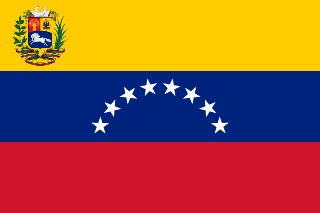
Venezuela Republic in northern South America

Venezuela, officially the Bolivarian Republic of Venezuela, is a country on the northern coast of South America, consisting of a continental landmass and a large number of small islands and islets in the Caribbean Sea. The capital and largest urban agglomeration is the city of Caracas. It has a territorial extension of 916,445 km2. The continental territory is bordered on the north by the Caribbean Sea and the Atlantic Ocean, on the west by Colombia, Brazil on the south, Trinidad and Tobago to the north-east and on the east by Guyana. With this last country, the Venezuelan government maintains a claim for Guayana Esequiba over an area of 159,542 km2. For its maritime areas, it exercises sovereignty over 71,295 km2 of territorial waters, 22,224 km2 in its contiguous zone, 471,507 km2 of the Caribbean Sea and the Atlantic Ocean under the concept of exclusive economic zone, and 99,889 km2 of continental shelf. This marine area borders those of 13 states. The country has extremely high biodiversity and is ranked seventh in the world's list of nations with the most number of species. There are habitats ranging from the Andes Mountains in the west to the Amazon basin rain-forest in the south via extensive llanos plains, the Caribbean coast and the Orinoco River Delta in the east.

See also

Transport in Colombia

Transport in Colombia is regulated by the Ministry of Transport.

Related Research Articles

Santiago Pérez Quiroz Airport

Santiago Pérez Quiroz Airport (Spanish: Aeropuerto Santiago Pérez Quiroz is an airport serving Arauca, the capital of the Arauca Department in Colombia. The runway is southeast of the city, and 2 kilometres south of Colombia's border with Venezuela.

Guaymaral Airport

Guaymaral Airport is a high-elevation airport in the north of Bogotá, Colombia, also serving the towns of Cota and Chía. The runway is 15 kilometres (9.3 mi) northeast of Bogota's El Dorado International Airport.

Perales Airport

Perales Airport is an airport serving the city of Ibagué in the Tolima Department of Colombia.

Caucayá Airport

Caucayá Airport is an airport serving the river town of Puerto Leguízamo in the Putumayo Department of Colombia. Puerto Leguízamo is on the Putumayo River, locally the border with Peru.

Jorge Enrique González Torres Airport airport serving San José del Guaviare, the capital of the Guaviare Department of Colombia

Jorge Enrique González Torres Airport is an airport serving San José del Guaviare, the capital of the Guaviare Department of Colombia. The runway is just north of the town and parallels the Guaviare River.

Guasdualito Airport airport in Venezuela

Guasdualito Airport, also known as Vare Maria Airport, is an airport serving Guasdualito in the Apure state of Venezuela.

Guápiles Airport airport in Costa Rica

Guápiles Airport is an airport serving Guápiles, a town in Pococí canton, Limón Province, Costa Rica. The runway is within the western section of the town.

El Porvenir Airport airport in Panama

El Porvenir Airport is an airport serving El Porvenir, in Panama. The airport is on an island 2 kilometres (1.2 mi) east of the mainland, in the archipelago bordering the Gulf of San Blas. All approaches and departures will be over the water.

San Miguel Airport (Panama) airport in Panama

San Miguel Airport is an airport serving San Miguel, a town in the Pearl Islands of Panama. It is just east of the town, on the northern side of Isla del Rey, the largest of the islands.

Panamá Pacífico International Airport airport in Panama

Panamá Pacífico International Airport is a commercial airport in Panama. It is located on the site of the former Howard Air Force Base, a United States Air Force base that was within the Panama Canal Zone. Panama City can be reached by crossing the nearby Bridge of the Americas.

Río Dulce Airport Guatemala

Las Vegas Airport is an airport 4 kilometres (2.5 mi) east of Río Dulce, a village in Izabal Department, Guatemala.

La Fortuna Arenal Airport airport in Costa Rica

Arenal Airport is an airport serving La Fortuna, a district in San Carlos Canton, Alajuela Province, Costa Rica. The airport is named after the Arenal Volcano, one of the major tourist attractions in the country.

El Porvenir Airport (Honduras) airport in Honduras

El Porvenir Airport is an airport serving the towns of Sabá and El Porvenir in Colón Department, Honduras.

El Arrayán Airport airport in Honduras

El Arrayán Airport is an airport serving the city of Olanchito in Yoro Department, Honduras.

Las Cachas Airport

Las Cachas Airport is an airstrip serving the hamlet of Cangrejera in La Libertad Department, El Salvador.

Cicuco Airport

Cicuco Airport is an airport serving the town of Cicuco in the Bolívar Department of Colombia. The airport is near the Ciénega El Medio, an arm of the Magdalena River.

Jaime Ortiz Betancur Airport

Jaime Ortiz Betancur Airport is an airport serving the town of Chigorodó in the Antioquia Department of Colombia.

General Navas Pardo Airport

General Navas Pardo Airport is an airport serving the town of Chaparral in the Tolima Department of Colombia.

Amalfi Airport (Colombia)

Amalfi Airport is an airport serving the town of Amalfi, in the Antioquia Department of Colombia.

Tiquie Airport airport serving Tiquié, a village in the Vaupés Department of Colombia

Tiquie Airport is an airport serving Tiquié, a village in the Vaupés Department of Colombia. The runway is inside the village, which is on the upper reaches of the Tiquié River (sv). Tiquié is 14 kilometres (9 mi) west of the border with Brazil.

References

The Aviation Safety Network (ASN) is a website that keeps track of aviation accidents, incidents, and hijackings. Their database contains details of over 10,700 reports. The ASN includes an aviation database with aviation investigations, news, photos, and statistics.