
Elche or Elx is a city and municipality of Spain, belonging to the province of Alicante, in the Valencian Community. According to 2014 data, Elche has a population of 228,647 inhabitants, making it the third most populated municipality in the region and the 20th largest Spanish municipality. It is part of the comarca of Baix Vinalopó.

Sabadell is a city in Catalonia, Spain. It is in the south of the comarca of Vallès Occidental and its joint capital (co-capital), on the River Ripoll, 20 km (12 mi) north of Barcelona. Sabadell is located 190 m (620 ft) above sea level.

Condado is an oceanfront, tree-lined, pedestrian-oriented upper middle to upper class community in Santurce. It is one of the forty subbarrios of Santurce in San Juan, Puerto Rico.

El Oro is the southernmost of Ecuador's coastal provinces. It was named for its historically important gold production. Today it is one of the world's major exporters of bananas. The capital is Machala.

Vilasantar is a municipality of northwestern Spain in the province of A Coruña in the autonomous community of Galicia. It belongs to the comarca of Betanzos.

Navas de San Juan is a Spanish village of the province of province of Jaén, Spain. According to the 2005 census (INE), the city has a population of 5,030 inhabitants. It is the biggest village in the region of El Condado. The river called Guadalimar runs for its municipal area.
Villaralto is located in the province of Córdoba, Spain. According to the 2018 census (INE), the town had a population of 1,154 inhabitants. Its area covers 24.07 km² and has a population density of 49.69 inhabitants per km². Its geographical coordinates are 38º 27' N, 4º 59' W and is located at an altitude of 585 metres and 80 kilometres from the provincial capital, Cordoba.
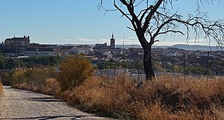
Illescas is a town and municipality of Spain located in the province of Toledo, Castilla–La Mancha. The municipality spans across a total area of 56.75 km2 and, as of 1 January 2020, it has a registered population of 29,558, which makes it the third most populated municipality in the province. It belongs to the traditional comarca of La Sagra.

El Viso de San Juan is a municipality located in the province of Toledo, Castile-La Mancha, Spain. According to the 2006 census (INE), the municipality has a population of 2339 inhabitants.

Husillos is a municipality located in the province of Palencia, Castile and León, Spain. According to the 2004 census (INE), the municipality had a population of 208 inhabitants.

Condado de Treviño is a municipality in the province of Burgos, autonomous community of Castile and León, Spain. This municipality and the geographically smaller La Puebla de Arganzón make up the enclave of Treviño. Although the enclave is part of Burgos it is surrounded by the province of Álava, part of the autonomous community of the Basque Country.

Santa Eufemia del Barco is a municipality located in the province of Zamora, Castile and León, Spain. According to the 2004 census (INE), the municipality has a population of 279 inhabitants.
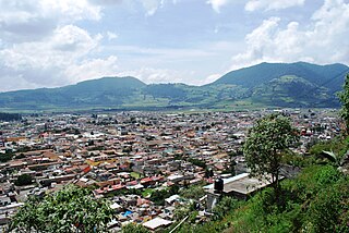
The municipality of Tenango del Valle is located in the southern portion of the Valley of Toluca in Mexico State, about 72 km southwest of Mexico City and 25 km south of Toluca. The municipal seat is the city of Tenango de Arista. While the seat is officially named Tenango de Arista, it is more commonly referred to as Tenango del Valle, as this was the original name of the town. Tenango del Valle is best known as the site of the Teotenango archeological site, which was a walled city inhabited from about 900 C.E. to 1550 C.E.

Santa Clara del Cobre is a Magical town and municipality located in the center of the state of Michoacán, Mexico, 18 km from Pátzcuaro and 79 km from the state capital of Morelia. While the official name of the municipality is Salvador Escalante, and the town is often marked as "Villa Escalante" or "Salvador Escalante" on maps, both entities are interchangeably called Santa Clara del Cobre. The town is part of the Pátzcuaro region of Michoacán, and ethnically dominated by the Purépecha people. These people have been working with copper since the pre-Hispanic era, and led to this town's dominance in copper crafts over the colonial period (1519–1821) until well into the 19th century. Economic reverses led to the industry's near-demise here until efforts in the 1940s and 1970s managed to bring the town's work back into prominence.

The Romería de El Rocío is a procession/pilgrimage on the second day of Pentecost to the Hermitage of El Rocío in the countryside of Almonte, Province of Huelva, Andalucia, Spain, in honor of the Virgin of El Rocío. In recent years the Romería has brought together roughly a million pilgrims each year.

The Fiesta de las Cruces or Cruz de Mayo is a holiday celebrated on the 3rd of May in many parts of Spain and Hispanic America.
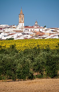
Rociana del Condado is a town located in the province of Huelva, Andalusia, Spain.
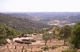
Los Pedroches is a natural region and comarca in Córdoba Province, Andalusia, southern Spain. It is located in the Sierra Morena area at the northern end of the province. The main town is Pozoblanco.
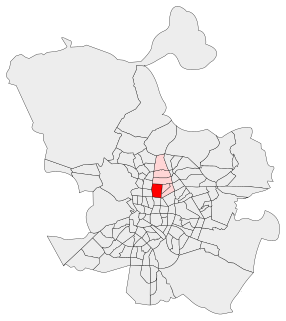
El Viso is a neighborhood of Madrid, part of the Chamartín District. Consisting mainly of residential detached houses, it is currently the wealthiest neighborhood of the Spanish capital, overtaking the Salamanca District. Aristocrats, businessmen, politicians and diplomats have inhabited this area for half a century. The neighborhood also hosts the main headquarters of the Spanish National Research Council (CSIC).
Gonzalo Téllez was a nobleman who was Count of Lantarón and Cerezo and is also mentioned in a document dated 903 as Count of Castile. He and his wife were the founders of the Monastery of San Pedro de Arlanza.


