
Dithmarschen is a district in Schleswig-Holstein, Germany. It is bounded by the districts of Nordfriesland, Schleswig-Flensburg, Rendsburg-Eckernförde, and Steinburg, by the state of Lower Saxony, and by the North Sea. From the 13th century up to 1559 Dithmarschen was an independent peasant republic within the Holy Roman Empire and a member of the Hanseatic League.
Duchy of Lauenburg is the southernmost Kreis, or district, officially called District of Duchy of Lauenburg, of Schleswig-Holstein, Germany. It is bordered by the district of Stormarn, the city of Lübeck, the state of Mecklenburg-Vorpommern, the state of Lower Saxony, and the city state of Hamburg. The district of Herzogtum Lauenburg is named after the former Duchy of Saxe-Lauenburg.
Stade is a district (Landkreis) in Lower Saxony, Germany. It has its seat in Stade and is part of the Hamburg Metropolitan Region.

Neuwerk (; is a 3 km2 tidal island in the Wadden Sea a marginal part of North Sea along the German coast. The population in 2023 was 21. Neuwerk is located 13 km northwest of Cuxhaven, between the Weser and Elbe estuaries. The distance to the centre of Hamburg is about 120 km.

Bremen-Verden, formally the Duchies of Bremen and Verden, were two territories and immediate fiefs of the Holy Roman Empire, which emerged and gained imperial immediacy in 1180. By their original constitution they were prince-bishoprics of the Archdiocese of Bremen and Bishopric of Verden.

The Duchy of Saxe-Lauenburg, was a reichsfrei duchy that existed from 1296 to 1803 and again from 1814 to 1876 in the extreme southeast region of what is now Schleswig-Holstein. Its territorial center was in the modern district of Herzogtum Lauenburg and originally its eponymous capital was Lauenburg upon Elbe, though the capital moved to Ratzeburg in 1619.

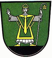
Jens Grand, the Firebug was a Danish archbishop of Lund (1289–1302), titular Archbishop of Riga and Terra Mariana (1304–1310), and Prince-Archbishop of Bremen, known as the central figure of the second ecclesiastical struggle in Denmark in the late 13th century. He was an outstanding jurist of canon law.

The Province of Hanover was a province of the Kingdom of Prussia and the Free State of Prussia from 1866 to 1946.

Magnus I of Saxe-Lauenburg was a Duke of Saxe-Lauenburg from the House of Ascania.

Neuhaus an der Oste is a municipality in the district of Cuxhaven, in Lower Saxony, Germany.
Henry IV, called the Elder, a member of the House of Welf, was Duke of Brunswick-Lüneburg and ruling Prince of Wolfenbüttel from 1491 until his death.

Cranz is a quarter in the Harburg borough of Hamburg, Germany. It is on the left bank of the Elbe river and one of the 104 quarters of Hamburg. In 2020 the population was 843.

The North German Plain or Northern Lowland is one of the major geographical regions of Germany. It is the German part of the North European Plain. The region is bounded by the coasts of the North Sea and the Baltic Sea to the north, Germany's Central Uplands to the south, by the Netherlands to the west and Poland to the east.
Albert II of Brunswick-Wolfenbüttel was Prince-Archbishop of Bremen in the years 1361–1395.

The region between the Elbe and Weser rivers forms the Elbe–Weser triangle, also rendered Elbe-Weser Triangle, in northern Germany. It is also colloquially referred to as the Nasses Dreieck or "wet triangle".

The Krempe Marsh is one of the Holstein Elbe marshes and lies northeast of the River Elbe between its tributaries of the Krückau and Stör and the edge of the geest. The main settlement in the Krempe Marsh is the town of Krempe; it is bisected by the Krempau river.
Eric IV of Saxe-Lauenburg was a son of Eric II, Duke of Saxe-Lauenburg and Agnes of Holstein.
Land Hadeln is a historic landscape and former administrative district in Northern Germany with its seat in Otterndorf on the Lower Elbe, the lower reaches of the River Elbe, in the Elbe-Weser Triangle between the estuaries of the Elbe and Weser.
Johann Rode von Wale was a Catholic cleric, a Doctor of Canon and Civil Law, a chronicler, a long-serving government official (1468–1497) and as John III Prince-archbishop of Bremen between 1497 and 1511.

John V, Count of Oldenburg and Delmenhorst was a member of the House of Oldenburg. He was the ruling Count of Oldenburg from 1500 to 1526. His parents were Gerhard VI, Count of Oldenburg and Adelheid of Tecklenburg.
