Elizabeth Park (Michigan)

Last updated
Elizabeth Park
ElizabethParkEntrance (2020).jpg
Entrance to Elizabeth Park
OSM Humanitarian map, Wayne County, Michigan.png
Red pog.svg
Location within the state of Michigan
Relief map of USA Michigan.png
Red pog.svg
Elizabeth Park (Michigan) (Michigan)
Location4250 Elizabeth Drive
Trenton, Michigan
Coordinates 42°07′56″N83°10′49″W / 42.13222°N 83.18028°W / 42.13222; -83.18028
Area162 acres (65.6 ha)
Created1919
Administered by Wayne County Park System

Elizabeth Park is a county-owned public park in southeast Wayne County in the U.S. state of Michigan. [1] The park is located in the city of Trenton along West Jefferson Avenue and the Detroit River just north of the Wayne County Bridge leading to Grosse Ile. Under private ownership until it was given to the county in 1919, Elizabeth Park is recognized as the first county park established in the state of Michigan. [2] [3]

Contents

The park is located mostly on an artificial island historically called Slocum's Island. [4] The island is separated from the mainland by a narrow canal. While Elizabeth Park occupies the northern portion of Slocum's Island, the Trenton Channel Power Plant occupies the portion south of the Grosse Ile Parkway.

History

Slocum's Isle listed on an 1893 map of Monguagon Township Monguagon Township 2.png
Slocum's Isle listed on an 1893 map of Monguagon Township

The area was occupied by the Native American tribe the Wyandot for several centuries before Europeans arrived to colonize the area. The Wyandot settled the village of Maguagon along the banks of the Detroit River, which was the site of the minor Battle of Maguaga during the War of 1812. The area was soon settled as Truaxton in 1816 by Abram Caleb Truax, who was a French Major who decided to stay in the area after the war. [5] In 1827, Lewis Cass, the governor of the Michigan Territory, organized Monguagon Township with Truax as the first township supervisor. As a part of the township, the area of Truaxton was renamed Trenton in 1847 and incorporated as a village in 1855.

Giles Bryan Slocum (1808–1884), who was an early businessman and landowner, moved to Truaxton in 1834. He built Truaxton's first dock along the Detroit River in that summer. He would later manage docks up and down the Detroit River. He used his wealth to purchase three miles (4.8 km) of Truaxton's riverfront. He built his large estate on what he called Slocum's Island, which was partially separated from the mainland by his own constructed canal. Slocum married Sophia Truax (daughter of Abram Caleb Truax) in 1838, and she inherited his estate when he died in 1884. She continued to live on Slocum's Island with her only daughter, Elizabeth Nichols (née Slocum). Sophia Truax died in 1912, and Nichols then inherited the island. [6]

Nichols died in 1919, and her children inherited the property. They donated the estate to the Wayne County Park Trustees in October 1919 on the condition that it be set aside as "Elizabeth Park" in honor of their mother. [2] [7] The Slocum estate, which consisted of 162 acres (65 ha), was given to the county and organized as Michigan's first county park. [2] [3] The donation was helpful in the creation of the Wayne County Park System, which had been hindered by a lack of funding to acquire their own properties. Though the new park system continued to have no funding afterward, the development of Elizabeth Park was made possible by financial support from the Michigan Department of Transportation, which improved the canal, created bridges connecting the island to the mainland, and built the road that circles the park. [7]

Recent status

One of the three pedestrian bridges connecting the island to the mainland portion of the park ElizabethParkWalkingBridge2.png
One of the three pedestrian bridges connecting the island to the mainland portion of the park

In 2003, the park underwent an over $1 million renovation of the crumbling Southshore Riverwalk, which was an original element of Elizabeth Park. The Northshore Riverwalk is also being improved at a cost of $1.2 million. This riverwalk is closer to the Trenton populace and is expected to draw in more visitors from the surrounding commercial district. [3] The park includes a marina on the southern end near Grosse Ile Parkway. [8] Fishing and boating remain very popular activities. Walking, skating, or fishing can be done from the 1,300 feet (396 m) of riverwalks, and the interior of the park contains hiking and cycling trails, a baseball field, skatepark, playground, and a large picnic area. [2]

The unique pedestrian bridges that cross the canal and connect Elizabeth Park to the mainland were constructed in the early stages of the park's development. There are three walkway bridges — all named Elizabeth Park Walkway Bridge — at different locations. All three of these bridges are still structurally sound but are in desperate need of restoration. [9] The only automobile bridge that crosses the canal is an arch bridge called the Elizabeth Drive Bridge on the north end of the park. The 59.7 ft (18.2 m) bridge was constructed in 1923 and retains most of its original features. However, like the pedestrian bridges, the Elizabeth Drive Bridge is in poor shape. The Michigan Historic Bridge Inventory lists the bridge as eligible for entry into the National Register of Historic Places. [10] [11]

Elizabeth Park is also mentioned for possible inclusion into the Detroit River International Wildlife Refuge, which is still in its preliminary stages of development. Since Elizabeth Park is owned by Wayne County, it is unsure at this time if the park would be included into the expanding refuge or if it would just include the surrounding waterways. [12]

In 2013 the foot bridges around Elizabeth Park were restored, the wrought iron railings were salvaged, cleaned an replace on the new bridges. They were dedicated in May 2014.

Trenton Channel Power Plant

The Trenton Channel Power Plant occupies the portion of Slocum's Island directly south of Elizabeth Park. TrentonChannelPowerPlant.jpg
The Trenton Channel Power Plant occupies the portion of Slocum's Island directly south of Elizabeth Park.

Quite the contrast to Elizabeth Park, the portion of Slocum's Island south of Grosse Ile Parkway is occupied by the large, coal-burning Trenton Channel Power Plant, which is owned and operated by DTE Energy. This property was not part of Giles Bryan Slocum's original property that was donated to the county in 1919 but has since been included as part of the island when the original canal around Slocum's property was expanded southward. The Detroit Edison Company, a present-day subsidiary of DTE Energy, purchased the southern portion of the island and constructed the Trenton Channel Power Plant in 1949. Much of their property is on the mainland surrounding West Jefferson Avenue. The main building—the two smokestack power station—is the only portion located on what is now technically the southern portion of Slocum's Island.

Despite its nature, the power plant works closely with environmental organizations to ensure the area is free of pollutants. For their efforts, the Trenton Channel Power Plant was awarded the Wildlife Habitat Council's Corporate Habitat of the Year award in 2004 “ 14 years ago”. DTE Energy regularly spreads crushed limestone along the banks of the Detroit River on Slocum's Island, because such an item provides a popular nesting habitat for native common terns. Common terns were once plentiful in the region before industrialism drove out all but a small number of them. [13] [14] Other birds, such as the bald eagles, peregrine falcons, and great blue herons also use the grounds for habitat. [14]

See also

Related Research Articles

<span class="mw-page-title-main">Detroit River</span> River connecting Lake Huron with Lake Erie

The Detroit River flows west and south for 24 nautical miles from Lake St. Clair to Lake Erie as a strait in the Great Lakes system. The river divides the metropolitan areas of Detroit, Michigan, and Windsor, Ontario—an area collectively referred to as Detroit–Windsor—and forms part of the border between Canada and the United States. The Ambassador Bridge, the Detroit–Windsor Tunnel, and the Michigan Central Railway Tunnel connect the cities.

<span class="mw-page-title-main">Wayne County, Michigan</span> County in Michigan, United States

Wayne County is the most populous county in the U.S. state of Michigan. As of 2020, the United States Census placed its population at 1,793,561, making it the 19th-most populous county in the United States. The county seat is Detroit. The county was founded in 1796 and organized in 1815. Wayne County is included in the Detroit-Warren-Dearborn, MI Metropolitan Statistical Area. It is one of several U.S. counties named after Revolutionary War-era general Anthony Wayne.
<span class="mw-page-title-main">Grosse Ile Township, Michigan</span> Civil township in Michigan, United States

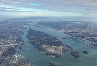
Grosse Ile Township is a civil township of Wayne County in the U.S. state of Michigan. The population was 10,777 at the 2020 census.

<span class="mw-page-title-main">Trenton, Michigan</span> City in Michigan, United States

Trenton is a city in Wayne County, Michigan, United States. At the 2010 census, the city population was 18,853.

Jefferson Avenue is a 63.71-mile-long (102.53 km) scenic road along the eastern part of the Detroit metropolitan area in the southeastern part of the U.S. state of Michigan. It travels alongside Lake Erie, the Detroit River, and Lake St. Clair. This road also provides access to many recreational facilities in the area. West Jefferson Avenue is primarily commercial, while East Jefferson Avenue contains a historic residential district.

<span class="mw-page-title-main">Downriver</span> Metro Detroit in Michigan, United States

Downriver is the unofficial name for a collection of 19 cities and townships in Wayne County, Michigan, south of Detroit, along the western shore of the Detroit River.

<span class="mw-page-title-main">Detroit River International Wildlife Refuge</span>

The Detroit River International Wildlife Refuge is the only international wildlife refuge in North America. Established in 2001 and managed jointly by the United States Fish and Wildlife Service and the Canadian Wildlife Service, it is located in a major metropolitan area. The Detroit River International Wildlife Refuge is one of over 540 National Wildlife Refuges managed by the U.S. Fish and Wildlife Service within the Department of the Interior. It occupies 7.88 square miles (20.41 km2) of scattered property but has drawn boundaries for further expansion.

DTE Electric Company was founded in 1886.
<span class="mw-page-title-main">National Register of Historic Places listings in Wayne County, Michigan</span>

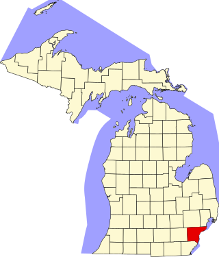
This is a list of the National Register of Historic Places listings in Wayne County, Michigan.

<span class="mw-page-title-main">Grosse Ile Toll Bridge</span> Bridge in Grosse Ile and Riverview in Wayne County, Michigan

The Grosse Ile Toll Bridge is a swing bridge that crosses the Trenton Channel of the Detroit River connecting Grosse Ile Township, Michigan to the mainland in Riverview, Michigan which is located in Wayne County, Michigan.

<span class="mw-page-title-main">Wayne County Bridge</span> Bridge in Wayne County, Michigan

The Wayne County Bridge is a swing bridge that crosses the Trenton Channel in the Detroit River. Located in Wayne County, Michigan, it connects Grosse Ile Township to mainland Trenton and is one of two bridges connecting the island of Grosse Ile to the mainland — the other being the tolled Grosse Ile Toll Bridge to the north. Locally, it is also known as "The Free Bridge".

<span class="mw-page-title-main">Monguagon Township, Michigan</span> Former civil township in Michigan, United States

Mongaugon Township, is a former township of Wayne County in the U.S. state of Michigan. Quarries including the DTE Energy Sibley Quarry that mines, gray limestone and celestine associated with calcite, fluorite, gypsum, epsomite, and rarely, sulfur were first worked by the French circa 1749. United States forces aided by Muskrat French defeated United Kingdom aided by Native Americans forces at the Battle of Monguagon during the War of 1812.

<span class="mw-page-title-main">Detroit International Riverfront</span> Area of Detroit, Michigan that borders the Detroit River

The Detroit International Riverfront is a tourist attraction and landmark of Detroit, Michigan, extending from the Ambassador Bridge in the west to Belle Isle in the east, for a total of 5.5 miles. The International Riverfront encompasses a cruise ship passenger terminal and dock, a marina, a multitude of parks, restaurants, retail shops, skyscrapers, and high rise residential areas along with Huntington Place. The Marriott at the Renaissance Center and the Robert's Riverwalk Hotel are also situated along the International Riverfront. Private companies and foundations together with the city, state, and federal government have contributed several hundred million dollars toward the riverfront development. Key public spaces in the International Riverfront, such as the RiverWalk, Dequindre Cut Greenway and Trail, William G. Milliken State Park and Harbor, and a cruise ship passenger terminal and dock at Hart Plaza complement the architecture of the area. The area provides a venue for a variety of annual events and festivals including the Detroit Electronic Music Festival, Detroit Free Press International Marathon, the Detroit International Jazz Festival, Motor City Pride, the North American International Auto Show, River Days and Detroit China Festival. In February 2021, the Detroit International Riverfront was voted best riverwalk in the United States by USA Today readers. It was selected a second time as the best riverwalk in the U.S. in 2022.

<span class="mw-page-title-main">Sugar Island (Detroit River)</span>

Sugar Island is a small island in the Detroit River between Grosse Ile and Boblo Island. Sugar Island is part of Grosse Ile Township, Wayne County, Michigan, United States, and lies about 0.5 miles (0.80 km) west of the border with Canada. Currently the island is uninhabited and was recently converted to a wildlife refuge by the US Fish and Wildlife service. The majority of the island is wooded and it is known for its white sandy beaches and easy access by boat.
<span class="mw-page-title-main">Lake Erie Metropark</span>

Lake Erie Metropark is a park in the Huron-Clinton system of metro parks. The park is a 1,607-acre (6.50 km2) recreational facility located between the mouth of the Huron River on Lake Erie to the south and the City of Gibraltar to the north, and consists of natural marshes and ponds, hike and bike trails, nature trails, a marina, and a boat launch. The park also has a wave action swimming pool, an 18-hole regulation golf course, and the Marshlands Museum and Nature Center. It has a three-mile (5 km) shoreline along Lake Erie and is a popular bird-watching site. The children's play area, located near the Wave Pool, previously consisted of a child-size city before being reconstructed into a modernized playground.

<span class="mw-page-title-main">Grosse Ile (Michigan)</span>

Grosse Ile is an American island in Wayne County in the U.S. state of Michigan. Located just west of the Canada–United States border in the Detroit River, it is the largest island in the river and the most-populated island in the state of Michigan. The island is administered by Grosse Ile Township.

<span class="mw-page-title-main">Trenton Channel Power Plant</span>

The Trenton Channel Power Plant, also known as the Trenton Stacks, was a coal-burning power station located in Trenton, Michigan. Completed in 1924, it is owned by Detroit Edison, a subsidiary of DTE Energy.
<span class="mw-page-title-main">Powder House Island</span> Island in Michigan, United States

Powder House Island (also known as Dynamite Island) is an artificial island on the lower Detroit River in southeast Michigan, directly adjacent to the Canada–United States border. It was constructed in the late 1880s by the Dunbar & Sullivan Company to store explosives during their dredging of the Livingstone Channel. It was constructed in a successful attempt to circumvent an 1880 court order forbidding the company to store explosives on nearby Fox Island.

<span class="mw-page-title-main">Stony Island (Michigan)</span> Island in the Detroit River, Michigan

Stony Island is an island in the Detroit River, in southeast Michigan. It has been used for hunting and fishing as long as humans have inhabited the region; from the mid-19th century to the mid-20th century, it was the site of a small settlement and served as a central location for the construction of the Livingstone Channel, as well as various civil engineering projects involving the Detroit River. By the 1990s, it had become completely uninhabited; it is now open to the public and administered by the Michigan Department of Natural Resources.

References

  1. U.S. Geological Survey Geographic Names Information System: Elizabeth Park
  2. 1 2 3 4 Wayne County Department of Public Services (2020). "Elizabeth Park" . Retrieved December 23, 2020.
  3. 1 2 3 U.S. Fish and Wildlife Service (2008). "Elizabeth South Shore Riverwalk" . Retrieved March 16, 2010.[ permanent dead link ]
  4. Romig, Walter (October 1, 1986) [1973]. Michigan Place Names: The History of the Founding and the Naming of More Than Five Thousand Past and Present Michigan Communities (Paperback). Great Lakes Books Series. Detroit, Michigan: Wayne State University Press. p. 519. ISBN   978-0-8143-1838-6.
  5. City of Trenton. "Trenton City History". Archived from the original on October 8, 2008. Retrieved March 15, 2010.
  6. Leake, Paul (1912). History of Detroit, a chronicle of its progress, its industries, its institutions, and the people of the fair City of the straits. Lewis Publishing. pp.  913–917. Retrieved March 15, 2010. Giles Bryan Slocum.
  7. 1 2 Wayne County Department of Public Services (2010). "Historic Summary of Wayne County Parks". Archived from the original on January 3, 2010. Retrieved March 15, 2010.
  8. Michigan Department of Natural Resources (2010). "Elizabeth Park Marina" . Retrieved March 16, 2010.
  9. Historic Bridges (2010). "Elizabeth Park Walkway Bridges". Archived from the original on June 8, 2011. Retrieved March 16, 2010.
  10. Michigan Department of Transportation (2009). "Elizabeth Pk. Dr. / Eliz. Pk. Canal" . Retrieved March 16, 2010.
  11. Historic Bridges (2010). "Elizabeth Drive Bridge". Archived from the original on June 8, 2011. Retrieved March 16, 2010.
  12. Metropolitan Affairs Coalition (Oct 2001). "A Conservation Vision for the Lower Detroit River Ecosystem" (PDF). Archived from the original (PDF) on 2012-08-21. Retrieved March 16, 2010.
  13. Cooperative Conservation America. "DTE Energy Trenton Channel Power Plant". Archived from the original on January 16, 2009. Retrieved March 15, 2010.
  14. 1 2 Wildlife Habitat Council (July 2005). "A Portfolio of DTE Energy's Activities with the Wildlife Habitat Council" (PDF). Archived from the original (PDF) on July 9, 2010. Retrieved March 15, 2010.