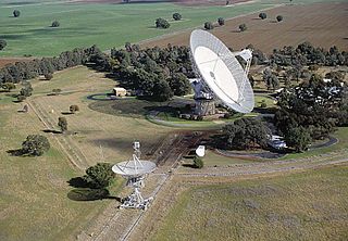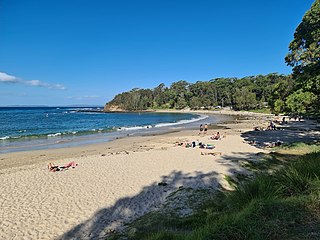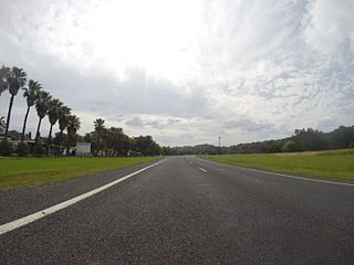
Binda is a village in the Southern Tablelands region of New South Wales, Australia in Upper Lachlan Shire.
Willow Vale is a Northern Village of the Southern Highlands of New South Wales, Australia, in Wingecarribee Shire. It is located 2 km north of Mittagong and is often considered part of Braemar along with its neighbour Balaclava.

Alectown is a town in the Central West region of New South Wales, Australia. The town is on the Newell Highway and in the Parkes Shire local government area, 382 kilometres (237 mi), west north west of the state capital, Sydney. The name is also applied to the surrounding rural locality, for postal and statistical purposes.

The City of Lismore is a local government area in the Northern Rivers region of New South Wales, Australia. The seat of the local government area is Lismore, a major regional centre of the state.
Kangaloon is a village in the Southern Highlands of New South Wales, Australia, in Wingecarribee Shire.

Fitzroy Falls is a village in the Wingecarribee Shire, located within the Southern Highlands region of New South Wales, Australia. The locality was known as Yarrunga, but was renamed after the 81-metre (266 ft) waterfall.
Canyonleigh is a locality in the Southern Highlands of New South Wales, Australia, in Wingecarribee Shire. Canyan Leigh was named by Mrs Jane Murray who took up a property between Paddys River and Long Swamp. The property overlooked the valley and this gave Mrs Murray the idea 'Canyan' or 'Canyon' being the name for a steep sided gully.
Paddys River is a locality in the Southern Highlands of New South Wales, Australia, in Wingecarribee Shire. The locality was previously known as Murrimba. It is south of Canyonleigh.
Wattle Ridge is a locality in the Southern Highlands of New South Wales, Australia, in Wingecarribee Shire. It is located near Buxton and Balmoral.
Kundabung is a locality on the North Coast of New South Wales, Australia.
Huntley is a suburb of the City of Wollongong to the west of Dapto. At the 2021 census, it had a population of 66.
Weston is a town in the Hunter Region of New South Wales, Australia. It is part of the City of Cessnock local government area, located approximately 11 km (7 mi) from Cessnock. At the 2016 census it recorded a population of 3,693.

Royalla is a rural locality on the border of New South Wales and the Australian Capital Territory. The area takes its name from the nearby Mount Rob Roy, and was originally a railway settlement on the Bombala railway line known as Rob Roy and changed to the current name in 1905. Modern Royalla is a large rural locality east of the Monaro Highway. The border with the ACT follows the western boundary of the easement of the former railway line to the east of the highway. The town was served by a railway station until 1975. The NSW part of Royalla had a population of 984 at the 2016 census.

Bendalong (Bendy) is a small town situated on the South Coast of New South Wales. It is located in the region of Ulladulla, in the City of Shoalhaven. At the 2016 census, it had a population of 95. Bendalong borders Manyana.

Tomakin is a small seaside village on the south coast of New South Wales between the major towns of Batemans Bay and Moruya. At the 2021 census, the town had a population of 1,233. It is most closely flanked by the other small villages of Guerilla Bay and Mossy Point.
Worrigee is a suburb of Nowra in the City of Shoalhaven in New South Wales, Australia. It lies southeast of Nowra. At the 2016 census, it had a population of 5,068.

Jingera is a locality in the Snowy Monaro Region, New South Wales, Australia. It lies south of Captains Flat and northeast of Bredbo. At the 2021 census, it had a population of 39. It had a public school from 1889 to 1911 and from 1914 to 1941, often operating "half-time".
Maimuru is a small village in southern New South Wales, Australia. The locality is in the Hilltops Council local government area.
Bentley is a locality in the Northern Rivers region of New South Wales and it is 23 kilometres (14 mi) north-west of the regional centre of Lismore. It sits within the local government area of Richmond Valley Council.
Lismore Heights is a locality in the Northern Rivers region of New South Wales, Australia. In 2021 census, Lismore Heights had a population of 2,117 people reflecting a decrease of 76 from the 2,193 counted in the 2016 census.


