Endapalli, Kadapa district

Last updated

Endapalli
Village
Location map India Andhra Pradesh EN.svg
Red pog.svg
Endapalli
Location in Andhra Pradesh, India
India location map.svg
Red pog.svg
Endapalli
Endapalli (India)
Coordinates: 14°02′36″N78°41′15″E / 14.0432°N 78.6875°E / 14.0432; 78.6875 Coordinates: 14°02′36″N78°41′15″E / 14.0432°N 78.6875°E / 14.0432; 78.6875
Country India
State Andhra Pradesh
District Kadapa
Elevation 143 m (469 ft)
Population (2011)
  Total 2,762
Languages
  Official Telugu
Time zone UTC+5:30 (IST)
PIN 516 269
Vehicle registration AP 04

Endapalli is a village in Kadapa district of the Indian state of Andhra Pradesh. It is located in Rayachoti mandal [1] .

Kadapa district District of Andhra Pradesh in India

YSR Kadapa district is said to be the heart of the Rayalaseema as it is centrally located and well connected with the 4 districts of Rayalaseema. The District has a glorious history and a rich cultural heritage. Kadapa district is one of the 13 districts in the Indian state of Andhra Pradesh. It is also one of the four districts in the Rayalaseema region of the state. The city of Kadapa is the seat of administration for the district.

India Country in South Asia

India, also known as the Republic of India, is a country in South Asia. It is the seventh largest country by area and with more than 1.3 billion people, it is the second most populous country as well as the most populous democracy in the world. Bounded by the Indian Ocean on the south, the Arabian Sea on the southwest, and the Bay of Bengal on the southeast, it shares land borders with Pakistan to the west; China, Nepal, and Bhutan to the northeast; and Bangladesh and Myanmar to the east. In the Indian Ocean, India is in the vicinity of Sri Lanka and the Maldives, while its Andaman and Nicobar Islands share a maritime border with Thailand and Indonesia.

Andhra Pradesh State in southern India

Andhra Pradesh is one of the 29 states of India. Situated in the south-east of the country, it is the seventh-largest state in India, covering an area of 162,970 km2 (62,920 sq mi). As per the 2011 census, it is the tenth most populous state, with 49,386,799 inhabitants. The largest city in Andhra Pradesh is Visakhapatnam. Telugu, one of the classical languages of India, is the major and official language of Andhra Pradesh.

Related Research Articles

Sriharikota town in Andhra Pradesh, India

Sriharikota is a barrier island off the Bay of Bengal coast located in the Nellore district of Andhra Pradesh, India. It houses the Satish Dhawan Space Centre, one of the two satellite launch centres in India. Indian Space Research Organisation (ISRO) launches satellites using multistage rockets such as the Polar Satellite Launch Vehicle and the Geosynchronous Satellite Launch Vehicle from Sriharikota.

A Postal Index Number (PIN), or sometimes redundantly a PIN code, is a code in the post office numbering or postal code system used by India Post, the Indian postal entity. The code is six digits long.

Jarjapupeta Census Town in Andhra Pradesh, India

Jarajapupeta is a census town in Vizianagaram district of the Indian state of Andhra Pradesh. It is located in Nellimarla mandal of Vizianagaram revenue division.

Marripalem Neighbourhood in Visakhapatnam, Andhra Pradesh, India

Marripalem is a neighbourhood area in Visakhapatnam. It is a residential area in the city. It has many population settlements with high raised buildings and apartments.

Gorinta village in Andhra Pradesh, India

Gorinta is an Indian village in Peddapuram Mandal in East Godavari District of Andhra Pradesh.This Village is located on the road linking Samalkot to prathipadu.

Kanagala Village in Andhra Pradesh, India

Kanagala is a revenue village in Guntur district of the Indian state of Andhra Pradesh. It is located in Cherukupalli mandal of Tenali revenue division.

Nagole Residential neighbourhood in Ranga Reddy, Telangana, India

Nagole is a residential and commercial locality in Ranga Reddy, Telangana, India

Kalavalapalli village in Andhra Pradesh, India

Kalavalapalli is a village in Chagallu mandal in West Godavari district in Andhra Pradesh state in India.

Bobbellapadu Village in Andhra Pradesh, India

Bobbellapadu is a village in Krishna district of the Indian state of Andhra Pradesh. It is located in Chandarlapadu mandal of Vijayawada revenue division. It is a part of Andhra Pradesh Capital Region.

Vinjanampadu is a village in Prakasam district of Andhra Pradesh, India. Yeddanapudi is the mandal for Vinjanampadu.

Katepally is a village in Nalgonda district in Telangana, India. It falls under Atmakur mandal.

Perali town in Andhra Pradesh, India

Perali is a small village located 7.9 km away from Bapatla, Andhra Pradesh, India. Perali is part of the Karlapalem mandal in Guntur district.

Dewaitha is a village in Dildarnagar Kamsar in the Ghazipur district, Indian state of Uttar Pradesh.

Peddapasupula is a village in Kadapa district, Andhra Pradesh, India.

Sakhavaram Village in Andhra Pradesh, India

Sakhavaram is a village in Prakasam District, Andhra Pradesh, India.

Vijjeswaram is a small town near the Godavari River in the Nidadavolu mandal of West Godavari district, Andhra Pradesh, India.

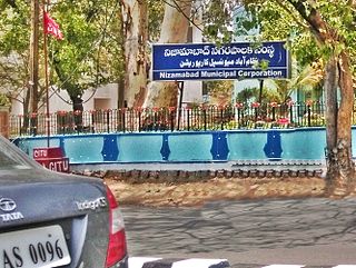
Nizamabad Municipal Corporation municipal governing body of Nizamabad

The Nizamabad Municipal Corporation is the local governing body, administering the city of Nizamabad in the Indian state of Telangana. It is the third largest city in the state after Hyderabad and Warangal. As of 2011 census, the municipal corporation had a population of 310,467. The municipal corporation consists of democratically elected members, is headed by a mayor and administers the city's governance, infrastructure and administration.

Basinenipalli Village in Andhra Pradesh, India

Basinenipalli is a village in Seetharamapuram Mandal of Nellore district in the Indian state of Andhra Pradesh.

Endapalli may refer to places in India:

Endapalli, West Godavari district Village in Andhra Pradesh, India

Endapalli is a village in West Godavari district of the Indian state of Andhra Pradesh. It is located in Chintalapudi mandal.

References

  1. "Pin Code: ENDAPALLI, CUDDAPAH, ANDHRA PRADESH, India, Pincode.net.in". pincode.net.in. Retrieved 2018-03-11.