Epse

Last updated
Epse
Epse, monumentale boerderij.jpg
Farm in Epse
Epse vlag.svg
2010-NL-P05-Gelderland-positiekaart-gemnamen.jpg
Red pog.svg
Epse
Location in the Netherlands
Netherlands location map.svg
Red pog.svg
Epse
Epse (Netherlands)
Coordinates: 52°13′30″N6°11′58″E / 52.22487°N 6.19949°E / 52.22487; 6.19949
Country Netherlands
Province Gelderland
Municipality Lochem
Area
[1]
  Total8.85 km2 (3.42 sq mi)
Elevation
[2]
7 m (23 ft)
Population
 (2021) [3]
  Total2,069
  Density230/km2 (610/sq mi)
Time zone UTC+1 (CET)
  Summer (DST) UTC+2 (CEST)
Postal code
7214 [1]
Dialing code 0575

Epse is a village in the municipality of Lochem, province of Gelderland, Netherlands. It lies south of the A1 motorway and north of Gorssel, which was a separate municipality encompassing Epse until 2005, when it was merged with Lochem. In 2021, the village had a population of 2,069. [3] The Dutch Reformed Church at its centre was built in 1930.

Contents

History

It was first mentioned in 1195 as de Epse. The etymology is unclear. [4] In 1840, it was home to 567 people. [5] The Dutch Reformed Church was built in 1930. [6] In 2021, it was announced that the church will close in 2023, and the Catholic church in neighbouring Joppe will also close. [7] In 2000, a northern section of Epse was transferred to Deventer for the construction of an industrial zone. The area was home to 58 people. [5]

Related Research Articles

<span class="mw-page-title-main">Gorssel</span> Village in Gelderland, Netherlands

Gorssel is a village in the municipality of Lochem, province of Gelderland, Netherlands. It is located about 9 km southeast of the city centre of Deventer, Overijssel. In 2015, it had a population of 4,043.

<span class="mw-page-title-main">Lochem</span> City and municipality in Gelderland, Netherlands

Lochem is a city and municipality in the province of Gelderland in the Eastern Netherlands. In 2005, it merged with the municipality of Gorssel, retaining the name of Lochem. As of 2019, it had a population of 33,590.

<span class="mw-page-title-main">Heeswijk</span> Village in North Brabant, Netherlands

Heeswijk is a Dutch village. It is located in the province of North Brabant, in the south of the Netherlands.

<span class="mw-page-title-main">Lobith</span> Village in Gelderland, Netherlands

Lobith is a village in the Dutch province of Gelderland. It is located in the municipality of Zevenaar. Traditionally, it is said that the Rhine enters the Netherlands at Lobith, although in reality, this happens about 4 km further upstream, near Spijk.

<span class="mw-page-title-main">Koarnjum</span> Village in Friesland, Netherlands

Koarnjum is a village in the municipality of Leeuwarden, in the Netherlands. The village is situated between Jelsum and Britsum and a population of around 370 in January 2017.
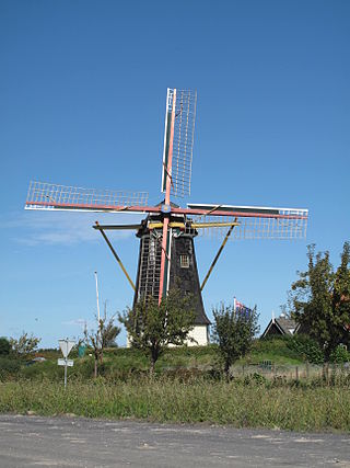
<span class="mw-page-title-main">Serooskerke, Walcheren</span> Village in Zeeland, Netherlands

Serooskerke is a village in the Dutch province of Zeeland. It is a part of the municipality of Veere, and lies about 6 km north of Middelburg.
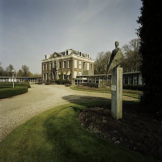
<span class="mw-page-title-main">Koudekerke</span> Village in Zeeland, Netherlands

Koudekerke is a village in the region of Walcheren in the Dutch province of Zeeland. It is a part of the municipality of Veere. As of 2018, the census reported the village has a population of 3,419, making it the largest settlement in Veere. The built-up area of the village was 0.55 km², and contained 1,133 residences.

<span class="mw-page-title-main">Vierpolders</span> Village in South Holland, Netherlands

Vierpolders is a village in the Dutch province of South Holland. It is a part of the municipality of Voorne aan Zee, and lies about 5 km north of Hellevoetsluis.
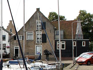
<span class="mw-page-title-main">Zwartewaal</span> Town in South Holland, Netherlands

Zwartewaal is a village in the Dutch province of South Holland, The Netherlands. It is a part of the municipality of Voorne aan Zee and lies about 5 km south of Maassluis.

<span class="mw-page-title-main">Hoenzadriel</span> Village in Gelderland, Netherlands

Hoenzadriel is a village in the Dutch province of Gelderland. It is a part of the municipality of Maasdriel and lies about 6 km north of 's-Hertogenbosch.

<span class="mw-page-title-main">Almkerk</span> Village in North Brabant, Netherlands

Almkerk is a village in the municipality of Altena, Netherlands. It is located about 7 km south of Gorinchem.

<span class="mw-page-title-main">Steenwijkerwold</span> Village in Overijssel, Netherlands

Steenwijkerwold is a village in the Dutch province of Overijssel. It is located in the municipality of Steenwijkerland, about 5 km northwest of Steenwijk. Steenwijkerwold was a separate municipality until 1973, when it became a part of Steenwijk.

<span class="mw-page-title-main">Laren, Gelderland</span> Village in Gelderland, Netherlands

Laren is a village in the Dutch province of Gelderland. It is located in the municipality of Lochem.

<span class="mw-page-title-main">Oranjedorp</span> Village in Drenthe, Netherlands

Oranjedorp is a village in the Netherlands and it is part of the Emmen municipality in Drenthe.

<span class="mw-page-title-main">Nistelrode</span> Village in North Brabant, Netherlands

Nistelrode is a village in the Dutch province of North Brabant. It is located in the municipality of Bernheze, about 8 km south of Oss.

<span class="mw-page-title-main">Almen</span> Village in Gelderland, Netherlands

Almen is a village in the Dutch province of Gelderland. It is in the municipality Lochem, about 7 km east of the city of Zutphen.

<span class="mw-page-title-main">Barchem</span> Village in Gelderland, Netherlands

Barchem is a village in the Dutch province of Gelderland, located in the municipality Lochem, about 15 km east of the city of Zutphen.

<span class="mw-page-title-main">Joppe, Netherlands</span> Village in Gelderland, Netherlands

Joppe is a village in the municipality of Lochem in the province of Gelderland, Netherlands.

<span class="mw-page-title-main">Noordwolde, Friesland</span> Village in Friesland, Netherlands

Noordwolde is a village in Weststellingwerf in the province of Friesland, the Netherlands. It had a population of around 3,600 as of 2017. Noordwolde-Zuid, the settlement to the south of Noordwolde is considered a separate village.

<span class="mw-page-title-main">Daarle</span> Village in Overijssel, Netherlands

Daarle is a village in the Dutch province of Overijssel in the Salland region. It is part of the municipality of Hellendoorn.

References

  1. 1 2 "Kerncijfers wijken en buurten 2021". Central Bureau of Statistics. Retrieved 22 March 2022. two entries
  2. "Postcodetool for 7214AA". Actueel Hoogtebestand Nederland (in Dutch). Het Waterschapshuis. Retrieved 22 March 2022.
  3. 1 2 (in Dutch) Statistische gegevens gemeente Lochem op 1 januari 2021, gemeente Lochem
  4. "Epse - (geografische naam)". Etymologiebank (in Dutch). Retrieved 22 March 2022.
  5. 1 2 "Epse". Plaatsengids (in Dutch). Retrieved 22 March 2022.
  6. "Kerk Epse". VVV Lochem (in Dutch). Retrieved 22 March 2022.
  7. "Sluiting dreigt voor kerkgebouwen Joppe en Epse". Gorssel (in Dutch). Retrieved 22 March 2022.