Erandique Airport

Last updated
Erandique Airport
Gualguire Airport
Summary
Airport type Public
Serves Erandique, Honduras
Elevation  AMSL 4,199 ft / 1,280 m
Coordinates 14°14′10″N88°26′15″W / 14.23611°N 88.43750°W / 14.23611; -88.43750 Coordinates: 14°14′10″N88°26′15″W / 14.23611°N 88.43750°W / 14.23611; -88.43750
Map
Honduras location map.svg
Airplane silhouette.svg
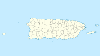
EDQ
Location of the airport in Honduras
Runways
Direction LengthSurface
mft
15/336802,231Grass
Sources: GCM [1] Google Maps [2] SkyVector [3]

Erandique Airport( IATA : EDQ, ICAO : MHGU) is an airstrip serving the town of Erandique in Lempira Department, Honduras.

An IATA airport code, also known as an IATA location identifier, IATA station code or simply a location identifier, is a three-letter code designating many airports around the world, defined by the International Air Transport Association (IATA). The characters prominently displayed on baggage tags attached at airport check-in desks are an example of a way these codes are used.

ICAO airport code four-letter code designating many airports around the world

The ICAOairport code or location indicator is a four-letter code designating aerodromes around the world. These codes, as defined by the International Civil Aviation Organization and published in ICAO Document 7910: Location Indicators, are used by air traffic control and airline operations such as flight planning.

Erandique Municipality in Lempira, Honduras

Erandique is a municipality in the Lempira Department of Honduras.

Contents

The runway is off the V-787 road, 3 kilometres (1.9 mi) east of town. It has a downslope to the south. There is distant rising terrain west through northeast.

The Soto Cano VORTAC (Ident: ESC) is located 48.3 nautical miles (89.5 km) east-northeast of Erandique Airport. The Ilopango VOR-DME (Ident: YSV) is located 51.1 nautical miles (94.6 km) southwest of the airstrip. [4] [5]

VORTAC

A VORTAC is a radio-based navigational aid for aircraft pilots consisting of a co-located VHF omnidirectional range (VOR) beacon and a tactical air navigation system (TACAN) beacon. Both types of beacons provide pilots azimuth information, but the VOR system is generally used by civil aircraft and the TACAN system by military aircraft. However, the TACAN distance measuring equipment is also used for civil purposes because civil DME equipment is built to match the military DME specifications. Most VOR installations in the United States are VORTACs. The system was designed and developed by the Cardion Corporation.

See also

Transport in Honduras

Transport in Honduras refers to transport in Honduras, a country in Central America.

Related Research Articles

Waspam Airport

Waspam Airport is an airport serving Waspam, a town on the Coco River on Nicaragua's border with Honduras.

Enriquillo Field airport in the Dominican Republic

Juancho Enriquillo Airport is an agricultural airstrip 4 kilometres (2.5 mi) southwest of Enriquillo, a Caribbean coastal town in the Barahona Province of the Dominican Republic.

Boquerón Airport

Boquerón Airport is a private airstrip 2.2 miles (3.5 km) east-southeast of the coastal town of Boquerón in the municipality of Cabo Rojo, Puerto Rico. It is located on road PR-301, and it has a single asphalt runway.

Tela Airport airport in Honduras

Tela Airport is an airport serving Tela, a town in the Atlántida Department on the northern coast of Honduras.

Lobatse Airport

Lobatse Airport is an airstrip serving Lobatse, a town in the South-East District of Botswana. The runway is 2 kilometres (1.2 mi) east of the town, and 3.2 kilometres (2 mi) west of the border with South Africa. There is a ridge between the town and airstrip that parallels the runway.

Same Airstrip

Same Airstrip is an airstrip serving the town of Same in the Kilimanjaro Region of Tanzania.

Orange Walk Airport

Orange Walk Airport is a public use airport 3 kilometres (2 mi) southwest of Orange Walk Town, Orange Walk District, Belize. The airport was also known as Tower Hill Airport.

Tshaneni Airfield

Tshaneni Airfield is an airstrip serving Tshaneni, in Eswatini.

San Miguel Airport (Panama) airport in Panama

San Miguel Airport is an airport serving San Miguel, a town in the Pearl Islands of Panama. It is just east of the town, on the northern side of Isla del Rey, the largest of the islands.

Amapala Airport airport in Honduras

Amapala Airport is an airstrip serving the town of Amapala on El Tigre Island, a volcanic island in the Gulf of Fonseca, Honduras.

Choluteca Airport airport in Honduras

Choluteca Airport is an airport serving the city of Choluteca in Choluteca Department, Honduras. The airport ICAO code is also variously listed as MHCH.

Celaque Airport airport in Honduras

Celaque Airport is an airport serving the town of Gracias in Lempira Department, Honduras. The airport was inaugurated in 2013.

La Esperanza Airport (Intibucá) airport in Honduras

La Esperanza Airport is an airport serving the cities of La Esperanza and Intibucá in the Intibucá Department of Honduras.

Nueva Ocotepeque Airport airport in Honduras

Nueva Ocotepeque Airport is an airport serving the town of Nueva Ocotepeque in Ocotepeque Department, Honduras. Nueva Ocotepeque is in a north-south valley 5 kilometres (3.1 mi) north of the El Salvador border, and 13 kilometres (8.1 mi) east of the Guatemala border.

La Esperanza Airport, Colón airport in Honduras

La Esperanza Airport is an airport serving a number of agricultural villages and towns in western Colón Department, Honduras. The largest nearby towns are Sonaguera (13 km) and Sabá (17 km).

Victoria Airport (Honduras) airport in Honduras

Victoria Airport is an airport serving the town of Victoria in Yoro Department, Honduras. The airport is adjacent to the southwest side of the town.

La Unión Airport (Honduras) airport in Honduras

La Unión Airport is an airport serving the town of La Unión in Olancho Department, Honduras.

Los Comandos Airport

Los Comandos Airport is an airstrip serving the town of San Francisco Gotera in Morazán Department, El Salvador.

La Cabaña Airport

La Cabaña Airport is an airstrip serving the town of La Cabaña in San Salvador Department, El Salvador.

San Ignacio Town Airstrip

San Ignacio Town Airstrip is a public use airport serving San Ignacio, a town in the Cayo District of Belize. The airport is 6 kilometres (4 mi) southwest of San Ignacio and 5 kilometres (3.1 mi) east of the border with Guatemala.

References

  1. Airport information for EDQ at Great Circle Mapper.
  2. Google Maps - Erandique
  3. "Gualguire Airport". SkyVector. Retrieved 23 September 2018.
  4. "Ilopango VOR-DME". Our Airports. Retrieved 23 September 2018.
  5. "Soto Cano VORTAC". Our Airports. Retrieved 23 September 2018.

The Aviation Safety Network (ASN) is a website that keeps track of aviation accidents, incidents, and hijackings. Their database contains details of over 10,700 reports. The ASN includes an aviation database with aviation investigations, news, photos, and statistics.