Erandique

Last updated

Erandique
Municipality
Erandique,Lempira 1.JPG
Panoramic view of Erandique
Honduras location map.svg
Red pog.svg
Erandique
Location in Honduras
Coordinates: 14°14′N88°28′W / 14.233°N 88.467°W / 14.233; -88.467
CountryHonduras
DepartmentLempira
Founded1600
City since3 March 1932;90 years ago (1932-03-03)
Area
  Total294 km2 (114 sq mi)
Population
 (2015)
  Total15,633
  Density53/km2 (140/sq mi)
Climate Aw

Erandique is a municipality in the Lempira Department of Honduras.

Contents

Erandique is one of the several municipalities of the Lempira department. One has to travel 65 kilometres (40 mi) on road CA11A from the city of Gracias passing by San Juan (del Caite). A second road (V-787) that leads to Erandique is going by the town of "Dolores" in Intibuca. Also this roads leads to the municipality of San Francisco. The main disadvantage of this second road is that is not repaired often. If one enters from San Juan, Erandique has one exit to San Francisco and the other to the rest of the municipalities such as San Andrés and so on.

The town is served by Erandique (Gualguire) Airport, a grass airstrip 3 kilometres (1.9 mi) east of town.

History

Erandique was founded in 1600 under the name of "Cerquin", due to its location on the west of the Cerquin hill. It was registered in 1733 in the volume II of the Real State book, dated on 28 November. According to tales from elderly citizens, the original act was lost and it was replaced on 14 February 1882, in the administration of Dr Marco Aurelio Soto. Erandique is one of the oldest municipalities and it became a city on 3 March 1932.

Geography

Erandique is still surrounded by pine forests, with some pockets of Sweetgum (Liquidambar) trees. The terrain is rugged, characterised by steep hills. The weather is cool during the rainy season (May–October), and warmer in the dry season. The predominant soil is derived from volcanic rocks. During the rainy season, this soil that forms from the degradation of the rocks becomes extremely slippery, and it is common for unpaved roads to wash away and for routes to become impassable. Many of the pine forests are still used as a source of biofuel for the local population.

Boundaries

Its boundaries are:

Resources

The coffee plantations have great importance to Erandique, but they are located in the villages and mountains at higher elevations around the city centre, such as "Cerquin" hill. Therefore, it is a gathering point of coffee and it also processes the grains. Following coffee, there is also agricultural production of corn and beans, as well as some vegetable crops and small herds of cattle. Currently there is electricity and telecommunications services from the national company and mobile phone services. It is very important to tell that a small hospital works in Erandique. It has an ambulance service and the serious cases are taken to Gracias. It is worth mentioning that a group of US volunteers runs a small clinic to help the poorest citizens. Daily bus service available to both Gracias and La Esperanza once per day. There is one gas station and several places to fix flat tires.

Population

Half of the population in Erandique are descended from native Indians. The other half of the population is mestizo (mixed-race ). During the holidays and other activities is when the direct descendants are seen; they still prefer to live isolated.

Demographics

At the time of the 2013 Honduras census, Erandique municipality had a population of 15,242. Of these, 80.26% were Indigenous (80.17% Lenca), 18.34% Mestizo, 0.69% Black or Afro-Honduran, 0.52% White and 0.19% others. [1]

Tourism

The landscapes in Erandique are considered beautiful around the country due to the pine and sweetgum (Liquidambar) forests. The people from Erandique are nice and welcoming. There are a couple of places for internet access. There are also several places to enjoy the typical food and only one that offers more variety of dishes, such as shrimps and seafood soup, since some come from the coastal city of La Ceiba. Downtown the visitor can see many old adobe houses. Some streets are paved with rocks and there are 2 very old churches to visit.

Related Research Articles

Intibucá Department Department in Honduras

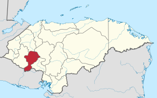
Intibucá is one of the 18 departments in the Republic of Honduras. Intibucá covers a total surface area of 1,186.1 square miles (3,072 km2). Its capital is the city of La Esperanza, in the municipality of La Esperanza.

La Esperanza, Honduras Place in Intibucá, Honduras

La Esperanza is the capital city and a municipality of the same name of the department of Intibucá, Honduras. La Esperanza is famous for having the coolest climate in Honduras. It is considered the heart of the Ruta Lenca, a region of Lenca ethnic influence that spans Honduras from Santa Rosa de Copan to Choluteca. Sites on the Lenca Trail have been designated by the government and United Nations development in order to encourage more cultural tourism, and help create new markets for the traditional crafts, such as pottery, practiced by the Lenca, in order to preserve their culture.

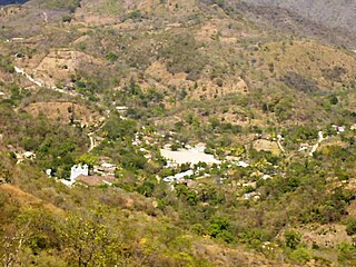
Concepción is a municipality in the Honduran department of Intibucá.

Candelaria, Lempira Municipality in Lempira, Honduras

Candelaria is a municipality in the Honduran department of Lempira.

Cololaca Municipality in Lempira, Honduras

Cololaca is a municipality in the Honduran department of Lempira.

Gualcince Municipality in Lempira, Honduras

Gualcince is a municipality in the Honduran department of Lempira.

La Campa Municipality in Lempira, Honduras

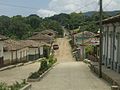
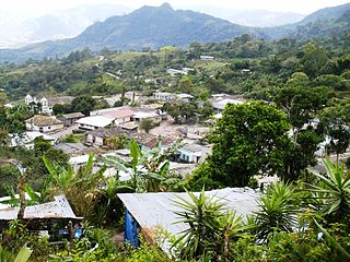
La Campa is a municipality and an aldea, or small town, in the Honduran Department of Lempira, located about 18 kilometres (11 mi) by dirt road from Gracias, the largest town in the immediate region.

La Iguala Municipality in Lempira, Honduras

La Iguala is a municipality in the Honduran department of Lempira.

Lepaera Municipality in Lempira, Honduras

Lepaera is a municipality in the Honduran department of Lempira. It has tropical climate all year round.

Piraera Municipality in Lempira, Honduras

Piraera is one of the municipalities of Lempira department in Honduras. It is located on one of the branches of "Congolón" mountain, it is 105 km away from the city of Gracias.

San Andrés, Lempira Municipality in Lempira, Honduras

San Andrés is a municipality in the Honduran department of Lempira.

San Francisco, Lempira Municipality in Lempira, Honduras

San Francisco is a municipality in the Honduran department of Lempira.

San Manuel Colohete Municipality in Lempira, Honduras

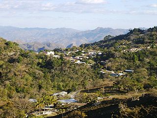
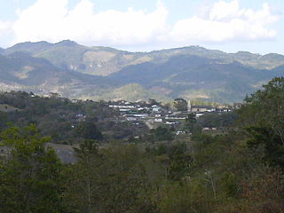
San Manuel Colohete is a municipality in the Honduran department of Lempira, located approximately twenty miles southwest of the departmental capital of Gracias. The population of the entire municipality is around 15,000 but within the town center about 1,500.

San Marcos de Caiquín Municipality in Lempira, Honduras

San Marcos de Caiquín is a municipality in the Honduran department of Lempira created November 4, 1994.

San Rafael, Lempira Municipality in Honduras

San Rafael is a municipality in the Honduran department of Lempira.

San Sebastián, Lempira Municipality in Lempira, Honduras

San Sebastián is a municipality in the Honduran department of Lempira.

Santa Cruz, Lempira Municipality in Lempira, Honduras

Santa Cruz is a municipality in the Honduran department of Lempira.

Tomalá Municipality in Lempira, Honduras

Tomalá is a municipality in the Honduran department of Lempira.

Valladolid, Lempira Municipality in Lempira, Honduras

Valladolid is one of the municipalities of the Lempira department of Honduras. It takes about 2.5 hours to travel there and it must be via Santa Rosa de Copán–San Marcos de Ocotepeque–Cololaca–Tambla–Valladolid.

Belén, Honduras Municipality in Lempira, Honduras

Belén is a municipality in the Honduran department of Lempira. The latitude is 15.75 north, the longitude is 87.93 west, and the altitude is 313 meters.

References

Coordinates: 14°14′N88°28′W / 14.233°N 88.467°W / 14.233; -88.467