Cololaca

Last updated
Cololaca
Municipality
Cololaca,Lempira 1.JPG
Central Park of Cololaca
Honduras location map.svg
Red pog.svg
Cololaca
Location in Honduras
Coordinates: 14°18′N88°53′W / 14.300°N 88.883°W / 14.300; -88.883
CountryHonduras
DepartmentLempira
Municipality since1835
Area
  Total221 km2 (85 sq mi)
Population
 (2015)
  Total9,093
  Density41/km2 (110/sq mi)
Climate Aw

Cololaca is a municipality in the Honduran department of Lempira.

Contents

Mayor's Office across Central Park Cololaca,Lempira 2.JPG
Mayor's Office across Central Park

Cololaca is one of the municipalities of the Lempira department. It is located more than 200 km away from Gracias. There is also an alternate way to go there, and that is taking a deviation in San Marcos de Ocotepeque. Taking this unpaved road takes about 30 minutes to Cololaca. The Government is currently working on paving the road from San Marcos de Ocotepeque to Cololaca.

History

It started in a private property, that belonged to an old community, back in 1628. According to tales of elderly inhabitants, it became legal as a municipality in 1835, from Guarita district.

Geography

The forests around Cololaca are Dry Sub Tropical forest, because they reflect the lack of water, but during the rainy season everything becomes green. It has very high and steep hills. And also many places ideal for cattle.

Parque Central de Cololaca Cololaca,Lempira 3.JPG
Parque Central de Cololaca

Boundaries

Its boundaries are:

Resources

The elevation and soil do not allow coffee plantations, but the processes of peeling, drying and toasting of coffee grains are done. Corn and bean crops are very important. But also vegetable are sown for local distribution. Cattle, milk and milk products are common in Cololaca. Since it is near San Marcos de Ocotepeque, the commerce activities are very fluid, and is the main provider for Cololaca.

Population

The typical cross-breed of native Indians and Spanish settlers is seen in Cololaca.

Demographics

At the time of the 2013 Honduras census, Cololaca municipality had a population of 8,532. Of these, 98.12% were Mestizo, 1.07% Indigenous (0.90% Lenca), 0.42% Black or Afro-Honduran and 0.39% White. [1]

Tourism

Cololaca has the typical distribution of colonial architecture. There is electricity and coverage for mobile phones. There are no recommendable hostels in Cololaca, but San Marcos de Ocotepeque is near with very good accommodations and venues for entertainment.

Related Research Articles

Lempira Department Department in Honduras

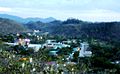
Lempira is one of the 18 departments in Honduras. located in the western part of the country, it is bordered by the departments of Ocotepeque and Copán to the west, Intibucá to the east, and Santa Bárbara to the north. To its south lies the El Salvador–Honduras border. The departmental capital is Gracias.

Candelaria, Lempira Municipality in Lempira, Honduras

Candelaria is a municipality in the Honduran department of Lempira.

Erandique Municipality in Lempira, Honduras

Erandique is a municipality in the Lempira Department of Honduras.

Gualcince Municipality in Lempira, Honduras

Gualcince is a municipality in the Honduran department of Lempira.

Guarita Municipality in Lempira, Honduras

Guarita is a municipality in the Honduran department of Lempira.

La Iguala Municipality in Lempira, Honduras

La Iguala is a municipality in the Honduran department of Lempira.

Las Flores, Lempira Municipality in Lempira, Honduras

Las Flores is a municipality in the Honduran department of Lempira.

La Virtud Municipality in Lempira, Honduras

La Virtud is a municipality in the Honduran department of Lempira.

Lepaera Municipality in Lempira, Honduras

Lepaera is a municipality in the Honduran department of Lempira. It has tropical climate all year round.

Mapulaca Municipality in Lempira, Honduras

Mapulaca is a municipality in the Honduran department of Lempira.

Piraera Municipality in Lempira, Honduras

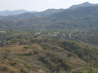
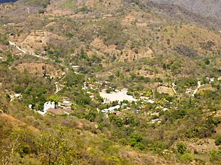
Piraera is one of the municipalities of Lempira department in Honduras. It is located on one of the branches of "Congolón" mountain, it is 105 km away from the city of Gracias.

San Francisco, Lempira Municipality in Lempira, Honduras

San Francisco is a municipality in the Honduran department of Lempira.

San Juan Guarita Municipality in Lempira, Honduras

San Juan Guarita is a municipality in the Honduran department of Lempira.

San Manuel Colohete Municipality in Lempira, Honduras

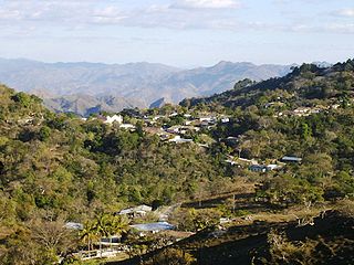
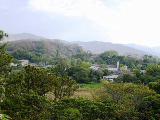
San Manuel Colohete is a municipality in the Honduran department of Lempira, located approximately twenty miles southwest of the departmental capital of Gracias. The population of the entire municipality is around 15,000 but within the town center about 1,500.

San Sebastián, Lempira Municipality in Lempira, Honduras

San Sebastián is a municipality in the Honduran department of Lempira.

Tambla Municipality in Lempira, Honduras

Tambla is a municipality in the Honduran department of Lempira.

Tomalá Municipality in Lempira, Honduras

Tomalá is a municipality in the Honduran department of Lempira.

Valladolid, Lempira Municipality in Lempira, Honduras

Valladolid is one of the municipalities of the Lempira department of Honduras. It takes about 2.5 hours to travel there and it must be via Santa Rosa de Copán–San Marcos de Ocotepeque–Cololaca–Tambla–Valladolid.

San Marcos is a town, with a population of 6,836, and a municipality in the Honduran department of Ocotepeque.

Belén, Honduras Municipality in Lempira, Honduras

Belén is a municipality in the Honduran department of Lempira. The latitude is 15.75 north, the longitude is 87.93 west, and the altitude is 313 meters.

References

Coordinates: 14°18′N88°53′W / 14.300°N 88.883°W / 14.300; -88.883