Guarita

Last updated
Guarita
Municipality
Guarita,Lempira 4.JPG
Panoramic View of Guarita
Honduras location map.svg
Red pog.svg
Guarita
Location in Honduras
Coordinates: 14°10′0″N88°47′6″W / 14.16667°N 88.78500°W / 14.16667; -88.78500
CountryHonduras
DepartmentLempira
Municipality20 November 1795;226 years ago (1795-11-20)
City20 March 1934;88 years ago (1934-03-20)
Area
  Total172 km2 (66 sq mi)
Population
 (2015)
  Total8,509
  Density49/km2 (130/sq mi)

Guarita is a municipality in the Honduran department of Lempira.

Contents

It is one of the oldest municipalities of the Lempira department. The best way to go to Guarita is via Santa Rosa de Copán-San Marcos de Ocotepeque-Cololaca-Guarita and it takes about 2.5 hours. This way is much preferable than going via Gracias. The distance between Guarita and San Juan Guarita municipality is scarcely half hill. The road is in good condition most of the year. The deviation is located about 20 km from Cololaca, taking a right. The left deviation leads to the Tambla municipality.

History

In the census of 1,791 it was part of "El Curato de Sensenti", the deed of land as a municipality was given on November 20, 1795. It became a city on March 20, 1934.

Geography

Guarita is based on the half of a mountain. It is surrounded by pine and oak tree forests. Also the mountains and hills are very steep and irregular. The weather has changed from cool to warmer every year due to the Forest exploitation.

Boundaries

Its boundaries are:

Resources

Because of its elevation from the sea level. Guarita provides the conditions for coffee plantations. There is also the forest exploitation as an issue of economical activity. Bean and corn crops can not miss, as they are part of the culture in the whole country. As the rest of the department, Guarita has electricity and mobile communications. There are two places that provide Internet access.

Population

The cross-breed of Spanish settlers and native Indian is the majority in Guarita.

Demographics

At the time of the 2013 Honduras census, Guarita municipality had a population of 8,378. Of these, 98.11% were Mestizo, 0.90% White, 0.81% Indigenous and 0.17% Black or Afro-Honduran. [1]

Tourism

Guarita is a municipality with a rich and vast history, because it was one of the first organizations of the Spanish colonization, as proof it can be considered that it was part of the "Curato de Sensenti" and district to the other organizations that were emerging throughout the history of the department. Its architecture style is quite simple and colonial. It is great place to enjoy the stillness of rural life. The Salvadoran media has an important influence in this municipality.

Related Research Articles

Intibucá Department Department in Honduras

Intibucá is one of the 18 departments in the Republic of Honduras. Intibucá covers a total surface area of 1,186.1 square miles (3,072 km2). Its capital is the city of La Esperanza, in the municipality of La Esperanza.

Lempira Department Department in Honduras

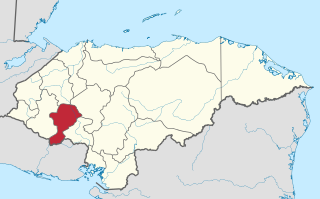
Lempira is one of the 18 departments in Honduras. located in the western part of the country, it is bordered by the departments of Ocotepeque and Copán to the west, Intibucá to the east, and Santa Bárbara to the north. To its south lies the El Salvador–Honduras border. The departmental capital is Gracias.

La Esperanza, Honduras Place in Intibucá, Honduras

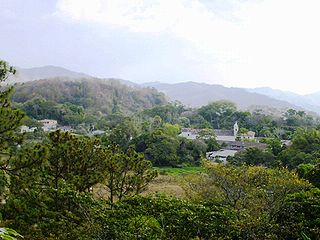
La Esperanza is the capital city and a municipality of the same name of the department of Intibucá, Honduras. La Esperanza is famous for having the coolest climate in Honduras. It is considered the heart of the Ruta Lenca, a region of Lenca ethnic influence that spans Honduras from Santa Rosa de Copan to Choluteca. Sites on the Lenca Trail have been designated by the government and United Nations development in order to encourage more cultural tourism, and help create new markets for the traditional crafts, such as pottery, practiced by the Lenca, in order to preserve their culture.

Candelaria, Lempira Municipality in Lempira, Honduras

Candelaria is a municipality in the Honduran department of Lempira.

Cololaca Municipality in Lempira, Honduras

Cololaca is a municipality in the Honduran department of Lempira.

Erandique Municipality in Lempira, Honduras

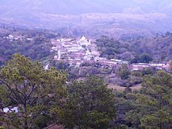
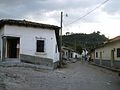
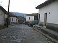
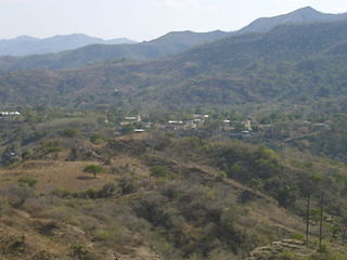
Erandique is a municipality in the Lempira Department of Honduras.

Gualcince Municipality in Lempira, Honduras

Gualcince is a municipality in the Honduran department of Lempira.

La Iguala Municipality in Lempira, Honduras

La Iguala is a municipality in the Honduran department of Lempira.

La Virtud Municipality in Lempira, Honduras

La Virtud is a municipality in the Honduran department of Lempira.

Mapulaca Municipality in Lempira, Honduras

Mapulaca is a municipality in the Honduran department of Lempira.

Piraera Municipality in Lempira, Honduras

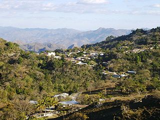
Piraera is one of the municipalities of Lempira department in Honduras. It is located on one of the branches of "Congolón" mountain, it is 105 km away from the city of Gracias.

San Andrés, Lempira Municipality in Lempira, Honduras

San Andrés is a municipality in the Honduran department of Lempira.

San Francisco, Lempira Municipality in Lempira, Honduras

San Francisco is a municipality in the Honduran department of Lempira.

San Juan Guarita Municipality in Lempira, Honduras

San Juan Guarita is a municipality in the Honduran department of Lempira.

Santa Cruz, Lempira Municipality in Lempira, Honduras

Santa Cruz is a municipality in the Honduran department of Lempira.

Tambla Municipality in Lempira, Honduras

Tambla is a municipality in the Honduran department of Lempira.

Tomalá Municipality in Lempira, Honduras

Tomalá is a municipality in the Honduran department of Lempira.

Valladolid, Lempira Municipality in Lempira, Honduras

Valladolid is one of the municipalities of the Lempira department of Honduras. It takes about 2.5 hours to travel there and it must be via Santa Rosa de Copán–San Marcos de Ocotepeque–Cololaca–Tambla–Valladolid.

Belén, Honduras Municipality in Lempira, Honduras

Belén is a municipality in the Honduran department of Lempira. The latitude is 15.75 north, the longitude is 87.93 west, and the altitude is 313 meters.

References

Coordinates: 14°11′N88°49′W / 14.183°N 88.817°W / 14.183; -88.817