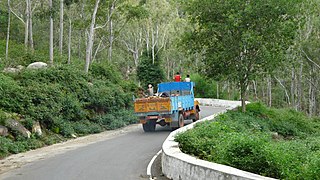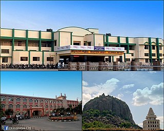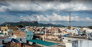
Vellore, also natively spelt as Velur, is a sprawling city and the administrative headquarters of Vellore district in the Indian state of Tamil Nadu. It is located on the banks of the Palar River in the northeastern part of Tamil Nadu and is separated into four zones that are further subdivided into 60 wards, covering an area of 87.915 km2 and housing a population of 423,425 as reported by the 2001 census. It is located about 137.20 kilometres (85 mi) west of Chennai, and about 213.20 kilometres (132 mi) east of Bangalore. Vellore is located on the Mumbai–Chennai arm of the Golden Quadrilateral. Vellore is governed under a mayor and the Vellore Municipal Corporation. It is a part of both the Lok Sabha and state assembly constituencies of Vellore.
Hardoi is a city and municipal board in Hardoi district in the Indian state of Uttar Pradesh. It is the administrative headquarters of Hardoi district. It is also known as Prahalad Nagari. Hardoi is about 100 km from the state capital Lucknow and about 385 km from New Delhi. Hardoi is a temple town.

Vellore district is one of the 38 districts in the Tamil Nadu state of India. It is one of the eleven districts that form the north region of Tamil Nadu. Vellore city is the headquarters of this district. As of 2011, the district had a population of 1,614,242 with a sex ratio of 1,007 females for every 1,000 males. In 2017 Vellore district ranked eleventh in list of districts in Tamil Nadu by Human Development Index.
Baghpat, historically known as Vyaghraprastha, is a city in the Indian state of Uttar Pradesh. It is the administrative headquarters of Bagpat district, which was established in 1997. It is part of the National Capital Region, surrounding New Delhi.
Chengam is an important market town and a taluk headquarter in the Foot hills of Eastern ghats in Tiruvannamalai district of Tamil Nadu, India. Chengam is the gateway to the Chengam pass in the Eastern ghats between Javvadhu hills to the north and Chennakesava hills to the south. The town is also the centre for various industrial activities which includes Sathanur dam hydro-electric project, Aavin milk processing plant and Periya Kolappadi SIDCO estate.

Jolarpettai is a railway town in Tirupattur district, Tamil Nadu, India. It is a commuter rail hub in Southern Railway, which is one of the largest Railway Junction in Tamil nadu. It is 7 km from district headquarter Tirupattur and 18 km from Vaniyambadi.
Kannamangalam, previously referred as Mangalam is a panchayat town in Tiruvanamalai district in the Indian state of Tamil Nadu. It is located around 21 km from Vellore. Places with the suffix "mangalam" were believed to have been given as charity by the Kings of a particular reign, "Kannamangalam" was thus named by the same criteria. The Naganathi River, which passes through locality serve the water needs of the town during seasonal periods. Mudaliars and Muslims form the majority of the population in Kannamangalam town. Where as, Vanniyars are abundant in neighbouring villages.
Kaveripakkam is a town panchayat in Ranipet district in the Indian state of Tamil Nadu.
Nemili is a Taluk in Ranipet district of Tamil Nadu state, announced on 31 August 2015 by Tamil Nadu Chief minister Selvi J.Jayalalitha. This city, before becoming a separate taluk, it was a town panchyat under Arakkonam Taluk .This town is located in the Ranipet district about 72 kilometres from the state capital of Chennai. Nemili is supposedly one of the hottest towns in Tamil Nadu, where the temperature can exceed 43 °C (110 °F) for several days in peak of the summer. People of all religions are living in the city. The major businesses are farming, hand loom and power looms. Nemili itself is a panchayat town in Ranipet District in the Indian state of Tamil Nadu.
Panapakkam is a panchayat town in Nemili Taluk of Ranipet district in the Indian state of Tamil Nadu.This town is located about 30 kilometres from Ranipet and 85 kilometres from Chennai. Panapakkam is supposedly one of the hottest towns in India, where the temperature can exceed 43 °C (110 °F) for several days in peak of the summer. Petrol pump station PALANI AGENCIES BPCL Petrol pump

Polur is a scenic town and a Religious site for Lord Narasimha called Sampathgiri, divisional headquarters and a market center in Tiruvannamalai district of Tamil Nadu in India. Located at the foothills of Javvadhi hills, a popular section of Eastern Ghats, Polur is often regarded as Gateway of Eastern ghats. Polur was once an eminent center of Tamil Jainism. The town is home to Dharani sugars, chemicals and fertiliser Pvt., Ltd, and number of agro based industries including coir industries. The famous Chittor - Cuddalore road passes through the town. The town is located 29 Kilometres north of city of Tiruvannamalai and 45 kilometres south of Vellore Metropolis.
Hadubangi, also romanized as Hadobhangi or Haddubangi, is a village in Kashinagara Tehsil, Gajapati District, Odisha, India. It is located near the Odia-Andhra Pradesh border, about 13 kilometres west of the district capital Paralakhemundi, and 11 kilometres southeast of the tehsil capital Kashinagara. As of the year 2011, It has a total population of 1,124.

Viluppuram, Villupuram, or Vizhuppuram is a municipality and the administrative headquarters of Viluppuram district.
Mannamkandam is a village in Devikulam Taluk, Idukki District, Kerala, India. It is located near the town of Adimali, approximately 22 kilometres northwest of the district capital Painavu, and 26 kilometres west of the taluk capital Devikulam. In 2011, it had a population of 40,593.

Thevalakkara is a village in the Karunagappally Taluk, Kollam District of the state of Kerala, India. It is located near the coast of the Indian Ocean, about 13 kilometres north of the district capital Kollam, and 7 kilometres southeast of the subdistrict capital Karunagappally. It contains a Devi temple along with a church and a mosque. The kadappa at Thevalakara is where ship masts (kadappa) were made for centuries. In 2011, it has a total population of 42,977.

Tiruvannamalai district is the second largest district in Tamil Nadu by area after Dindigul District and one of the 38 districts in the state of Tamil Nadu, in South India. It was formed in the year 1989 through the bifurcation of North Arcot into the Tiruvannamalai Sambuvarayar and Vellore Ambedkar districts. The city of Tiruvannamalai is the district headquarters.

Pernambut is a town and village headquarters also a Municipality in Vellore district in the Indian state of Tamil Nadu. The economy is dependent on leather tanning industry, earning it the nickname Leather Tanning city of Tamil Nadu. Pernambut is a municipality and headquarters of Pernambut Taluk which is an administrative division comprising 52 Revenue villages in the district of Vellore.
Vadgaon is a census town in Nashik district in the Indian state of Maharashtra.
Korhalli is a large village located in Almel Taluk in Bijapur District of Karnataka State, India.

Tonk Khurd is a city in Dewas district, in the state of Madhya Pradesh, India. It is the headquarters of Tonk Khurd tehsil and lies 28 km (17 mi) north-east of the district headquarters of Dewas and 172 km (107 mi) west of the state capital, Bhopal.


