
Vernon Parish is a parish located in the U.S. state of Louisiana. As of the 2020 census, the population was 48,750. The parish seat is Leesville. Bordered on the west by the Sabine River, the parish was founded in 1871 during the Reconstruction era.
DeSoto Parish is a parish located in the U.S. state of Louisiana. The parish was formed in 1843. At the 2020 U.S. census, the population was 26,812. Its parish seat is Mansfield. DeSoto Parish is part of the Shreveport–Bossier City metropolitan statistical area.

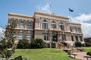
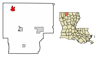
Beauregard Parish is a parish located in the U.S. state of Louisiana. As of the 2020 census, the population was 36,549. The parish seat is DeRidder. The parish was formed on January 1, 1913.

Benton is a town in, and the parish seat of, Bossier Parish, in the U.S. state of Louisiana. The population was 2,048 in 2020. The town is named for 19th century U.S. Senator Thomas Hart Benton, a Democrat from Missouri and an ally of U.S. President Andrew Jackson.

Blanchard is the suburban town in, and the second-largest municipality by population of Caddo Parish in the U.S. state of Louisiana. With a population of 3,538 at the 2020 U.S. census, it is part of the Shreveport–Bossier City metropolitan statistical area.

Iowa is a town in Calcasieu Parish, Louisiana, United States. The population was 3,436 in 2020. It is part of the Lake Charles metropolitan statistical area.
Haynesville is a town in northern Claiborne Parish, Louisiana, United States, located just south of the Arkansas border. The population was 2,039 in 2020.

Dows is a city in Franklin and Wright counties of the U.S. state of Iowa. The population was 521 at the time of the 2020 census. The town was incorporated on May 3, 1892.
Louisiana's 4th congressional district is a congressional district in the U.S. state of Louisiana. The district is located in the northwestern part of the state and is based in Shreveport-Bossier City. It also includes the cities of Minden, DeRidder, and Natchitoches.

Louisiana's 7th congressional district was a congressional district in the U.S. state of Louisiana located in the southwestern part of the state. It last contained the cities of Crowley, Eunice, Jennings, Lafayette, Lake Charles, Opelousas, Sulphur and Ville Platte.

Ophir Township is located in LaSalle County, Illinois. As of the 2010 census, its population was 508 and it contained 201 housing units. Ophir Township was originally named Fremont Township, but was renamed in May, 1850.
Elks is an unincorporated community in Lafayette Parish, Louisiana, United States.

KLCL is a radio station licensed to Lake Charles, Louisiana, United States. The station is currently owned by Townsquare Media. The station's studios are located on North Lakeshore Drive, just northwest of downtown Lake Charles, and its transmitter is located in Westlake, Louisiana. Programming includes: Hugh Hewitt, Brian Kilmeade, Charlie Kirk, Dave Ramsey, Larry Elder, Buck Sexton and Charlie Jones.

Ahsahka is a small unincorporated community located in Clearwater County, Idaho, United States, and is close to the Dworshak Dam. Ahsahka is located at 46°30′08″N116°19′27″W. The ZIP Code for Ahsahka is 83520.
Lake City Air Force Station is a closed United States Air Force General Surveillance Radar station. It is located 4.4 miles (7.1 km) west-southwest of Lake City, Tennessee. It was closed in 1960.

The Federal Correctional Institution, Memphis is a medium-security United States federal prison for male inmates located in Memphis, Tennessee. It is operated by the Federal Bureau of Prisons, a division of the United States Department of Justice. It also includes a satellite prison camp for minimum-security male offenders.
Pelzer is an unincorporated community in Boon Township, Warrick County, in the U.S. state of Indiana.
Livona is an unincorporated community in Hazelton Township, Emmons County, North Dakota, United States. It is located on the T-intersection between 63rd Street SW and North Dakota State Highway 1804. Situated on the eastern shore of Lake Oahe, it is approximately 30 miles (48 km) south of Bismarck and 12.5 miles (20.1 km) west of Hazelton. It is at an elevation of 1,663 feet (507 m) and is just north of Badger Creek.

Vulcan Island is a small island in the Sacramento–San Joaquin River Delta. It is part of San Joaquin County, California. Its coordinates are 37°59′21″N121°24′22″W, and the United States Geological Survey measured its elevation as 7 ft (2.1 m) in 1981. It appears on a 1952 USGS map of the area.
