
The Mohawk River is a 149-mile-long (240 km) river in the U.S. state of New York. It is the largest tributary of the Hudson River. The Mohawk flows into the Hudson in Cohoes, New York, a few miles north of the state capital of Albany. The river is named for the Mohawk Nation of the Iroquois Confederacy. A major waterway, in the early 19th century, the river's east-west valley provided the setting and water for development of the Erie Canal, as a key to developing New York. The largest tributary, the Schoharie Creek, accounts for over one quarter (26.83%) of the Mohawk River's watershed. Another main tributary is the West Canada Creek, which makes up for 16.33% of the Mohawk's watershed.

Schoharie Creek is a river in New York that flows north 93 miles (150 km) from the foot of Indian Head Mountain in the Catskills through the Schoharie Valley to the Mohawk River. It is twice impounded north of Prattsville to create New York City's Schoharie Reservoir and the Blenheim-Gilboa Power Project.

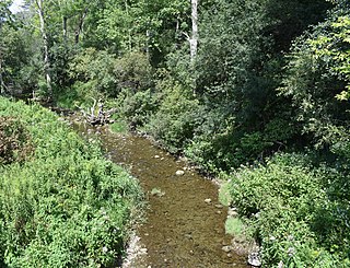
Fox Creek is a 24.8-mile-long (39.9 km) tributary of Schoharie Creek in Schoharie and Albany counties in the U.S. state of New York. It rises in the southeastern part of the town of Berne, west of the Helderberg Mountains, and flows west, passing through the hamlets of East Berne, Bensons Corner, Berne, and West Berne, continuing through the town of Wright, where it passes the hamlets of Gallupville and Shutter Corners before entering the town of Schoharie, where it flows into Schoharie Creek near the hamlet of Vroman Corners. Fox Creek is part of the Hudson River watershed, Via Schoharie Creek and the Mohawk River.
Sauquoit Creek is a 17.0-mile-long (27.4 km) river in New York, United States. It lies within the southern part of Oneida County. The creek flows eastward, then turns sharply and flows generally northward through the Sauquoit Valley to the Mohawk River, entering the river on the east side of Whitesboro. It is therefore part of the Hudson River watershed.

Hayden Creek is a river in Otsego County, in the U.S. State of New York. It begins north-northwest of the Hamlet of East Springfield and flows generally southward before flowing into Otsego Lake south of the Hamlet of Springfield Center.
Cripple Creek is a river in southern Herkimer County and northern Otsego County in the state of New York. It begins northeast of Warren and flows through Weaver Lake then Young Lake before flowing into Otsego Lake south of Springfield Center. Was formally referred to as Lawyers Creek.
Mink Creek or Otskonoga, also known as Trout Brook, is a stream in northern Otsego County, New York. Its source is adjacent to US Route 20 just east of the community of Brighton and west-northwest of the Village of Richfield Springs and flows northeast into an unnamed swamp in adjacent Herkimer County. It then exits the swamp and flows south back into Otsego County before converging with Canadarago Lake south of Richfield Springs. The Iroquois' name for the creek is Otskonoga.
Hyder Creek is a river in Otsego County in the state of New York. It begins west of the Hamlet of Richfield and flows east, then southeast before flowing into Canadarago Lake south of the Village of Richfield Springs.

The Canajoharie Creek is a river that flows into the Mohawk River in the Village of Canajoharie in the U.S. State of New York. The name "Canajoharie" is a Mohawk language term meaning "the pot that washes itself", referring to the "Canajoharie Boiling Pot", a 20-foot (6.1 m) wide and 10-foot (3.0 m) deep pothole in the Canajoharie Creek, just south of the village of Canajoharie. Bowmans Creek is one main tributary that enters the creek east of the Hamlet of Sprout Brook. The other main tributary is Brimstone Creek which enters the creek north-northwest of the Village of Ames.
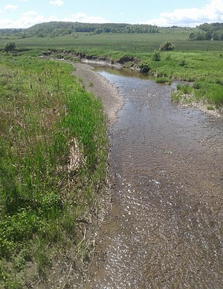
Flat Creek is a river in Schoharie and Montgomery counties in the state of New York. It begins east of Sharon Springs and flows in a general northward direction before flowing into the Mohawk River in Sprakers. Flat Creek Falls, also known as Sprakers Falls, is located on the creek by Sprakers. The indians referred to the creek as Onogerreah, and the mouth of the creek as Utlogowanke.
South Chuctanunda Creek is a river in Montgomery and Schenectady counties in the state of New York. It flows into the Mohawk River in Amsterdam.
Cranesville is a populated place situated in Montgomery County, New York, United States. It is hamlet within the town of Amsterdam on New York State Route 5, along the Mohawk River. It has an estimated elevation of 269 feet (82 m) above sea level. The community is named after early settler David Crane. Cranesville was struck by a tornado in September 2011 which caused significant tree damage along with some damage to buildings.
Caroga Creek is a river in Fulton and Montgomery counties in the U.S. State of New York. It begins at East Caroga Lake and flows south passing through Rockwood Lake before converging with the Mohawk River in the Hamlet of Palatine Church.
Cayadutta Creek is a river in Fulton and Montgomery counties in the state of New York. It begins northwest of Gloversville and flows in a general southward direction before flowing into the Mohawk River in Fonda. The Indian meaning of Cayadutta is "rippling waters" or "shallow water running over stones". This stream has commercial and historical importance as the cities of Johnstown and Gloversville lie on its banks.
Kayaderosseras Creek also called Kaniatarósera'as Stream is a river located in Montgomery and Fulton counties in the state of New York. The creek begins southeast of Johnstown and flows in a generally southeast direction before converging with the Mohawk River by Fort Johnson, just west of Amsterdam. Kaniatarósera'as Stream, is a Mohawk name which translates to "waves splashing".
Cincinnati Creek is a river in Oneida County in the state of New York. It begins southwest of the hamlet of Alder Creek, and flows into the West Canada Creek in Mapledale.
Fly Creek is a river in Montgomery and Schoharie counties in the state of New York. It begins at an unnamed swamp north of Sloansville and flows into the Schoharie Creek south of Sloansville.
The Saw Kill is a 14.3-mile-long (23.0 km) tributary of the Hudson River, called the Metambesem by the Algonquin people of the area and sometimes called Sawkill Creek today. It rises in the town of Milan and drains a 22-square-mile (57 km2) area of northwestern Dutchess County, New York, that includes most of the town of Red Hook to the west and part of Rhinebeck to Red Hook's south.
Brimstone Creek is a river in Schoharie County and Montgomery County in New York. It begins east of the Village of Sharon Springs and flows mostly in a northwest direction before flowing into Canajoharie Creek north-northwest of the Village of Ames.
Platter Kill is a river in Schoharie County in the state of New York. It flows into the Schoharie Creek. The Platter Kill's 11-square-mile (28 km2) watershed accounts for about 1.2 percent of the Schoharie basin.

