
Mansfield is a suburb in the City of Brisbane, Queensland, Australia. In the 2021 census, Mansfield had a population of 8,851 people.

Bald Hills is the northernmost suburb in the City of Brisbane, Queensland, Australia. In the 2021 census, Bald Hills had a population of 7,000 people.

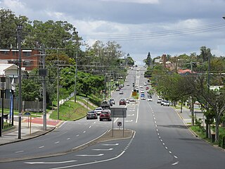
Caboolture is a town and suburb in the City of Moreton Bay, Queensland, Australia. It is located on the northern side of the Caboolture River. In the 2021 census, the suburb of Caboolture had a population of 29,534 people.

Kelvin Grove is an inner northern suburb in the City of Brisbane, Queensland, Australia. In the 2021 census, Kelvin Grove had a population of 7,909 people.

Forest Lake is an outer south-western suburb of the City of Brisbane, Queensland, Australia. In the 2021 census, Forest Lake had a population of 22,676 people.

Albany Creek is a southern suburb in the City of Moreton Bay, Queensland, Australia. In the 2021 census, Albany Creek had a population of 16,385 people.

Miles is a rural town and locality in the Western Downs Region, Queensland, Australia. In the 2021 census, the locality of Miles had a population of 1,874 people.

Malanda is a rural town and locality in the Tablelands Region, Queensland, Australia. In the 2021 census, the locality of Malanda had a population of 2,000 people. The economy is based upon agriculture and tourism.

Alexandra Hills is a residential locality in the City of Redland, Queensland, Australia. In the 2021 census, Alexandra Hills had a population of 16,472 people.

Fig Tree Pocket is a riverside western suburb in the City of Brisbane, Queensland, Australia. In the 2021 census, Fig Tree Pocket had a population of 4,345 people.
Holland Park West is a suburb in the City of Brisbane, Queensland, Australia. In the 2021 census, Holland Park West had a population of 6,468 people.

Everton Park is a northern suburb of the City of Brisbane, Queensland, Australia. In the 2021 census, Everton Park had a population of 10,111 people.

Stafford Heights is a northern suburb in the City of Brisbane, Queensland, Australia. In the 2021 census, Stafford Heights had a population of 6,992 people.

Durack is an outer south-western suburb in the City of Brisbane, Queensland, Australia. In the 2021 census, Durack had a population of 7,788 people.

Pallara is an outer southern suburb in the City of Brisbane, Queensland, Australia. In the 2021 census, Pallara had a population of 3,861 people.

Rochedale ( "roach-dale") is an outer southern suburb in the City of Brisbane, Queensland, Australia. In the 2021 census, Rochedale had a population of 7,633 people.
Albany Creek State High School is a public co-educational secondary school located in the Moreton Bay suburb of Albany Creek, Queensland, Australia. It is administered by the Queensland Department of Education, with an enrolment of 1,549 students and a teaching staff of 121, as of 2023. The school serves students from Year 7 to Year 12.
Clontarf Beach State High School (CBSHS) is a public co-educational secondary school located in the Moreton Bay suburb of Clontarf, Queensland, Australia. It is administered by the Queensland Department of Education, with an enrolment of 909 students and a teaching staff of 88, as of 2023. The school serves students from Year 7 to Year 12.

Bracken Ridge State High School (BRSHS) is a public co-educational secondary school located in the Brisbane suburb of Bracken Ridge, Queensland, Australia. It is administered by the Queensland Department of Education, with an enrolment of 640 students and a teaching staff of 61, as of 2023. The school serves students from Year 7 to Year 12.

Caloundra is a coastal suburb and the central business district of the town of Caloundra in the Sunshine Coast Region, Queensland, Australia. In the 2021 census, the suburb of Caloundra had a population of 3,932 people.
