South West England, or the South West of England, is one of the nine official regions of England in the United Kingdom. It consists of the counties of Cornwall, Dorset, Devon, Bristol, Gloucestershire, Somerset and Wiltshire. Cities and large towns in the region include Bath, Bristol, Bournemouth, Cheltenham, Exeter, Gloucester, Plymouth and Swindon. It is geographically the largest of the nine regions of England with a land area of 9,203 square miles (23,836 km2), but the third-least populous, with an estimated 5,764,881 residents in 2022.

The A30 is a major road in England, running 284 miles (457 km) WSW from London to Land's End.

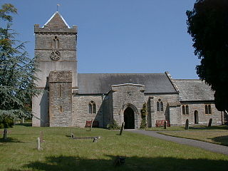
Puriton is a village and parish at the westerly end of the Polden Hills, in Somerset, England. The parish has a population of 1,968. The local parish church is dedicated to St Michael and All Angels. A chapel on Woolavington Road was converted to a private house some 20 years ago. The parish includes the hamlets of Dunball and Down End.

South Hams is a local government district on the south coast of Devon, England. Its council is based in the town of Totnes, although the largest town is Ivybridge. The district also contains the towns of Dartmouth, Kingsbridge and Salcombe and numerous villages and surrounding rural areas.

Ivybridge is a town and civil parish in the South Hams, in Devon, England. It lies about thirteen miles east of Plymouth. It is at the southern extremity of Dartmoor, a National Park of England and Wales and lies along the A38 "Devon Expressway" road. There are two electoral wards in Ivybridge East and Ivybridge West with a total population of 11,851.

North Devon is a local government district in Devon, England. Its council is based just outside Barnstaple, the district's largest town. The district also includes the towns of Ilfracombe, Lynton and Lynmouth and South Molton along with numerous villages, seaside resorts and surrounding rural areas.
Honiton is a market town and civil parish in East Devon, situated close to the River Otter, 17 miles (27 km) north east of Exeter in the county of Devon. Honiton has a population estimated at 12,154.

Wellington is a market town in Somerset, England. It is situated 7 miles (11 km) south west of Taunton, near the border with Devon, which runs along the Blackdown Hills to the south of the town. The town had a population of 16,669, which includes the residents of the parish of Wellington Without, and the villages of Tone and Tonedale.

Cullompton is a town and civil parish in the district of Mid Devon and the county of Devon, England. It is 13 miles (21 km) north-east of Exeter and lies on the River Culm. In 2021, the parish as a whole had a population of 10,071, while the built-up area of the town had a population of 9,439.

In the United Kingdom, regional development agencies (RDAs) were nine non-departmental public bodies established for the purpose of development, primarily economic, of England's Government Office regions between 1998 and 2010. There was one RDA for each of the NUTS level 1 regions of England. Similar activities were carried out in Wales by the Welsh Government Department of Economy and Transport, in Northern Ireland by the Department of Enterprise, Trade and Investment and in Scotland by Scottish Enterprise and Highlands and Islands Enterprise.

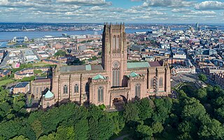
The Liverpool City Region is a combined authority area in North West England. It has six council areas: the five metropolitan boroughs of Merseyside and the unitary authority of Halton in Cheshire. The city region had a population of 1,571,045 in 2022. Its largest settlement and administrative HQ is Liverpool.

Cranbrook is a new town being developed in East Devon, England, which at the 2021 census, had a population of 6,743 residents across 8 "phases". However, the town is growing at a fast pace. It is located 6 mi east-north-east of Exeter and north-west of Rockbeare, between the B3174 road and the West of England Main Line railway. The civil parish was formed on 1 April 2015.
Bristol is a city in south west England, near the Bristol Channel coast, approximately 106 miles (170 km) west of London. Several factors have influenced the development of its transport network. It is a major centre of employment, retail, culture and higher education, has many historic areas, and has a history of maritime industry. The city has a population of 450,000, with a metropolitan area of 650,000, and lies at the centre of the former County of Avon, which includes many dormitory towns, and has a population of one million.

City College Plymouth is a tertiary institution and further education college in South West England offering a range of technical, professional and vocational qualifications, Apprenticeships, Access to Higher Education and Foundation Degree courses, plus professional and bespoke training to local employers.

Devonwall is one name given to various proposals to link or combine the counties of Cornwall and Devon together in whole or in part. The name was initially used to describe political concept introduced in the United Kingdom in the 1970s by the Conservative government. It was an attempt to link the two counties together in an economic, political and statistical sense to form a South West region. This involved combining and centralising some local government functions and services such as the police, ambulance, fire services, as well as media output such as local TV and newspapers.

The Leeds City Region, or informally Greater Leeds, is a local enterprise partnership city region located in West Yorkshire, England. Prior to the West Yorkshire devolution deal, the partnership covered parts of South and North Yorkshire. According to the Office for National Statistics, as of 2017 the city region ranked 2nd behind Greater London for both population and GVA in the United Kingdom. It has a population of 2,320,214 million and a GVA of £69.62 billion.

In England, local enterprise partnerships (LEPs) were voluntary partnerships between local authorities and businesses, set up in 2011 by the Department for Business, Innovation and Skills to help determine local economic priorities and lead economic growth and job creation within the local area. They carried out some of the functions previously carried out by the regional development agencies which were abolished in March 2012. In certain areas, funding was received from the UK government via growth deals. Funding for LEPs was withdrawn by the Rishi Sunak Conservative government in April 2024 and their functions were assumed by local authorities, some of whom have formed Business Boards as replacements.

Exeter is a cathedral city and the county town of Devon, South West England. It is situated on the River Exe, approximately 36 mi (58 km) northeast of Plymouth and 65 mi (105 km) southwest of Bristol.
The Greater Birmingham & Solihull Local Enterprise Partnership (GBSLEP) was one the Local Enterprise Partnerships set up by UK Government to drive economic development in England.

The GW4 Alliance is a consortium of four research intensive universities in South West England and Wales. It was formed in January 2013 by the universities of Bath, Bristol, Cardiff and Exeter to enhance research collaboration and innovation, and launched at the House of Commons in October 2014. It is the UK's first pan-regional partnership, involving an institution from a devolved nation.


