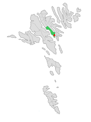
Norðragøta, also just referred to as Gøta, is a village on Eysturoy island, Faroe Islands.

Klaksvík is the second largest town of the Faroe Islands behind Tórshavn. The town is located on Borðoy, which is one of the northernmost islands. It is the administrative centre of Klaksvík municipality.

Eysturoy is a region and the second-largest of the Faroe Islands, both in size and population.

Sørvágur is a village on the island of Vágar in the Faroe Islands.

Sandur is a village on the south coast of the island of Sandoy in the Faroe Islands. The Sandur hoard of silver coins, dating to the end of the 11th century, attests to the long history of the village. In January 2024, the population stood at 529.

Leirvík is a town on the Faroe Islands and was an important regional ferry harbour at the east coast of the second-largest island Eysturoy. Leirvík has a population of 1,055 (2024).

Viðareiði is the northernmost settlement in the Faroe Islands and lies on the Island of Viðoy, which belongs to the Norðoyar Region.

Sumba is the southernmost village of the Faroe Islands, located on the island of Suðuroy. It is located in Sumbiar Municipality.

Norðoyatunnilin is a two-lane road tunnel under the Leirvíksfjørður in the Faroe Islands. It connects the islands of Eysturoy and Borðoy. The tunnel is 6.2 km long and goes down to a depth of 150 metres below sea level. The maximum gradient is approximately 6%. The tunnel entrances are near the towns of Leirvík on Eysturoy, and Klaksvík on Borðoy. Until the Eysturoyartunnilin opened in December 2020, Norðoyatunnilin was the longest tunnel in the Faroe Islands.

Gøtu Ítróttarfelag, commonly known as just GÍ, was a football club based in Gøta, in the Faroe Islands.

Syðrugøta is a village on the east coast of the Faroese island of Eysturoy in Eystur Municipality.

Víkingur is a Faroese professional football club based in Leirvík. The club was founded in 2008 after the merger of GÍ Gøta and Leirvík ÍF. They play at the Serpugerði Stadium in Norðragøta. Both villages are part of the same municipality Eysturkommuna, located on the island of Eysturoy and about 5 kilometers away from each other. The club won the Faroese championship for the first time in the 2016 season. In the 2017 season, Vikingur won the championship again.

The Faroe or Faeroe Islands, or simply the Faroes, are an archipelago in the North Atlantic Ocean and an autonomous territory of the Kingdom of Denmark. The official language of the country is Faroese, which is closely related to and partially mutually intelligible with Icelandic.

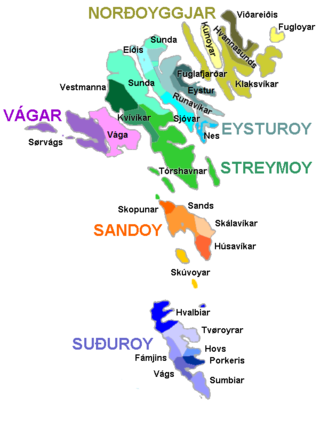
The Faroe Islands are administratively divided in 29 municipalities (kommunur), with about 120 cities and villages. Until December 31, 2008, there were 34 municipalities, and until December 31, 2004, there were 48 municipalities. In the coming years the number of Faroese municipalities is expected to drop to somewhere between 7 and 15, as there is currently a rationale towards municipal amalgamation and a decentralization of public services. In 1998 it was suggested that no municipality should have fewer than 2,000 inhabitants, but whether this will be true is a political question. The Faroese government has furthermore decided not to conduct forced, top-down amalgamation, but to leave the process to the free will of the municipalities. In many small municipalities there is some resistance to the amalgamation process, and as a result two kinds of municipalities are being created: large municipalities (town-municipalities) that are eager to attract smaller municipalities into amalgamation, and small municipalities which are either trying to avoid amalgamation or seek to amalgamate with other small municipalities. The geographically large Sunda municipality is an example of this. The larger municipalities are organized in Kommunusamskipan Føroya (KFS) and the smaller are organized in Føroya Kommunufelag (FKF).

Vágar Municipality is a municipality in the Faroese Islands.

Sjóvar Municipality is a municipality of the Faroe Islands. The name of the municipality has its origins from the farm Sjógv á Strondum which gave name to Sjóvar parish. The name comes from the Faroese word for seawater (sjógvur). Sjóvar covers a part of the island of Eysturoy. It consists of the villages of Strendur, Innan Glyvur, Selatrað, Morskranes and Kolbanargjógv.

Eysturoyartunnilin is a large undersea road tunnel under the Tangafjørður sound in the Faroe Islands, connecting the island of Streymoy to the island of Eysturoy, meaning east island. It also crosses the southern part of Skálafjørður, and connects the towns of Runavík on the eastern side and Strendur on the western side of the fjord, and includes the world's first undersea roundabout in the middle of the network.

Hanna Jensen is a Faroese high school teacher and a liberal - conservative politician (Progress).

The Streymin Bridge, is an important highway bridge in the Faroe Islands. It connects the two biggest and most populous islands of Streymoy to the west and Eysturoy to the east. Crossing the Sundini sound at its narrowest point, it is jokingly referred to as the 'Bridge over the Atlantic', being the only inter-island bridge in the Faroe Islands, and one of the few such bridges in the Atlantic Ocean.


