
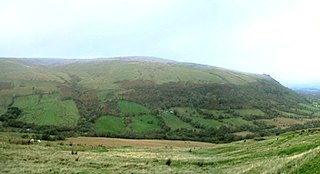
Fan Frynych is the northernmost peak of the Fforest Fawr massif in the Brecon Beacons National Park, South Wales. It is classed as a subsidiary summit of Fan Fawr and makes up half of the Craig Cerrig-gleisiad and Fan Frynych National Nature Reserve with its sister peak Craig Cerrig-gleisiad.

The Black Mountain is a mountain range in South, Mid and West Wales, straddling the county boundary between Carmarthenshire and Powys and forming the westernmost range of the Brecon Beacons National Park. Its highest point is Fan Brycheiniog at 802 metres or 2,631 ft. The Black Mountain also forms a part of the Fforest Fawr Geopark.

Fan Fawr is a mountain in the Fforest Fawr section of the Brecon Beacons National Park, in Powys, Wales and over 734 m (2,408 ft) high.
The Nedd Fechan is a river almost wholly within the county of Powys, Wales, currently administered as part of the unitary authority of Powys. It rises on the eastern slopes of Fan Gyhirych in the Fforest Fawr section of the Brecon Beacons National Park and flows south for 7 miles (12 km) to join with the Afon Mellte at Pontneddfechan, their combined waters continuing as the River Neath to the sea near Swansea. The only significant tributary of the Nedd Fechan is the Afon Pyrddin which joins it at Pwll Du ar Byrddin. Downstream of this confluence it forms the boundary between Powys to its east and Neath Port Talbot to its west.

Fforest Fawr is an extensive upland area in the county of Powys, Wales. Formerly known as the Great Forest of Brecknock in English, it was a royal hunting area for several centuries but is now used primarily for sheep grazing, forestry, water catchment and recreation. It lies within the Brecon Beacons National Park.

Fan Nedd is a mountain in the Fforest Fawr area of the Brecon Beacons National Park in Wales. In common with the rest of the Fforest Fawr uplands it is within the county of Powys.

Fan Llia is a subsidiary summit of Fan Fawr in the Fforest Fawr section of the Brecon Beacons National Park, Wales. In common with other peaks in the Fforest Fawr uplands it lies within the county of Powys.

Fan Gyhirych is a mountain in the Fforest Fawr section of Brecon Beacons National Park in south Wales. It lies within the county of Breconshire, and administered as part of the unitary authority of Powys.
Fan Bwlch Chwyth is a peak in the Fforest Fawr section of the Brecon Beacons National Park and within the county of Powys.

Fan Hir is a peak at the eastern end of the Black Mountain in the Brecon Beacons National Park in southern Wales. It is a subsidiary summit of Fan Brycheiniog. It falls within the county of Powys and is also a part of the traditional area of Fforest Fawr. Its Welsh name means "long peak", a fitting description, particularly if seen from the east when its steep eastern face is seen to advantage. It is about 2.5 miles or 4 km long and faces east. Its summit is 2490 feet above sea level. Fan Hir is separated from its higher neighbour to the north-west, Fan Brycheiniog by a col known as Bwlch Giedd, where a path rises from Llyn y Fan Fawr via a stone staircase.

Fforest Fach is a small area of unenclosed land within Brecon Beacons National Park southwest of Sennybridge in the county of Powys, Wales. Translating from Welsh as 'little forest', it is named in opposition to the much larger area of unenclosed land to the south which is known as Fforest Fawr or the 'great forest'. Whilst Fforest Fawr and Fforest Fach have been distinct areas for many centuries, the odd situation now arises where Fforest Fach now finds itself within Fforest Fawr Geopark, the boundaries of which are drawn rather more widely than those of the traditional royal hunting forest.
The hill possesses two indistinct summits, the higher of which at 382m is in the south whilst that to the north at 381m is crowned by a trig point. There was formerly a rifle range at the north-western corner of the hill.
Cefn Llechid is a small area of unenclosed land in the Brecon Beacons National Park east of Sennybridge in the county of Powys, Wales. It lies within Fforest Fawr Geopark. Its plateau-like summit surface peaks at 400m where it is marked by a trig point. A couple of small bodies of water lie in a hollow on the plateau. The hill is owned and managed by the Brecon Beacons National Park Authority.

Picws Du is the second highest peak of the Carmarthen Fans in the Carmarthenshire section of the Black Mountain in the west of the Brecon Beacons National Park in south Wales. The highest peak is Fan Foel immediately next along the ridge and it is a subsidiary summit of Fan Brycheiniog. Picws Du falls within Fforest Fawr Geopark and its prominent summit is marked by a large Bronze Age round barrow at a height of 2457 feet above sea level. Waun Lefrith is the other, lower summit of the Bannau Sir Gâr / Carmarthen Fans situated to the west. The peak overlooks the glacial lake of Llyn y Fan Fach in the cwm below. As the peak sits on the edge of the escarpment on a ridge which juts out into the valley below, the views from the summit are panoramic and extensive. The views to the north are especially impressive when the weather is clear, looking towards the Cambrian Mountains, Mynydd Epynt and Brecon. Swansea and the Bristol Channel can just be seen on the horizon to the south, across the gently falling dip slope. Pen y Fan and Corn Du are distinctive landmarks seen directly to the east across Fforest Fawr.
Cefn Cul is a hill in the Fforest Fawr sector of the Brecon Beacons National Park in Powys, southern Wales. It is a broad north-northeast to south-southwest aligned ridge whose summit reaches a height of 562 m above sea level. The hill is bounded to the west by the upper valley of the River Tawe though which the old Trecastle road runs whilst to the east is the pass of Bwlch Bryn-rhudd over which the A4067 road runs from the Crai valley south to that of the Tawe.

Foel Fraith is a hill in the Black Mountain in the county of Carmarthenshire, southwest Wales. It lies within the Brecon Beacons National Park and Fforest Fawr Geopark. Its plateau-like summit attains a height of 602 metres (1,975 ft) above sea level. To the north the subsidiary summit of Cefn y Cylchau reaches 556 feet (169 m), and to the southeast is the subsidiary summit of Carn Fadog or Cefn Carn Fadog, which reaches a height of 512 metres (1,680 ft).

Trichrug is a hill four miles east of Llandeilo and 3 miles south of Llangadog in the county of Carmarthenshire, southwest Wales. It lies within the Brecon Beacons National Park and Fforest Fawr Geopark. Its summit at a height of 415m above sea level is marked by a trig point. It is a Marilyn with a prominence of 191 metres.

Mynydd Myddfai is a hill 4.5 miles southeast of Llandovery in the county of Carmarthenshire, southwest Wales. It lies within the Brecon Beacons National Park and Fforest Fawr Geopark. The hill is in the form of a broad ridge aligned southwest to northeast with three or four distinct tops separated by cols. The northwest side drops steeply away towards the village of Myddfai whilst the other side is a more shallow slope down towards Glasfynydd Forest which encircles Usk Reservoir. The plateau surface of the hill rises to a height of 440m at OS grid ref SN 806297 where a trig point has been erected.
Mynydd Bach Trecastell is a hill on the border between the counties of Carmarthenshire and Powys in southwest Wales. It lies within the Black Mountain range of the Brecon Beacons National Park and Fforest Fawr Geopark. Its summit is plateau-like and reaches a height of 412m at OS grid ref SN 827312 at Y Pigwn. The name signifies the 'little hill of castle town'.
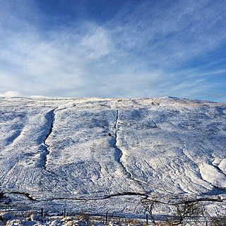
This article describes the geology of the Brecon Beacons National Park in mid/south Wales. The area gained national park status in 1957 with the designated area of 1,344 km2 (519 sq mi) including mountain massifs to both the east and west of the Brecon Beacons proper. The geology of the national park consists of a thick succession of sedimentary rocks laid down from the late Ordovician through the Silurian and Devonian to the late Carboniferous period. The rock sequence most closely associated with the park is the Old Red Sandstone from which most of its mountains are formed. The older parts of the succession, in the northwest, were folded and faulted during the Caledonian orogeny. Further faulting and folding, particularly in the south of the park is associated with the Variscan orogeny.
