Fannin, Texas | |
|---|---|
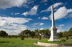 Fannin Battleground State Historic Site | |
 Fannin  Fannin | |
| Coordinates: 28°41′44″N97°14′9″W / 28.69556°N 97.23583°W | |
| Country | United States |
| State | Texas |
| County | Goliad |
| Elevation | 141 ft (43 m) |
| Time zone | UTC-6 (Central (CST)) |
| • Summer (DST) | UTC-5 (CDT) |
| GNIS feature ID | 1373703 |
Fannin is an unincorporated community in eastern Goliad County, Texas, United States. [1] Its elevation is 141 feet (43 m). [2] It is part of the Victoria, Texas Metropolitan Statistical Area.
